
For permeable pavement, Ohio’s clay-rich soils pose challenge
A permeable pavement feature in Kinston, N.C. (Credit: NCSU-BAE)
For someone used to working in North Carolina’s coastal regions, Ryan Winston soon found that the soils in northeast Ohio were different: They contain a much higher level of clay. That doesn’t affect the construction of the permeable pavement structures he is researching, but it certainly impacts the data.
Preliminary data indicate that permeable pavement on clay soil in Ohio infiltrates 20 percent of the stormwater runoff volume that hits it. Permeable pavement over sandy soils in North Carolina will register infiltration rates of 90 percent or more.
“Compare that to sandy soils and it is vastly reduced performance,” said Winston, an extension associate with North Carolina State University. “But you’re still reducing runoff by 20 percent, and there’s something to be said for that as well.”
N.C. State University, Chagrin River Watershed Partners, Old Woman Creek National Estuarine Research Reserve, Ohio Department of Natural Resources and Erie County Soil and Water Conservation District are monitoring permeable pavements in northern Ohio to determine how much they reduce runoff in order to properly credit the benefits of these stormwater control measures. Other research questions include permeable pavement design improvements and maintenance concerns over time.
Three of the sites use interlocking pavers, while one is made of permeable concrete. But Winston says both essentially serve the same purpose, with layers of rock beneath them that stores and slows down water. “The differences are not consequential as far as system performance goes,” said Winston.
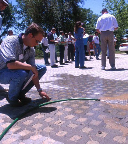
The first component of the large-scale project is monitoring the hydrological performance of the sites. All have weather stations, weirs and pressure transducers deployed. Soil moisture and temperature sensors have been installed within bioretention and permeable pavement at a few sites to help researchers understand issues with freezing, thawing and water temperature changes.

Monitoring equipment installed in a catch basin at Willoughby Hills. This system allows for collection of both hydrologic and water quality data through the use of a weir, a depth logger, and an automated water quality sampler. (Credit: Ryan Winston)
Weather sensors record rainfall, temperature, relative humidity and barometric pressure. These data help to estimate evaporation from bioretention and porous pavement stormwater controls. Pressure transducers track water level and soil probes track moisture. Bubbler flow meters are also used to depict water movement through the permeable systems. ISCO Samplers also take water samples in the mass data collection effort.
Data has been collected since 2012 from a site at Perkins Township, a Sandusky suburb. Monitoring at the others is still so new that conclusions can’t yet be drawn from their data, says Winston.
“We’re still midway through data collection, but so far what affects performance the most is the underlying soil,” said Winston. With the low infiltration rates that go along with clay-heavy soils, large storms of around two inches of rainfall could see runoff reductions of just 10 percent. However, even with lower infiltration rates, permeable pavements are a valuable stormwater management strategy because they provide storage that reduces peak flows and non-point source pollution, minimizing negative impacts on receiving waters. Smaller storms could have a reduction of 40 percent.

The Willoughby Hills installation features impermeable asphalt draining into permeable interlocking concrete pavement. (Credit: Ryan Winston)
Sumps, or zones where water can gather, are created by using an upturned elbow in the underdrain of a stormwater practice, forcing water to pond internally. This allows more time for water to infiltrate into underlying soils. That small tweak and others like it can slow the flow of water enough to impact stormwater storage and outflow.
Winston and other researchers have also built new technologies and redundancies into their monitoring schemes. At one site, for example, they used two pressure transducers instead of one to chart discrepancies between the water level readings they yield. Soil probes, instead of measuring the moisture in grimy earth below, have been used to track moisture in permeable pavement itself.
Many permeable pavement projects have standard asphalt driving lanes which are sloped or pitched to permeable pavement in the parking stalls. One problem with permeable pavement is clogging; sediment from tire wear, dustfall and wear of the pavement contributes to surface clogging of these systems. “We want to be able to predict how fast these systems clog and what sort of maintenance intervals we need,” said Winston.
Informing maintenance needs, collecting environmental data and helping better designs of permeable pavement structures are all goals of the project. From there, Winston and others hope to take what they learn and plug it into models that can improve permeable pavement installations in the future.
This research was funded by the National Estuarine Research Reserve System Science Collaborative. It has been guided by input from a group of stormwater professionals in Northern Ohio. The Chagrin River Watershed Partners website contains more information on the project and who has been involved.
Top image: A permeable pavement feature in Kinston, N.C. (Credit: NCSU-BAE)


0 comments