
Post-Sandy, Atlantic states take stock of offshore sand for rebuilding barriers and beaches
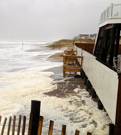
Waves hit the beach at Sandbridge, Va., during Hurricane Sandy. (Credit: Bill Gassett)
After Hurricane Sandy whipped up waves and created storm surges, beaches along the Atlantic Coast were severely impacted. As part of the rebuilding effort, research into sand resources up and down the seaboard is underway.
Scientists are hoping to learn more so that projects to build storm surge barriers and restore beachfronts can be carried out more effectively and sustainably. Scientists at the Virginia Institute of Marine Science are working to map the state’s offshore sand, surveying sand deposits lying beneath state and federal waters along Virginia’s portion of the outer continental shelf.
“What’s out there? What’s the extent of our resources?” said Steven Kuehl, professor of marine science at The College of William & Mary, which houses the institute. “That’s what we want to figure out.”
He is joined by scientists Scott Hardaway and Donna Milligan at VIMS and researchers from the Virginia Department of Mines, Minerals and Energy, as well as the Bureau of Ocean Energy Management. They will sift through as much existing data on the sand resources as they can, comparing things like seismic profiles, sediment core samples and side-scan sonar mosaics to get a more accurate idea of what sand resources are there.
The analysis will focus on an area between three and eight miles offshore, just outside Virginia waters, and cover regions near False Cape, Sandbridge and Wallops – home to a NASA flight facility. Scientists will also look to answer questions that could impact Virginia Beach, a major tourist attraction that brings in billions of dollars to local economies annually.
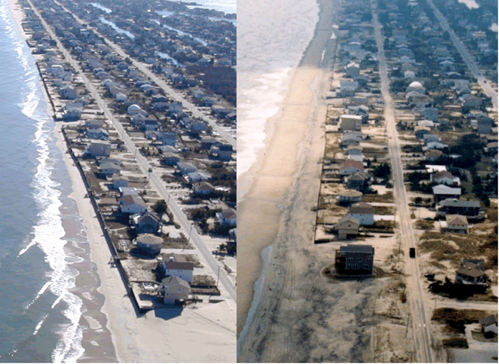
Sandbridge, Va., before (left) and after (right) beach nourishment. (Credit: Scott Hardaway/VIMS)
Kuehl says the research team has amassed data on the subject going back to the 1970s, with large contributions coming from VIMS itself. The U.S. Army Corps of Engineers also has a lot of findings to share, but some of their data isn’t easy to access.
“The Army Corps has done a ton of coring work in the past,” said Kuehl. But much of the data is stored in closed databases. “So it requires making personal contacts, or tracking some of the samples down.”
As part of the analysis, different sand sizes and types will be considered. This plays a role both aesthetically and structurally for beach health. “You’ve got to have the right sand. You don’t want to put gravel on a beach and you don’t want to put mud,” said Kuehl. “For the right caliber of sand – location and thickness wise – it’s worth going after (that data).”
Researchers will also work to predict what, if any, deposits of valuable minerals, like titanium or zirconium, may exist along the seaboard. In some cases, economically important minerals can be found offshore, and Kuehl says it’s a “double bonus” finding where they are. If their locations can be pinpointed, sand-extraction efforts can be combined with mining the rare-earth metals to save time and resources.
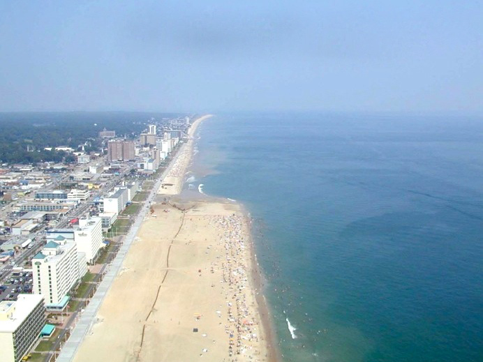
Aerial view of beach nourishment underway at Virginia Beach. (Credit: Scott Hardaway/VIMS)
Ultimately the findings will be plugged into models to show the sand resources off the Virginia coast. Core data will be pushed into a GIS database and seismic data will be used to trace subsurface layers. By combining models on core data and layers, it will be possible to extrapolate what’s in the subsurface.
“We’ll have a 3-D data compilation that shows the vertical extent of different layers of the shelf,” said Kuehl. “In contrast to predictive models, we’re making an actual physical model to create a picture of what’s there.”
Top image: Waves hit the beach at Sandbridge, Va., during Hurricane Sandy. (Credit: Bill Gassett)


0 comments