
Satellite imagery shows likely cause of wildfire spread, firefighter deaths
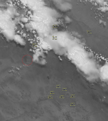
A University of Wisconsin-Madison satellite imagery blog showed satellite recordings of atmospheric movement that likely caused rapid shifts in the Prescott, Ariz. fire that killed 19 firefighters.
The fire started on June 28 from a lightning strike. On June 30, climate conditions were favorable for the growth of the small wildfire.
Thunderstorms developed over northwest Arizona and moved toward the southwest. Strong winds from the thunderstorm outflow boundary likely caused the fire to grow rapidly and change direction.
Satellite imagery shows time-lapses of pyrocumulus and pyrocumulonimbus clouds, which result from clouds forming over hot areas like forest fires.
The rapid spread of the fire overtook the 19 Granite Mountain Hotshot firefighters, killing them while they hunkered down in protective shelters.
Image: Atmospheric movement likely related to shifts in the Prescott, Ariz. wildfire (Credit: University of Wisconsin-Madison Cooperative Institute for Meteorological Satellite Studies)


0 comments