
Scientists break new ground in measuring groundwater from space
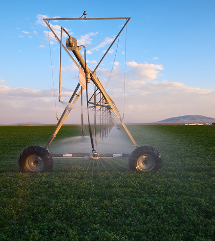
Center-pivot irrigation in the San Luis Valley (Credit: Michael Rael, via Flickr)
A bird’s-eye view of the San Luis Valley shows a clear mosaic of lush green circles carpeting the otherwise high-and-dry region of southern Colorado, where center-pivot irrigation sends a dwindling supply of groundwater over fields of potatoes and other crops.
Scientists at Stanford University have recently published a breakthrough in the effort to keep closer track of aquifers there and around the world from the higher vantage of low orbit.
Groundwater is a crucial but fleeting resource in the West, where it hides hundreds of feet underground and often escapes rigorous monitoring or management. Depletion is a real concern: A 2013 U.S. Geological Survey study found that the nation drew down its aquifers from 1900 to 2008 by enough water to fill Lake Erie twice.
But for the most part, pumping is poorly monitored and data on changing water tables can be sparse or closely guarded, according to Jesse Reeves, a postdoctoral scholar at Stanford and lead author of the new study.
“People just sort of pump what they need,” Reeves said. “If the levels in their well are decreasing, then they drill the well deeper.”
Groundwater managers rely on flow models to predict how aquifers will change in the future. The models work off of inputs like streamflow and estimates of pumping rates, but they’re hampered by significant uncertainty, Reeves said.
“Those models are huge, clunky over-calibrated things,” she said. “There are just too many knobs and buttons to press, so it’s just very hard.”
Without ample data on water table levels from monitoring wells, scientists have previously turned to satellite-based instruments that measure the slightest changes in elevation, or deformation, of the Earth’s surface. Those changes can be related to stress and strain on the surface from a shifting aquifer deep underground.
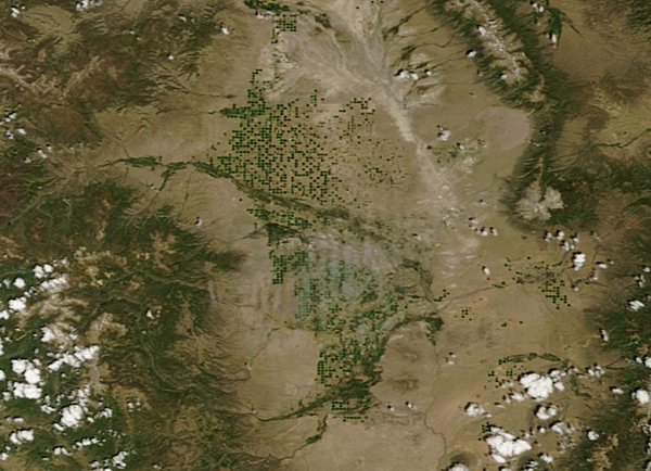
A satellite view of the San Luis Valley, with green circles of crops irrigated with groundwater pumped through center-pivot irrigation (Credit: NASA)
Scientists have used satellite tools to indirectly supplement groundwater monitoring, using the data, for example, to restrain unwieldy models. But Reeves and her colleagues have taken that work one step further, foregoing the flow models and successfully predicting hydraulic head at three monitoring well sites in the San Luis Valley.
This application of the satellite method was a simple case that worked well, Reeves said. The relationship between changes in the aquifer and surface deformation can be complex, but it’s fairly clear in the San Luis Valley. While getting it right at three wells in southern Colorado is a long way off from remotely monitoring the world’s imperiled aquifers, that doesn’t take away from the fact that no one has done this before.
“It is a breakthrough,” Reeves said. “In highlighting that this is possible, there is just so much more that we could be doing.”
Part of the work ahead includes translating the data from from the satellite-based InSAR — Interferometric Synthetic Aperture Radar — tools into a form more suitable for a more general audience. That includes managers thirsty for more information on the invisible resource they’re trying to regulate.
“Water managers email me all the time asking questions about how soon they can get their hands on this data,” Reeves said. “It’s just so specialist right now.”
The study is published in the journal Water Resources Research.
Image: Center-pivot irrigation in the San Luis Valley (Credit: Michael Rael, via Flickr)


0 comments