Monitoring system tracks tidal and solar cycle influence on Potomac tributary
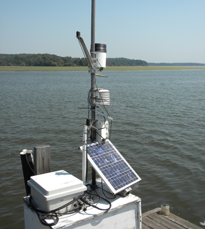
A water quality monitoring station on the Occoquan River (Credit: Christian Jones)
From the dam that creates the Occoquan Reservoir downstream to its confluence with the Potomac River, the Occoquan River is a tidally-influenced system. A continuous water quality monitoring station there is helping researchers tease out the effects of tides and other drivers on the river’s daily and seasonal patterns.
“We know that it is a tidal system and we know that the tide is twice daily, and also some of the parameters are very responsive to solar cycles which are one cycle a day,” Said Christian Jones, a professor of environmental science and policy at George Mason University. “So we wanted to try to untangle those two cycles to see which parameters were most influenced by one cycle versus the other.”
The monitoring station on the Occoquan is one of three in the tidal Potomac maintained by George Mason University’s Potomac Environmental Research and Education Center. Measurements from the stations are automatically uploaded to the center’s Potomac Online Data System.
The data system lets the university expose students to modern ways of collecting scientific data, said Jones, the center’s director. Making the measurements freely available to the public online also contributes to a broader mission of serving the wider community.
“K through 12 students or teachers, managers, other scientists–the whole range of stakeholders can use this as a resource for education, for management, for research,” Jones said.
Of course, they’re also using it for their own research, including a study recently published in the journal Inland Waters. The study, lead by Jones, analyzes daily and seasonal patterns in dissolved oxygen, pH, temperature and conductivity.
The data, collected at 15 minute intervals from April to November 2010 with a YSI 6600 multi-parameter sonde, allowed the researchers to detect shifts in the water quality variables and identify whether they were driven by daily sunlight cycles or twice-daily tidal fluctuations.
The results showed that dissolved oxygen and pH followed solar cycles, which was expected, as sunlight during the day activates photosynthesis in aquatic vegetation that generates oxygen before dropping back at night. They also saw a pattern in conductivity, a surrogate for salinity, that followed the tidal cycle. That was also expected, as high tides bring in saltier water from the Chesapeake and Potomac that moves back out with the low tide.
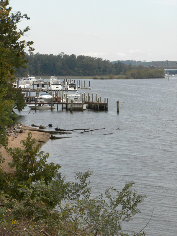
Occoquan River flows through 25 miles of Northern Virginia (Credit: Christian Jones)
Although those patterns were more or less what the researchers expected to find, there is still value in affirming that the system works like scientists thought it should
“There are assumptions that people bring to the table, and they may be so enthralled by their assumptions that they don’t question it,” he said. “The thing is we haven’t had these devices that could give us that level of data (until recently). I think it’s worth it’s worth going back and trying to validate it.”
And the study wasn’t without surprises. Though oxygen and pH patterns at the study site patterns were most significantly driven by solar cycles, the data also showed a smaller tidal influence.
At a longer time scale, the researchers saw the stable cycles that had set up over the summer “reset” in October when a sustained rain event brought an influx of freshwater into the system. The daily dissolved oxygen pattern, for example, disappeared when the rain flushed the algae out of the water column. The cycles reemerged a few days after the storm.
The data analyzed in the study that shows the regular day-to-day operation of this site in the Occoquan will serve as a baseline for future analysis, Jones said. Meanwhile, the system will remain in the water, ready to measure how the river responds to the next big event.
“We want it to be available for the long term. You don’t know when these perturbations are going to occur. So if you’re not already out there, it’s too late,” Jones said. “We’re trying to be in it for the long term so that it’s not just something that was a research project and then it went away.”


0 comments