
Upper Colorado River Gets Most Streamflow From Groundwater
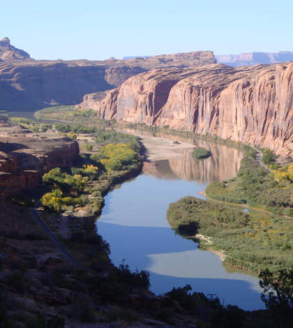
Water flowing on the Colorado River near Moab, Utah. (Credit: U.S. Geological Survey)
The Colorado River is one of the most over-allocated rivers in the world, meaning that everyone living along or near its banks depends on its water. So figuring out how to safeguard this incredibly valuable resource for the future, wrought with more demand and perhaps less supply, is critical.
Researchers with the U.S. Geological Survey (USGS) conduct a lot of work around the river, and have a special interest in tracking its flows. This is clear thanks to the number of stream gages the agency has deployed along the Colorado River’s banks.
But those gages can only go so far, showing what is happening on the river at the moment, and USGS scientists have an eye toward the future health of the Colorado River. And they have recently used a new method to more accurately estimate the percentage of groundwater that supports streamflow in the river.
Researchers studied long-term records of water chemistry and streamflow data at 146 sites in the Upper Colorado River Basin in Colorado, Utah, New Mexico and Arizona. The data were then analyzed to create a model to predict and map where streamflow originates in the basin.
Water data were analyzed using the USGS Spatially Referenced Regressions On Watershed attributes (SPARROW) water-quality modeling framework. On average, it revealed that 56 percent of the streamflow in the basin originates from groundwater.
The model was also used to estimate the amount of water lost during stream transport to the Lower Colorado River Basin, which is due largely to withdrawals for irrigation and evaporation to the atmosphere.
In the high-elevation headwaters of the Colorado River Basin, researchers found there is a greater percentage of snowmelt and precipitation contributing to the surface-water streamflow. As water flows further into the basin at lower elevations, a greater percentage of streamflow is from groundwater.
The results provide a modeled snapshot of present-day groundwater and surface water conditions at a regional scale and help to serve as a foundation for future studies that will predict groundwater response to climate and human-induced changes.
Scientists involved with the effort say the findings could help decision makers effectively manage current and future water resources in the Colorado River Basin. In light of recent droughts, predicted climate changes and human consumption, they note there is an urgent need for everyone to start thinking of both groundwater and surface water as a single resource.
The Colorado River Basin currently supports 50 million people, an amount expected to increase by 23 million between 2000 and 2030. On average, 90 percent of streamflow in the Colorado River Basin originates in the Upper Basin, which is the area above Lees Ferry, Arizona.
The river’s water has a multitude of uses that include irrigation, municipal and industrial purposes, electric power generation and mining activities, among others.
The study was conducted by the USGS WaterSMART initiative and the USGS National Water Quality Assessment Project. Full results are published online in the journal Water Resources Research.
Top image: Water flowing on the Colorado River near Moab, Utah. (Credit: U.S. Geological Survey)


0 comments