
USGS video explains the agency’s stream gauging on the San Pedro River
The U.S. Geological Survey has more than 3,000 active stream gauges monitoring rivers across the country. A video produced recently by the USGS features Hannah Coy, a USGS field worker explaining some stream gauging practices.
The federal agency uses several different types of gauges to measure water levels, each with a varying degree of accuracy. The video describes the use of a USGS Automated Local Evaluation in Real-Time Stream Gauge, which actively reports when water levels change rapidly or reach a predetermined point.
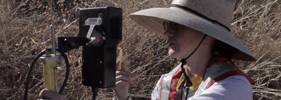
The tall steel gauge stands attached to a catwalk amidst the red rocks of the San Pedro River near Tucson, Ariz. Coy describes how the ALERT gauge works and also discusses some of her measurement methods to verify the gauge’s readings.
She uses a handheld meter to double-check water levels and take flow readings.
Image:U.S. Geological Survey field worker Hannah Coy takes measurements in the San Pedro River (Credit: USGS)


0 comments