Without public info, researchers track fracking sites through satellite images
Researchers and concerned citizens are watching Pennsylvanian hydraulic fracturing sites from above, according to a recent report from Smithsonian magazine. John Hopkins scientists have been looking for a connection between poor health and chemical exposure by tracking fracking sites.
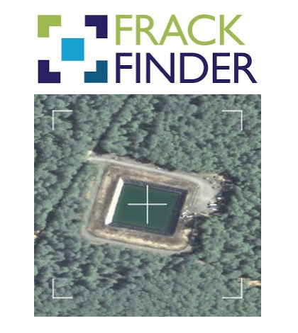
State officials can’t reveal the sites’ locations, so the researchers partnered with Sky Truth, a non-profit organization, to locate the fracking waste ponds.
Sky Truth’s project involved 200 volunteers spotting fracking ponds on satellite images. Sky Truth recently released their map which shows 500 fracking ponds, a little over 45 times as many ponds in 2005. The scientists’ next task is studying asthma patients who live near the sites to see if their health has worsened.


0 comments