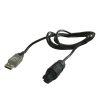
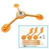
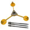
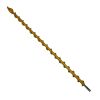
Sentek Drill & Drop Soil Moisture Probe
Features
- Quick and easy undisturbed installation due to tapered shape
- Measures the true soil profile, not slurry
- Pre-normalized sensors with built-in default calibration equation
- Free ground shipping
- Expedited repair and warranty service
- Lifetime technical support
- More
Overview
The Sentek Drill & Drop is a fully encapsulated, easy-to-install soil measurement probe. Probes are available in five lengths: 10cm, 30cm, 60cm, 90cm, and 120cm, with sensors fixed at every 10cm (4”) increment. Purchase options are either with soil moisture + temperature sensors or soil moisture + temperature + salinity.
Deployment
Due to the ease of install and protected electronics, the Drill & Drop is ideally suited to situations where a monitoring probe may need to be moved between sites in short-term and annual crops. Having the electronics completely encapsulated and able to be completely buried also makes the probe suited to long-term installations, where machinery will often pass, such as dry land and feed crops. Being able to leave the probe in the ground means long-term, uninterrupted data trends, and comparison between seasons is possible.
The Drill & Drop also covers the issue of data continuity and integrity where the probe does need to be reinstalled. The ingenious tapered probe and matching auger allows direct, slurry-free, installation. This direct installation method means that the probe is measuring ‘real’ representative soil conditions immediately after install, because the surrounding soil has not been disturbed.
In The News
Long-Term Monitoring in the Chautauqua Lake Watershed
With a widely developed shoreline, Chautauqua Lake experiences influxes of non-point source pollution that have historically impacted the health of the lake. The Chautauqua Lake Association (CLA) has been monitoring the lake for over two decades, reporting on changes that have occurred over the years. A pair of local lake advocates, Jane and Doug Conroe, have lived on the lake for over 40 years and have played an important role in establishing monitoring programs and facilitating consistent data collection throughout the watershed. Doug has been involved with the Chautauqua Lake Association (CLA) since the pair moved to the area in 1980, and is currently serving as the Executive Director.
Read MoreNo Red Herrings: Data Driving the Largest Salt Marsh Restoration in the NE USA
The Herring River system encompasses around 1,000 acres in the Towns of Wellfleet and Truro, Massachusetts. In 1909, the Chequessett Neck Road dike was built at the river’s mouth, drastically limiting tidal flow. Today, it’s one of the most restricted estuaries in the northeastern United States. As a result, the area has suffered environmental decline, including poor water quality, hypoxia, lower pH, and salt marsh degradation. In 2023, the Town of Wellfleet received $14.7 million from NOAA’s Office of Habitat Conservation to fund the Herring River Restoration Project (HRRP). Francesco Peri, President and CEO at Charybdis Group LLC, uses a network of NexSens data loggers to monitor water level and water quality on the Herring River.
Read MoreCarbon and Nutrient Monitoring in the Great Lakes Using Satellite Observations
Carbon and nutrients are the foundation of lake food webs and play an important role in the chemical and physical processes that shape aquatic ecosystems and various lake dynamics. Studying these cornerstones can help improve understanding of other lake conditions like harmful algal blooms, hypoxia, and phytoplankton community composition. The way in which these characteristics are monitored varies, though many rely on a proxy approach wherein parameters are extrapolated from the measurement of a different parameter. An assistant professor at Cleveland State University, Brice Grunert, is working to improve current strategies and take a satellite approach to monitoring the Great Lakes.
Read More


