
Monitoring Water Quality In Lake Mead In A Time Of Drought
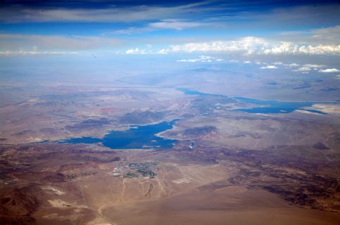
Lake Mead and surrounding area from above. (Credit: Doc Searls via Wikimedia Commons / CC CY 2.0)
The Colorado River Basin stretches over approximately 246,000 square miles, snaking through the southwestern “basin states”: Arizona, Colorado, California, New Mexico, Nevada, Wyoming and Utah. From there the river flows into Mexico, a reminder of the connected past — and future — of our countries.
Historically, the river itself provides water to in excess of 30 million people, helps hydropower plants generate more than 10 billion kilowatt-hours per year, offers a chance for recreation for many in the region and allows farmers to irrigate almost 4 million acres of crops in both the US and Mexico. The Colorado River is also the locus for a host of ecosystems, small and large, all dependent upon its water for life. Wildlife, fish and plants in the region are almost universally tied to the health of the river.
Adjusting to Drier Times

Changing water levels in Lake Mead. (Credit: Ken Dewey / NOAA)
However, the Colorado River system is now under threat, facing the worst drought on record. Scientists and policymakers in the region are now called upon to manage the competing interests that rely upon the river against the growing challenges of decreasing stream flows, increasing population and climate change. The water level of Lake Mead, one of the primary water storage reservoirs for the river, has plummeted more than 130 feet since the start of 2000.
Southern Nevada and much of Arizona rely heavily on the Colorado River for water. As the levels of Lake Mead decline, new challenges arise; it’s possible that hydropower facilities will be unable to operate as they’re intended, that shortages will be declared and that water quality will suffer as levels drop. The Southern Nevada Water Authority (SNWA) has been monitoring and coping with the drought for more than ten years, and that response has included both scientific study and detailed water resource plans.
For example, SNWA assisted the Las Vegas Valley in reducing the consumption of Colorado River water by 30 billion gallons between 2002 and 2016 despite a boom in population of more than 600,000 people by implementing one of the country’s most comprehensive and progressive conservation programs. This program includes mandatory watering and landscape restrictions and boasts a high level of community participation — and the significant results you’d expect to see with this kind of adherence to an aggressive plan.
Nevada’s Secretary of the Interior may declare a shortage if Lake Mead drops below 1,075 feet. If this should happen, the allocation for the state will fall from 300,000 acre feet annually to 287,000 acre feet. A single acre-foot is equivalent to 325,851 gallons of water, so that’s a significant adjustment, especially for a region with a growing population. However, because the SNWA’s conservation program has been so successful, Southern Nevada is not using its full allocation at the moment, so even a shortage would not have an immediate impact on the area.
Water Quality in Lake Mead

Low water levels in Lake Mead compared to the historical high mark. (Credit: Ken Dewey / NOAA)
The larger and more immediate problem with the dwindling water levels in Lake Mead is water quality. Because the lake is such an important regional water source, it is of course consistently scrutinized for quality. Organisms present in Lake Mead can cause or worsen odor and taste problems, even in the treated water supply already slated for drinking. Such organisms also clog the water treatment filters SNWA uses, so SNWA tests for them regularly.
Teams of scientists are also watching Lake Mead for signs of destratification. In warmer weather, the top portion of the lake’s water heats more quickly than deeper portions, which causes thermal stratification, a distinct layering of water. This process separates warm and cold water, and also protects the deeper layers of water by trapping pollution and organisms in the warmer layers near the surface. The intakes for the lake are located at those same depths, and so they draw from the higher quality, deeper water. However, destratification can take place when the layers break down in cooler weather, mixing organisms and pollutants into the other layers and possibly the intakes.
Drought also affects water quality negatively, in similar ways, and in its own unique ways that demand specialized monitoring. Caitlin Glover of the Las Vegas Valley Water District (LVVWD) explained the recent measures necessitated by the drought:
“In order to adapt to changing water quality brought on by drought conditions, the Water Quality Research and Development group at the Southern Nevada Water Authority (SNWA) is overseeing the purchase of a suite of instruments capable of monitoring the raw water from Lake Mead in real time. This suite of instruments is intended to act as a first response to changes in Lake Mead water quality due to drought conditions,” Glover explained. “This includes the purchase of the Fondriest buoy, which is capable of monitoring several water quality parameters concurrently near the confluence of the Las Vegas Wash and Lake Mead; upstream of the drinking water intake. The Las Vegas Wash contains all of the flow from the valley into Lake Mead and is primarily composed of treated wastewater (about 80 percent).”

A view of the dam. (Credit: National Park Service)
These drought conditions appear to be something that will be an ongoing problem. “Drought conditions are expected to continue with Lake Mead, having dropped by more than 143 feet since 2000,” Glover confirmed. “This has left the storage capacity at 38 percent of its potential.”
Right now, the team already monitors for various water quality indicia, but Glover explained how this new system will be different.
“The monitoring system will allow for data collection every 15 minutes and will be able to capture changing water quality, particularly algal bloom events potentially associated with the Las Vegas Wash. Turbidity, chlorophyll and blue-green algae are currently monitored by grab sample collection, which occurs infrequently at this location, at most once per week,” Glover detailed. “Red excitation chlorophyll, optical brighteners and tryptophan are not currently monitored by SNWA, but are useful parameters to better understand the presence of wastewater effluent and algae near the confluence. All of the data collected by this buoy would provide an early warning to the SNWA treatment plant operators so that they could respond to changes in influent water quality and thereby continue to protect public health. Furthermore, the data can be incorporated in the modeling of Lake Mead conducted by SNWA.”
Obviously this kind of monitoring can help tell scientists about problems right when they arise. The SNWA will respond based on the data they capture; Glover explained, “Our main concern with the drought is that the water will be more difficult to treat meaning that we would have to upgrade our treatment plants at great expense.”
Moving forward, the team hopes to be using this new real-time system to generate better information and respond to problems immediately, as they arise. In the longer term, if patterns emerge, they can make more effective long-term plans for mitigation.
Top image:Lake Mead and surrounding area from above. (Credit: Doc Searls via Wikimedia Commons / CC CY 2.0)
One Comment
Leave a Reply


Emmanuel ogbe
November 26, 2017 at 6:03 pm
These images are divine.
This is extremely natural.