Posts for tag "water level"
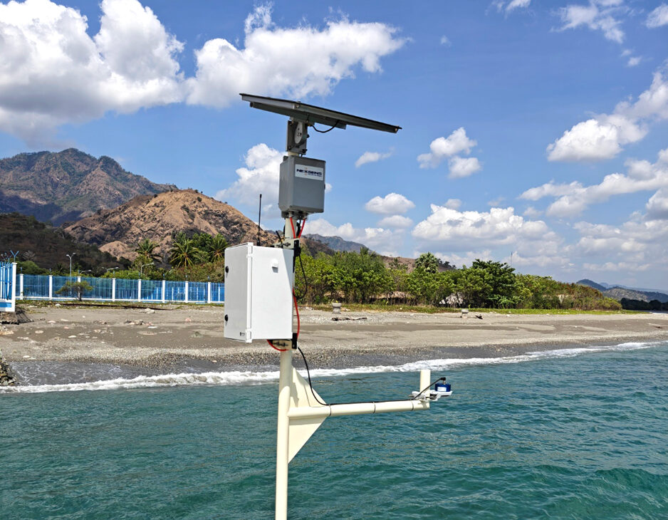
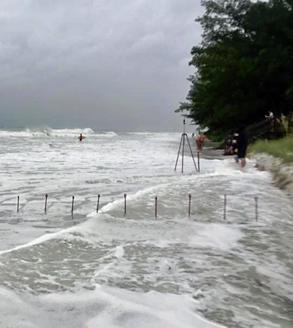
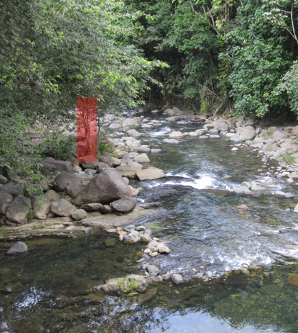
New Tide Gauges Bring Real-Time Ocean Data to Timor-Leste’s Shores
Timor-Leste is a growing country in Southeast Asia that occupies the eastern half of the island of Timor. Since its emergence in 2002 as the first new sovereign state of the 21st century, it has made “significant...
- Posted October 6, 2025
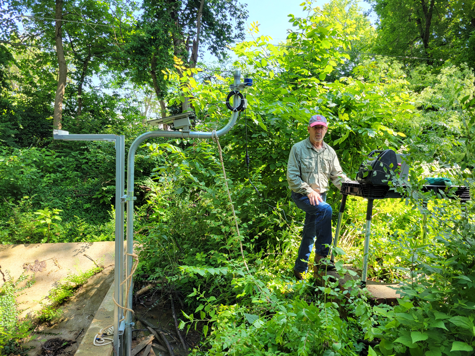

30 Minutes to Act: University City’s Award-Winning Flash Flood Prediction System
Flooding is already the deadliest severe weather hazard in Missouri, and under high-emissions scenarios, the central US is predicted to emerge as a flash flooding hotspot. University City, a suburb of St Louis, Missouri, is “violently” and...
- Posted August 11, 2025
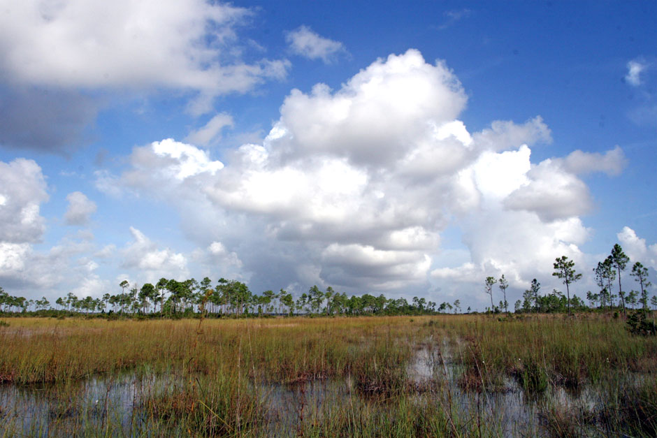

Everglades Restoration: A Story of Wetlands and Water
Everglades restoration efforts aim to restore historical hydrology, providing relief to stressed peatlands.
- Posted September 23, 2020
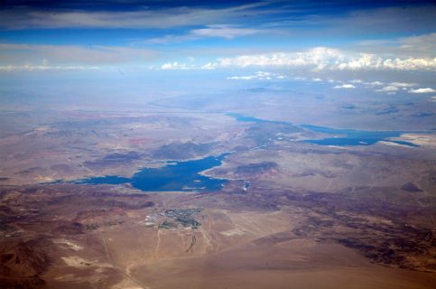

Monitoring Water Quality In Lake Mead In A Time Of Drought
Scientists are using early warning data to protect the public health and balance competing interests surrounding the Colorado River and Lake Mead.
- Posted November 7, 2017

White Bear Lake Stands Out In Study Of Twin Cities Lakes
U.S. Geological Survey scientists find lake levels in the Twin Cities, including White Bear Lake, vary largely based on geology and land use.
- Posted October 27, 2016
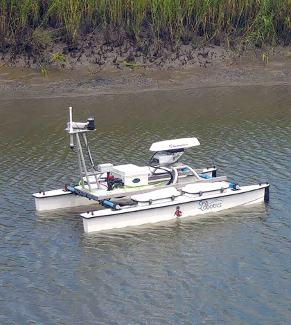

Coastal Marshes: Unmanned Surface Vehicle Has Eyes On Rising Seas
North Carolina State University researchers use an unmanned surface vehicle to study organic matter and carbon flux in coastal marshes.
- Posted October 14, 2016
Recording High-Water Marks Depends On GPS Data, Elevation
The U.S. Geological Survey establishes high-water marks after floods using GPS data cross-referenced with existing elevation measurements.
- Posted October 7, 2016
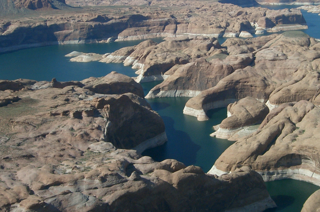
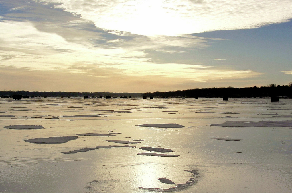
Lake Powell Not Full Enough To Withstand Heavy Drought
Lake Powell is only about half filled nowadays and an extreme drought could very likely empty the lake, a modeling study finds.
- Posted September 29, 2016
Hurricane Hermine: USGS Scientists In Eight States Sampled Through Storm
As Hurricane Hermine’s storm path crossed Florida and the U.S. eastern seaboard, USGS scientists were some of the first on the scene.
- Posted September 27, 2016
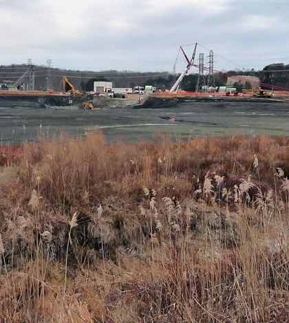
Sonar Altimeter Data Help In Fly Ash Pond Dewatering Project
Experts at Los Alamos Technical Associates use a sonar altimeter and fishfinder in a fly ash pond dewatering project to help protect aquatic life.
- Posted September 23, 2016
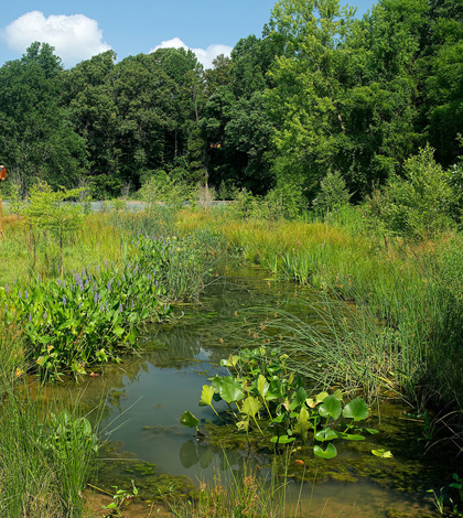
Water Level Sensors Show Promise Of New Haven Rain Gardens
Yale University investigators track New Haven rain gardens with water level sensors, showing their usefulness in reducing flow to combined sewer overflows.
- Posted September 6, 2016
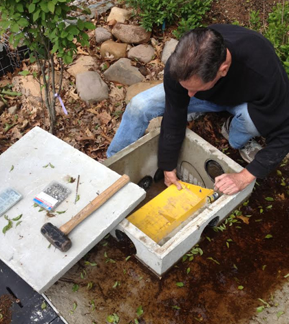
Level Data Key For Restoration Projects, Stormwater Management
RK&K engineers use In-Situ water level and barometric pressure loggers to monitor wetland restoration projects and in stormwater management.
- Posted July 28, 2016
Extreme Erosion In Rivers Not Always Linked To High Rainfall
U. of Pennsylvania researchers find that extreme erosion in rivers doesn’t always coincide with extreme levels of rainfall.
- Posted May 23, 2016
NASA’s Coastal Sites Threatened By Rising Seas
NASA owns a lot of properties around the country, amounting to a total value of around $32 billion. These include some famous launch sites like the Kennedy Space Center, which supported some of the Apollo Mission launches,...
- Posted April 15, 2016
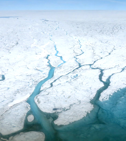
Rising Sea Levels Linked With Greenland Changes
Scientists at Rutgers University have found that rising sea levels are linked with a number of trends around Greenland. These include vanishing Arctic sea ice, persistent weather systems and surface ice melting on the island itself. During...
- Posted April 8, 2016
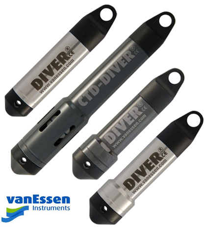
Van Essen Diver Loggers Join Fondriest Product Lineup
New to Fondriest Environmental’s product portfolio are the Van Essen Instruments Diver loggers, which are ideal for monitoring groundwater and surface water in a variety of applications. See below for a short description of each new addition....
- Posted March 21, 2016
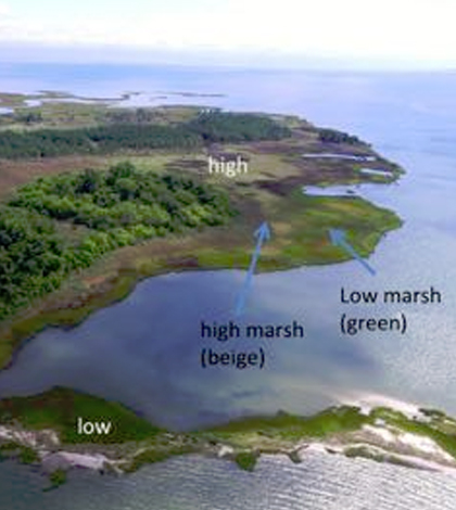
Salt Marshes More Resilient To Sea Level Rise Than Thought
Salt marshes aren’t as vulnerable to sea level rise as has been previously thought, according to researchers at William & Mary’s Virginia Institute of Marine Science (VIMS). The claims that salt marshes are so vulnerable, scientists argue,...
- Posted March 10, 2016
Multiple Studies Find Sea Levels Rising At Historically Quick Rate
Multiple studies are pointing to manmade climate change as the cause for continuing rises in sea levels, according to the New York Times. The level rises have been spurred by greenhouse gas emissions, scientists say. The emissions...
- Posted March 8, 2016
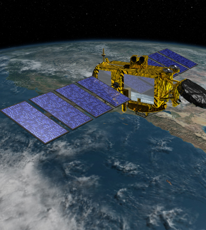
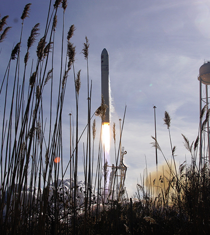
Jason-3 Satellite For Tracking Sea Levels Launches Successfully
A new satellite for monitoring the rise of the world’s oceans has successfully been launched into space, according to the New York Times. The launch took place Jan. 17, and was completed by Space Exploration Technologies Corporation,...
- Posted January 26, 2016
Great Salt Lake Level Hits Record Low
The north arm of Great Salt Lake is seeing record-low water levels, according to Fox 13 TV in Salt Lake City. Hydrologists studying the declines say that the levels haven’t been this low since the 1960s. At...
- Posted January 5, 2016


