Using Traditional Ghanaian Fishing Canoes to Monitor the Gulf of Guinea
Each year, towards the end of the Northern Hemisphere’s summer, something mysterious and profoundly impactful begins generating deep in the ocean. Off the Gulf of Guinea, which stretches along West Africa and the equatorial Atlantic Ocean, a deep-sea upwelling begins taking place.
Wind and ocean currents driven by the Earth’s rotation allow cold water from thousands of feet below the waves to begin forging its way to the surface. This water is loaded with chemical nutrients, causing a surge in primary production driven by phytoplankton, resulting in a feast for marine life.
This feast extends to humans as well, as fishers from across the coast often benefit from increased catch during these times. Therefore, understanding the mechanisms that drive this upwelling is crucial to predict and improve this industry that is both culturally and economically important to West Africa.
Yet, a historic lack of resources has made studying this region of the Atlantic difficult. This is changing, however, as a group of researchers led by the University of Ghana and partnering with the University of Rhode Island (URI) and Woods Hole Oceanographic Institute hopes to change that with a unique plan: attaching water quality monitoring sensors to local fishing canoes.
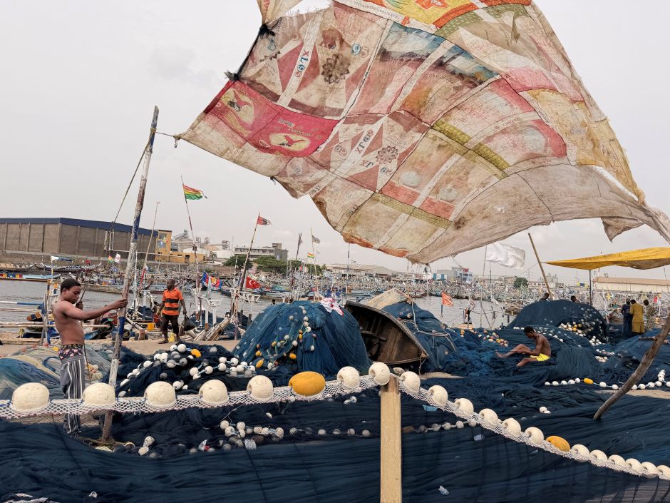
A sunshade in the Tema canoe basin. (Credit: Melissa Omand)
Attaching Sensors to Traditional Ghanaian Fishing Canoes
Melissa Omand is an associate professor at the URI Graduate School of Oceanography and a co-lead for the collaborative project, which is part of URI’s Ocean Margins Initiatives. She was drawn to the big questions around what drives upwelling in the Gulf of Guinea, and knew the importance of understanding this underresearched phenomenon in the face of climate change.
“It’s important because we often don’t study equatorial processes as much as we’ve studied the subtropical zones, because that’s where most of the resources for doing this kind of observational work are located,” Omand says. “So this was a chance to work with the University of Ghana to establish a regular program of monitoring what’s happening.”
The five-year program, which is funded by Schmidt Science’s Ocean Biogeochemistry Virtual Institute (OBVI), began in the summer of 2025. Omand says the project’s goal is to use observations and computer models of temperature, nutrients, and planktonic algae and animals to understand when and where the upwellings occur, and deduce the physical forces that drive them.
Intensive water quality sampling will occur during the summer months aboard ships from the Ghanaian Navy and, starting in 2027, Schmidt Science’s Falkor (too) research vessel. But field work will continue throughout the year, filling in gaps and offering crucial nearshore data where larger vehicles don’t reach, and where phytoplankton persist in the largest numbers.
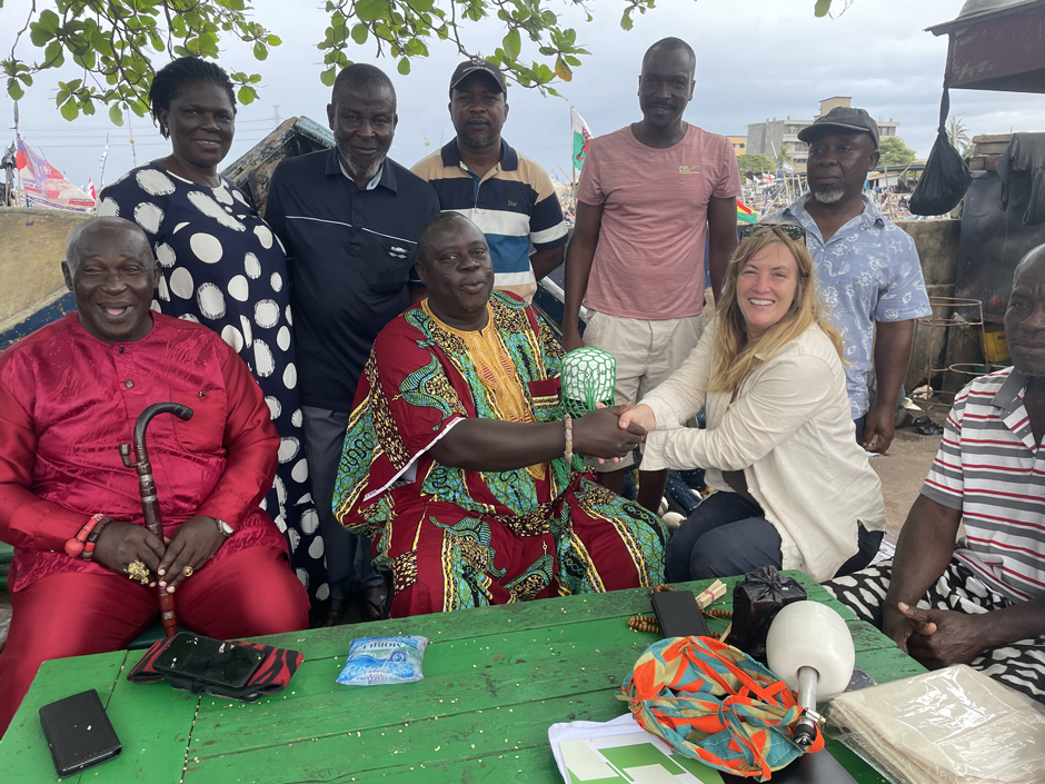
Melissa presents the fisher chiefs and canoe owners with the GPS beacons. (Credit: Melissa Omand)
This work will be carried out by local students and, uniquely, Ghanaian fishermen. Omand explains that with such a large coastal area to cover and the monetary challenges of establishing a large-scale monitoring network, she and her colleagues knew it was crucial to use the resources already found in the Gulf.
“Our goal was [to] set up a program that would leverage the types of access to the ocean that were already available, rather than saying, ‘Oh, well, you need this expensive research vessel,’” Omand explains. “It’s like, ‘What’s already there that can be used?’”
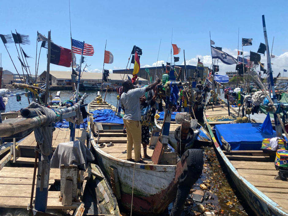
What’s there are thousands of fishing canoes, dozens of feet long, with outboard motors strapped to the back. In Tema, the busiest fishing port in Ghana and the location of the project’s first sensors, these vessels stretch as far as the eye can see along the sandy coastline.
The colourful wooden canoes crowd together on the beaches or anchor at sea, waiting to be released onto the waves. The incredible sight reflects the significance of this industry, and the project is eager to utilize these vessels in the Gulf of Guinea.
In August, Omand equipped four canoes with URI-built GPS beacons based on SPOT Satellite devices. She explains that this is the first step to building the project, as the canoe owners and the fishermen’s families on shore can now track their location, which sometimes reaches over 100 miles off the coast.
After giving the canoes a test run with GPS beacons, Omand will return to Tema in December with more beacons and, importantly, some HOBOnset Wireless Temperature Sensors to begin plotting temperature data in conjunction with GPS data, to enable a real-time prediction of the onset of seasonal upwelling.
Together with the beacons, this fleet of sensors will begin building the base of what Omand and her colleagues hope to be the first established ocean monitoring network in West Africa.
Fishers installing the GPS beacon on their canoes. (Credit: Melissa Omand)
Working with Local Fishers to Monitor the Gulf of Guinea
With only sporadic water quality research having previously occurred in the Gulf of Guinea, Omand and her project co-leads knew they had work to do. An important step for Omand was working with the Canoe and Fish Gear Owners Association in Ghana. The Tema regional chairperson, Jefferson Reuben Ocansey, has connected the foreign scientists in the project with local fishers.
“The fishers are very happy about [the project],” Ocansey says.
Omand also emphasises that the fishers have been extremely welcoming and open to the project, along with the students at the University of Ghana who will be participating. The crucial part for Omand was establishing that there are benefits for both science and fisheries through this monitoring.
“It was important to kind of establish what our intentions are: what we are trying to achieve, and why we are trying to achieve that,” Omand says. “And then the fishers always wanted to know, ‘Well, how is this going to help me?’”
Along with safety from the GPS beacons that Ocansey emphasised, Omand believes fishers will benefit from water quality measurements, as stocks and catch rates have been declining for the last several years.
She says that using the GPS to pinpoint productive catch locations and tracking temperature to predict the nutrient upwelling will both help fishers target the best fishing locations.
Regional fisheries associations have already placed closures on extraction for months at a time, so locals are eager to understand why their stock is suffering and what they can do to help.
“They’ve been so welcoming and willing to collaborate with us [because of] the potential benefits that having these beacons on their vessels might pose for them,” Omand explains. “They deeply love the ocean, and they see it as their livelihood, their resource that they rely on above anything else, and they want to take care of it.”
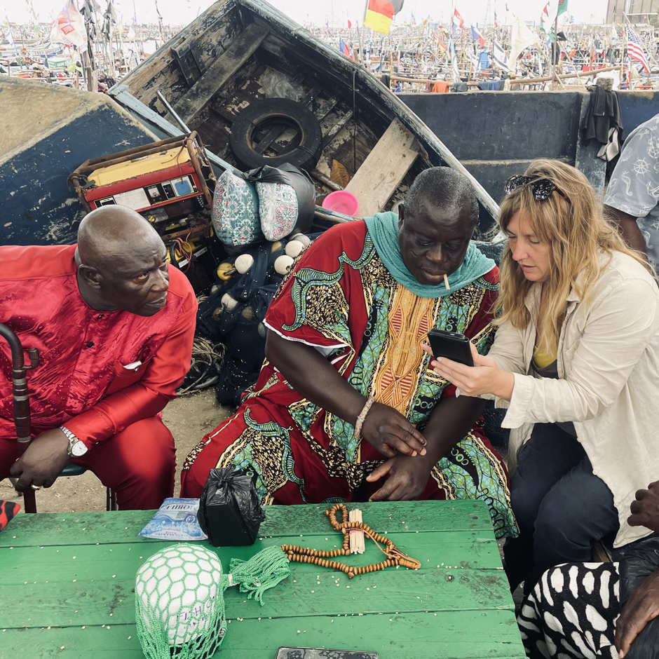
Melissa setting up tracker links for the Tema fishing chiefs and canoe owners’ smartphones. (Credit: Jefferson Ocansey)
The Future of the OBVI Project
In the end, Omand and her colleagues hope to build a monitoring system that can last long after their five-year program ends. By expanding their temperature sensor fleet, which Omand says can be used as a proxy for nutrients, she eventually hopes to add more sensors for parameters like solar radiation, wind, and acoustic backscatter.
However, building a sustainable monitoring network goes beyond just buying sensors. By working collaboratively with local fishers and universities, the team is working to sustain the work beyond the five-year funding window.
“Even when the project ends, fishers will own the project for security and safety of life and property,” Ocansey explains.
The University of Ghana also helps connect students to the project. Omand says they will not only learn about water quality monitoring themselves, but will also be able to share their findings with others through their own research and published papers.
“There’s a lot of planning that goes into this type of field work, and it’s a lot of incremental steps to get to the point where everything is just working together, and everything goes smoothly,” Omand explains
The commitment from local universities and international research organisations shows promise for the Gulf of Guinea. Ghanaian families can trace their fishing roots back for generations, so understanding the natural processes that drive their livelihoods extends beyond mere scientific inquiry.
Omand has seen how letting locals lead, whether they are scientists or fishers, can transform a project as important as monitoring one of the world’s most highly productive marine ecosystems.
“I think that it’s worth not taking our own paradigms or our own expectations about what is required to do good science,” Omand says, “but really trying to look around at how people are interacting with the ocean in different places, and what kinds of access is already there, and what are the questions that they most want to be answered.”
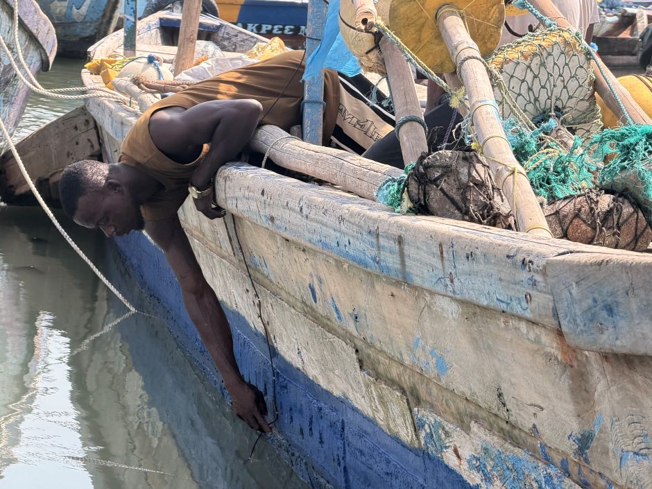
A fisher fixes the probe along the side of the hull. (Credit: Melissa Omand)


0 comments