Buoy Camera Research: Key for Regional Science Consortium
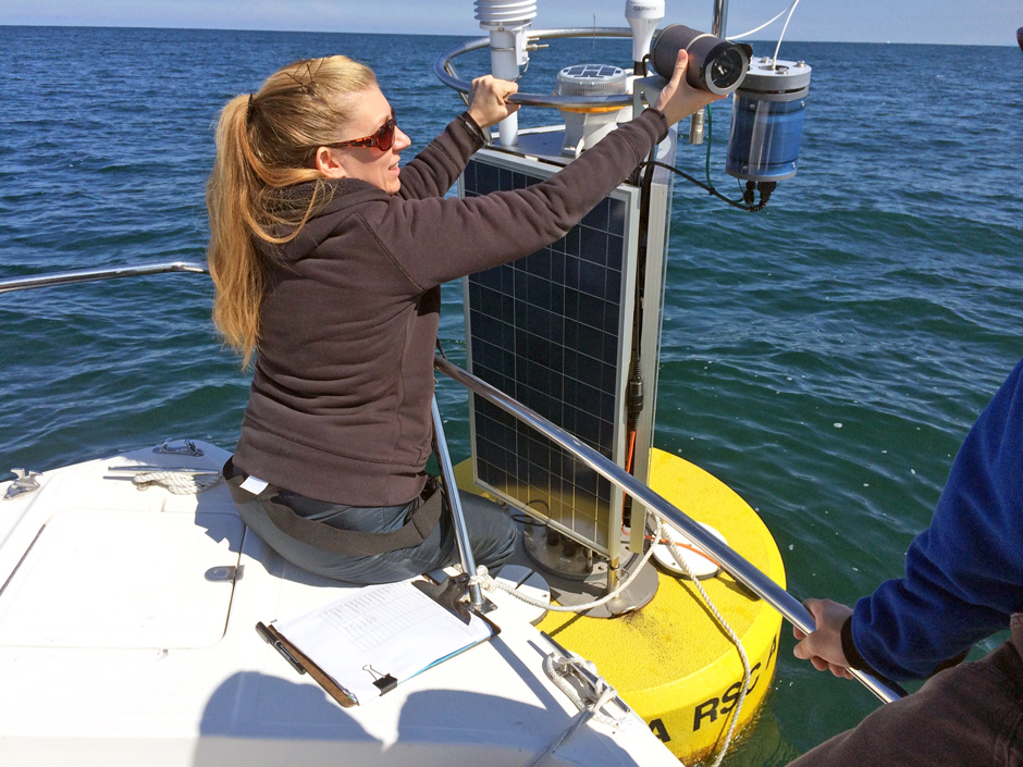 Dr. Jeanette Schnars checking and cleaning the video camera on the Nearshore Buoy. (Credit: Jeanette Schnars)
Jeanette Schnars has been the Executive Director of the Regional Science Consortium, a cooperative research leader located on the shore of Lake Erie, for 15 years. In that time, she has overseen some major technological innovations, such as the increased use of buoy cameras. “We were actually one of the first research groups to use video monitoring on a buoy,” she recalls.
The Regional Science Consortium (RSC) is a non-profit collective of researchers and educators that facilitates knowledge gathering and dissemination regarding the Lake Erie and Ohio River Basin ecosystems for K-12, member colleges, and the general public.
“The focus is on research and education, creating educational opportunities and experiences, and putting applied research information into the hands of waterfront managers as well as those overseeing water quality, wetland restoration, and state agency functions. We provide information so they in turn can provide better management,” says Schnars.
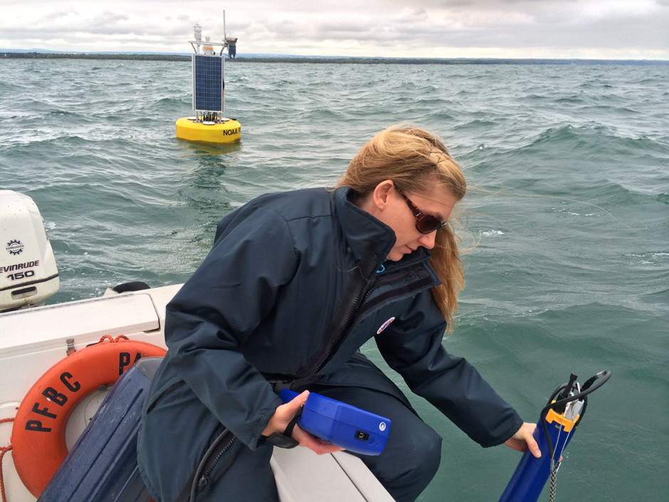
Jeanette Schnars checking the accuracy of the water quality parameters with the EXO2 sonde at the Nearshore Buoy. (Credit: Jeanette Schnars)
Buoys with Video Cameras are Essential in Upholding the RSC and its Mission
The RSC has four buoys on Lake Erie and two weather stations along the shoreline. All provide real-time data to managers, researchers, and the public. They also offer a long-term database with well over a dozen parameters that show how conditions have changed over time. “These are useful for research and monitoring projects. We can compare parameters buoys and weather stations are measuring to the data that is being collected,” Schnars explains.
The buoys are equipped with weather stations and a water quality sonde, which measures water temperature, dissolved oxygen, turbidity, pH, and a blue-green algae sensor used to monitor Harmful Algal Blooms (HAB). The buoys also have a wave meter that measures wave height, maximum wave height and wave period. All data is updated every 20 minutes. Two of the buoys also include a video camera, capturing 10-second videos every hour. Buoys are deployed from May through October annually.
“The data collected by the buoys is processed through NexSens and is then posted to our website. All of the data is stored and can be accessed to examine changes or trends over the years. We’ve been collecting data since 2007,” Schnars mentions. “Our data is provided in real-time to the Great Lakes Observing System (GLOS), the NOAA National Data Buoy Center, and the NOAA National Weather Service.”
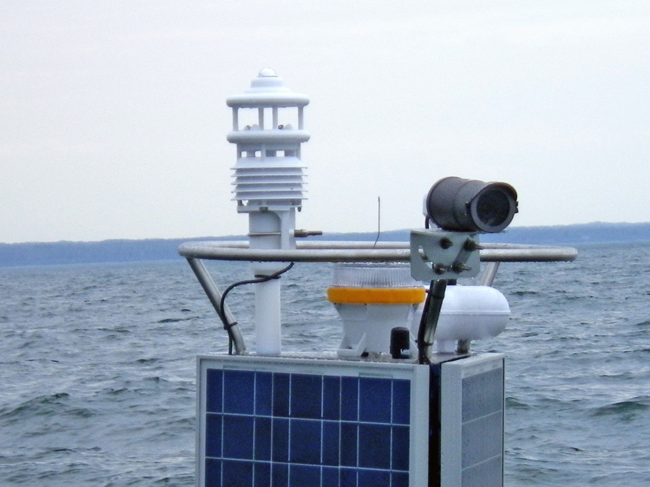
Buoy camera. (Credit: Jeanette Schnars)
Fishermen use the buoy and buoy video data to find water temperature, wind velocity, and wave conditions.
Local windsurfing groups and kayaking groups also use the buoy camera data.
Erie Bird Observatory also uses the buoy camera and data, as they plan their fieldwork to monitor the different populations of birds at Presque Isle State Park. The video data provides a visual of environmental conditions, which may provide insight into the behaviors of the birds they monitor.
Other users of the buoy video data also include Lakeshore Towing, a small business aiding boaters on Lake Erie and Presque Isle Bay. Lakeshore Towing also deploys and retrieves the buoys each year. In addition, other users include the PA Fish and Boat Commission Law Enforcement, the U.S. Coast Guard, and the U.S. Border Patrol.
The Ultimate Goals for the Buoy Camera Data are Diverse
“They were installed as another line of data for us to compare to the wave meter data, so we could determine if the wave meter was recording accurately. However, it turned out that the public also uses the video data. It lets them answer questions like, ‘What does a three-foot wave look like?’” Schnars explains. Wave height and wave period data are uploaded every 20-minutes, and the video is uploaded each hour as a 10-second video. Waves are typically 3-feet or less on a good day for boating. Storm events may have 12-15 foot waves.
The tallest wave measured by the buoy was in 2015, measuring 26.5 feet during a severe storm event. But wave height isn’t the only important information boaters need to know. “The buoy video also gives the public information on the presence of waves with whitecaps,” says Schnars. “We have no other way to capture this information. Whitecaps on waves indicate rougher conditions, which is useful for boaters, fishermen, and others to know. The buoy cameras will give those who want to go out on the water a more complete picture than the simple wave measurement.”
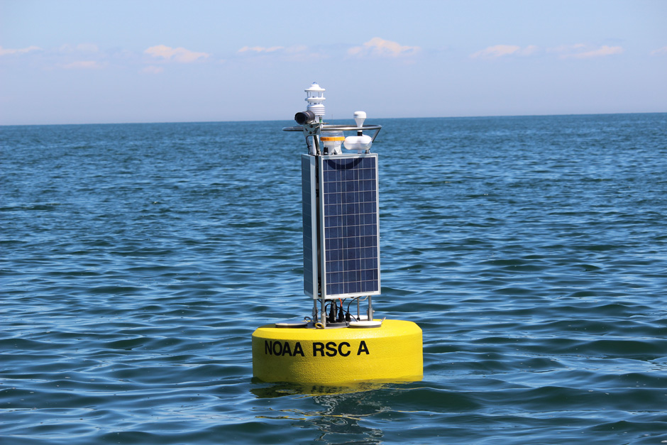
Buoy. (Credit: Jeanette Schnars)
“The buoy cameras have operated very well,” Schnars says. “NexSens worked with us to make everything compatible, and we really have had few technical challenges over the years. Even with the continual exposure to wind, water, and waves, we have not had to do much maintenance. Not to mention, the cameras have captured some great videos of storm events and sunsets.”
The Future of Buoy Cameras and RSC
In the future, Schnars and others plan on raising money to continue and potentially upgrade all things buoy, including operations, repairs, towing, and maintenance. Many organizations make donations to keep the RSC buoys going. RSC would need about $10,000 to $25,000 or more per year to maintain the buoys. Last year the RSC received a generous grant from the PA Fish and Boat Commission to support the buoy program and make the many necessary upgrades. The Great Lakes Observing Grant of $100,000 originally funded the nearshore buoy’s construction, deployment and retrieval. Buoy probes may last 2-5 years while, alternatively, wave meters need to be replaced, weather stations need to be upgraded, and cellular modems need to be upgraded as technology advances.


0 comments