Coral Reef Early Warning System Buoy
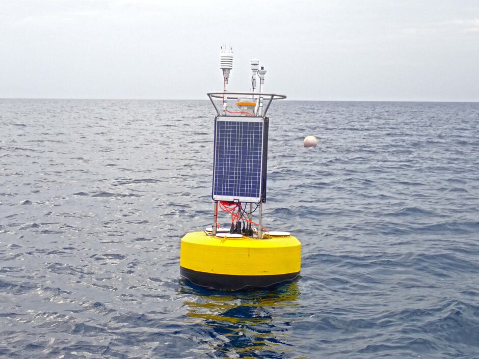
The buoy installed and in service. (Credit: CCMI, via communication)
For almost a decade, the buoys of the Coral Reef Early Warning System (CREWS) have been situated in the Caribbean Sea, providing the world with weather patterns and data about climate change. Since June 2018, a new, state-of-the-art oceanographic buoy was installed by the Central Caribbean Marine Institute (CCMI), which runs the CREWS system. This new addition to the CREWS buoy system offers ocean state and weather data in near real-time, all accessible from a computer or smartphone.
Kate Holden, CCMI’s Director of Advancement, connected with EM about the new buoy and the system, and what makes them both so state-of-the-art.
Watching the reef
One of the main goals behind the Coral Reef Early Warning System is keeping coral around the world healthy.
“The purpose of CREWS, which is overseen by the National Oceanic and Atmospheric Administration (NOAA), is to provide a global network of instrument buoys,” explains Jon Clamp, CCMI Director of Operations. “These buoys act in concert with one another and can track and understand global oceanic trends, thereby leading to early warnings of potential destructive trends allowing managers to develop strategies for mitigation of some of these issues.”
The buoy contains a weather station, measuring air temperature; wind direction; maximum and minimum wind speed; average wind speed; barometric pressure; relative humidity; and rainfall amount, duration, intensity, and interval. “It also measures PAR (Photosynthetically Active Radiation) or sunlight, above the water and at up to 1 meter depth,” adds Clamp.
Other instruments measure dissolved oxygen, pH, conductivity (salinity), and temperature. This allows the CCMI team to track changes in ocean acidification, a serious threat to corals.
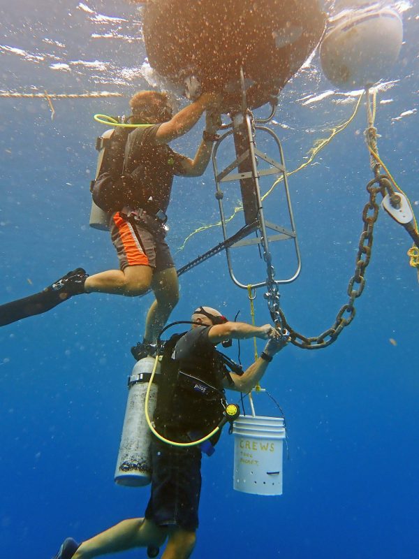
A team member maintains the buoy. (Credit: CCMI, via communication)
The new CREWS also includes an Acoustic Doppler Current Profiler (ADCP) which quantifies how water moves across the reef system.
“This measures the movement of the ocean water beneath the buoy from 0 to 50 feet through 13 different points or about every 4 feet,” states Clamp. “This allows us to look at the complexity of water movement in detail as currents on the surface may not reflect the currents at 50 feet.”
A deeper understanding of these currents can help the team to understand how fish and corals interact both inside and outside of marine protected areas.
“Understanding the physical motion of water through the refinement of an ADCP will help build models of localized water movement, to predict the direction and speed of movement of the coral spawn, in turn identifying potential sites for coral recruitment. Identifying these sites can lead to reef managers designating protected areas that may not have been understood prior to this technology,” clarifies Clamp. “This can also apply to many other broadcast spawning species. Utilizing water movement as a parameter will improve the understanding and inter-connectivity of many reef species.”
Better buoys
Taken together, the sophisticated instrumentation package on the new buoy can track rising temperatures linked to coral bleaching and changes in ocean chemistry that affect photosynthesis, acidification, and other environmental concerns.
“The new buoy also has a significantly smaller physical footprint, so it is easier to maintain, deploy and retrieve and is, therefore, less demanding on the resources and easier to handle,” comments Clamp. “Data is collected and displayed using updated real-time technology via smartphone, which is more responsive and user-friendly. Previously, the data output was unwieldy, and with the new system, we can present data in graphic ways that are easy to understand and therefore relevant to a broader scientific and lay community. Previously this would have been acres of excel spreadsheets. All these elements bring us to the cutting edge of how data and technology are presented and understood, thereby allowing a faster path for environmental resource managers, governmental departments and stakeholders to adapt to the changing needs of our environment.”
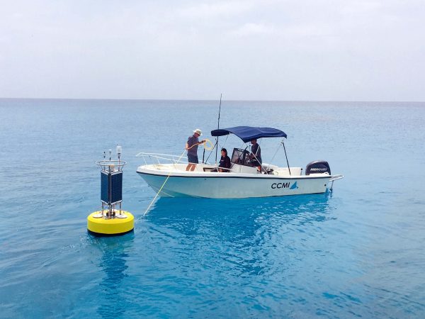
The new CREWS buoy being towed to a new location. (Credit: CCMI, via communication)
In fact, thanks to the interlinked cellphone app, a smartphone is really all anyone needs to get conditions and data from the system.
“The smartphone app is available to the general public and is already used by interested stakeholders such as dive shops, sailors and fishermen,” confirms Clamp. “The website is available to resource managers, scientists and entities interested in long-term trends and historical records.”
Part of the aim of this tech and its implementation is to find innovative ways to restore coral reefs. The team also hopes that they’ll someday be using the technology to answer questions they haven’t yet conceived.
“The idea is to incubate potential strategies to help coral reefs to develop resilience and to identify coral species that can adjust to the potential environmental changes that we are witnessing now,” concludes Clamp. “This equipment can help understand the many different parameters that stress coral species. The data output has led to experimenting with how some corals survive in differing depths, locations and temperature exposure. We are also spearheading projects involving multiple species. Ultimately though, the CREWS allows scientists to ask more in-depth questions due to the refinement of specific data.”
The CCMI team invites readers to watch for new developments on their website: https://reefresearch.org/
Top image: The buoy installed and in service. (Credit: CCMI, via communication)


0 comments