GIS-based tool could help reduce nutrient runoff into Mississippi, Ohio Rivers
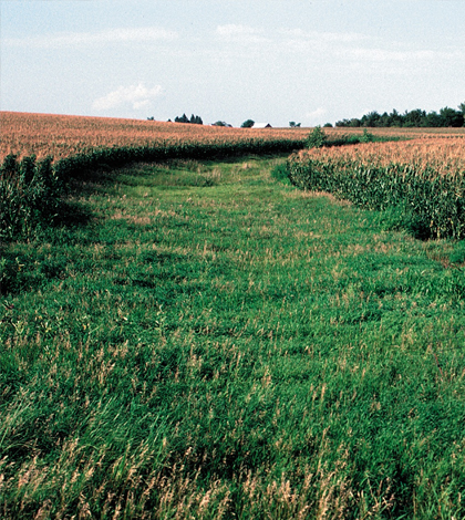
A grassed waterway in Cherokee County, northwest Iowa. (Credit: Lynn Betts / USDA Natural Resources Conservation Service)
Dealing with nutrient runoff is no easy task. Lots of methods to mitigate it have to do with what’s going on at the surface, like the application of fertilizers or disturbance of soils. But looking at what is happening beneath the surface is just as important.
With that in mind, scientists at the Iowa Department of Natural Resources and the Iowa Geological Survey used GIS data to make a framework that could ease decisions for state agencies, non-governmental organizations and other entities working to manage water resources in the Upper Mississippi and Ohio River basins.
“We were looking at the water flux associated with the basin,” said Keith Schilling, research engineer at the Iowa Geological Survey and lead author of the work. “Our study is unique in that it looks at the conditions beneath the fields, the agricultural-hydrological connection.”
Pre-existing data were used for the work, so there was no field component. Instead, scientists analyzed GIS databases to find ideal spatial maps relating to soil coverage, land slope, permeability and other factors. The tool was made by overlaying and intersecting the different maps.
Using soil maps, researchers could identify what was under the crop fields to look at the range of permeability from sandy to clay. That’s a built-in classification, says Schilling. Others in the framework include high, low, flat and glaciated slopes, as well as what’s growing on a watershed’s cropland.
“There are ways to relate permeability to slope,” said Schilling. “They drive water and nutrient movement over land, so it gives you an idea of infiltration versus runoff.”

High-resolution map of the agro-hydrology regions of the Upper Midwest. (Credit: Schilling, et al.)
The tool is most useful for those people who deal with managing multiple watersheds. Farmers are already going to be familiar with what’s happening in their local watersheds, he says. Still, the concepts used at the larger-scale are translatable at local levels.
So practices like building terraces or planting grass along waterways can be used to reduce overland flow. Other methods, more geared toward managing nitrate levels, involve things like loss-controlled wetlands or bioreactors.
The framework covers more than 11,000 watersheds around the Mississippi and Ohio River basins. It currently exists in a format mostly useful to researchers, but there are plans to scale it up for broader use.
“We’ll be providing a web interface for this study, not just an abstract one,” said Schilling. “It’ll be a web application that people can use, and launches hopefully in the next few weeks.”
Top image: A grassed waterway in Cherokee County, northwest Iowa. (Credit: Lynn Betts / USDA Natural Resources Conservation Service)


0 comments