New Technologies Reducing Uncertainty in Estimation of River Flow
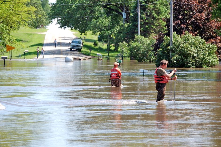
USGS personnel monitoring flood waters in Waverly, IA. Credit: U.S. Geological Survey from Reston, VA, USA [CC0]
Some of the most interesting data in the world of river and stream monitoring come at times when it’s practically impossible to capture—during extreme weather events, for example. Timing alone makes capturing unusual events a challenge, and these kinds of issues have prompted researchers to use classic monitoring data along with new technologies to develop and improve hydraulic modeling for estimating river flows.
Steven Lyon, a Conservation Scientist with The Nature Conservancy, Professor at Stockholm University and Associate Professor at The Ohio State University, spoke with EM about the research.
“The idea is modeling stream flow and hydraulics, combining that into an uncertainty framework and using it to determine whether we can use remote sensing products, LIDAR, or even UAV technology to scan and assess rivers, improve hydraulic models, and estimate flows,” explains Dr. Lyon. “So using combined technologies to achieve a higher accuracy or more consistent flow estimation.”
Initially, Dr. Lyon was working with various colleagues, including US Geological Survey (USGS) researchers, that deploy physically-based hydraulic models in the field.
“We wanted to actually look at the physics and determine, for example, how much drag a boulder in the water creates on water flow,” details Dr. Lyon. “There are many new technologies to actually measure high resolution, topographic information, physical things such as boulders and roughness, including LIDAR or drone technology. Is there enough information there to measure remotely that we can use to inform these models to actually make an estimation?”
The team hopes that ultimately if users can deploy technologies such as LIDAR scans or UAV drones to characterize the physical layout, symmetry, or topography of a river very quickly, they can then “plug” that data into a hydraulic model. The model could then provide a rating curve, the flow at a function of height in the river, among the key metrics needed for river monitoring worldwide.
“It’s never going to replace people out in the field, but it could get us into really remote locations, and that’d be awesome,” Dr. Lyon remarks. “In Sweden where we started the work they’re pushing for a national-scale LIDAR scan, and more and more countries are coming online with LIDAR and high-resolution topography information. The question was how to use that to try to estimate river flows.”
New technologies and uncertainty
Dr. Lyon points out that anytime new technologies and models come together, uncertainty is a problem.
“One of the things we learned early on was that just making a few discharge measurements, a few river flow measurements, added a lot of information,” Dr. Lyon details. “We shifted a little bit to treating the hydraulic models as a framework for assessing uncertainty. We wondered, can we bring together high-resolution information, hydraulic modeling, and some uncertainty in the form of statistical inference to actually learn and constrain our ability to monitor rivers? That’s where we’ve taken the research.”
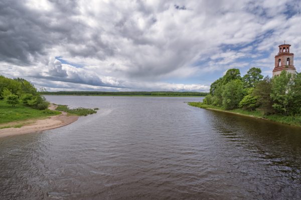
River flows into Volga. The view is from east to west. Yaroslavl Region, Russian Federation (Credit: Эдуард Косарев [CC BY-SA 4.0 (https://creativecommons.org/licenses/by-sa/4.0)]
“Right now we do that by going out many, many times under many, many different flow conditions for years to measure all the different possible combinations of flow and river heights,” states Dr. Lyon. “But if we could only go out one or two times and get the same type of information, that would be very powerful, because it’d be cost-effective.”
That’s the trick the team is hoping to pull off now: getting enough information to monitor stream flow very efficiently during one or two field visits.
“This is the classic thing: we’re never going to replace field visits or going out and actually measuring flow, but if you could do it once or twice in a year and then fill in all those time gaps between with the high-end physics model and the high-resolution data, that’s really, really powerful,” emphasizes Dr. Lyon. “So that’s what we’re trying to achieve.”
The team works hard to ensure they have both the right amount and type of data.
“To create the models themselves, there’s some basic information to understand,” comments Dr. Lyon. “For example, the roughness of the channel is a characterization of the actual, physical measurement of where things are. Those are just parameter sets in a model, but at that point, the quality of the data becomes a factor. Those are some of the things we’re exploring right now: what are the assumptions about the data quality, and what resolution is good enough?”
To answer this question, Dr. Lyon considers the product or audience for the information.
“We work with researchers at a field site up in the mountains in Costa Rica,” Dr. Lyon says. “Just knowing something with confidence about streamflow at that site could get you pretty darn far, relative to an unknown from a research perspective. However, if we’re trying to constrain and design a flood control structure downstream that location, we would have a much different audience, so we’d want to have a different resolution. So it’s about the timing of the flows and the design and how they match up, and the impact of the uncertainty or the impact of the data quality on the final product, and that’s something that we’re exploring openly.”
Over the course of the multiple-year project, the team has observed an onion-like effect as answering one question leads to many others.
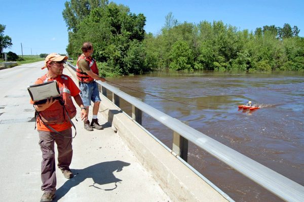
USGS personnel monitoring river in Finchfield, IA. Credit: U.S. Geological Survey from Reston, VA, USA [CC0]
In other words, can the model be used to constrain the uncertainty of vegetation roughness rather than estimate river flow to determine the impact of a nature-based solution to mitigate flood potential, for example? This would assist TNC and others in implementing more effective restoration plans.
“Working with the Nature Conservancy, one of the fundamental questions we have across the board in conservation and restoration is what’s the quantified impact of our efforts?” queries Dr. Lyon. “If we reestablish a floodplain with trees or with other vegetation, what does that really mean in terms of the amount of water stored and the amount of flood prevented? And how do you even get at that estimate?”
These are difficult questions that involved high levels of feedback and uncertainty.
Building a better mousetrap or looking for nails?
Moving forward, the team is looking for ways to improve the modeling and put it and the technologies to work.
“I guess the analogy is that we were trying to build a better mousetrap, and then we realized we were building a hammer instead, and decided to see what kind of nails are out there for us to pound down,” quips Dr. Lyon. “If we can take this kind of a framework, the hydraulic modeling informed by high-resolution data from the landscape, and construct that into an uncertainty framework, and achieve the ability to assess uncertainty, we’ll see what kind of problems we can solve with that, such as flood mitigation or more effective restoration.”
For example, isolating and separating out hydrological versus hydraulic changes, or changes in how water moves through the landscape versus the changes in the channel structure itself, is another challenge the team is tackling.
“If we have changes as flows or land covers change, we changed the water cycling, but what does it mean if the channel also changes? Dr. Lyon asks. “Which one are you observing when you’re actually looking at river flow? You see changes in your hydrograph or your streamflow with time, but is that because the hydraulics have changed or is it because the hydrology is changing? That’s important to understanding climatic change impacts.”
And building a better mousetrap means testing.
“I don’t know if the world’s going to beat a path to our door, but if we can start using this tool to take on some of these challenges, I think there’s some utility there,” remarks Dr. Lyon. “You think about the highest flows that happen in a year. If you’re out there wading right then, that’s super dangerous. You can’t measure it, and the chances of you actually hitting it in time because it’s such a rare event are very, very low anyway.”
The researchers hope to help users avoid missing their best data, and they’re exploring how to use physics to fill in gaps left by uncertainty to do that.
“That’s one of the major utilities we see for this type of a product: using our combined understanding of physics and uncertainty to get at those rare moments in time that have huge impact that defy empirical observation; that’s the crux of it. Modeling will never replace measurement. They go together, and the question is how to make the most of both,” comments Dr. Lyon. “So far it seems to work well, but as always, we have to test it everywhere. If it’s on a shelf and it’s only a research-grade product and no one actually uses it, we fail to do something we’re trying to do: engage stakeholders as much as possible.”


0 comments