USGS Scientists Create Models To Predict Soil Erosion Risk After Wildfires
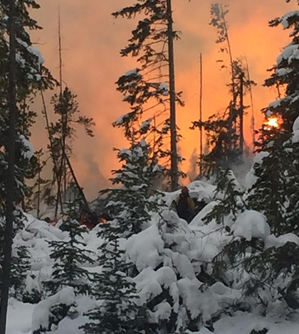
Tunnel Hill Fire, Colorado. (Credit: Arapaho and Roosevelt National Forests & Pawnee National Grassland / U.S. Forest Service)
Although wildfires conjure up images of damaged foliage and fleeing wildlife, there is damage done beyond harm to plants and animals. The soil itself suffers from wildfires passing over it. Fire-ravaged soil can be considerably more subject to erosion, which in turn lowers area water quality. In addition, the affected area can be more susceptible to future wildfires, but that is dependent on the way vegetation recovers.
In order to better assess wildfire risks to soils and watersheds, U.S. Geological Survey scientists, including Joel Sankey, research geologist at the Southwest Biological Science Center, have developed the first ensemble of models that describes potential risks of post-wildfire soil erosion and sedimentation in watersheds across the entire western U.S. It is Sankey’s hope that scientists, land managers and others can use the modeling approach to estimate and mitigate soil erosion due to wildfires in the future.
Sankey’s ensemble model was made by synthesizing several building blocks that already existed — in particular, GIS soil erosion models and models expressing projections of future fire risks. The current work is a large-scale estimate for the entire West to help land managers and large communities.
“However, we hope to also make fine-tuned estimates for post-wildfire erosion risks for individual watersheds or subwatersheds in our future work,” Sankey emphasizes. “That is information land managers are going to be interested in having.”
Essentially, Sankey seeks to predict changes in fire and erosion as a function of climate change. In the current iteration of his model, he is looking to incorporate more climate change effects. Sankey’s modeling approach is unique, as he is attempting to incorporate all watersheds and future fire estimates. As a result, his model gives a better estimate of potential erosion and sedimentation than previous ones.

Tunnel Hill Fire, Colorado. (Credit: Arapaho and Roosevelt National Forests & Pawnee National Grassland / U.S. Forest Service)
“It’s important to see what happens after wildfires in watersheds that are projected to burn more frequently in the future: Is the soil as susceptible to erosion after repeated fires? Does vegetation come back? If so, what is the vegetation? Is that vegetation more or less susceptible to burning and is it resulting in a conversion from one vegetation community type to another that is either more or less flammable from a wildfire fuel’s perspective? For example, if there’s a fire and grasses come in and replace previous non-grass vegetation, that could make the area more flammable than it was before the burn, as dried grasses are easy to ignite,” he says. On the other hand, if vegetation fails to regrow in the area, Sankey says “that actually may make the area less flammable in the future, since there won’t be fuel for a wildfire to use.”
Sankey hopes to fine-tune soil erosion estimates for individual watersheds in the future. For a baseline, he plans on looking at watershed records at the beginning of the century and project until 2050. He also wants to look at historical changes in the previous century and compare, zeroing in on watersheds that are frequently burned.
Sankey mentions the protective cover over soil is lost when vegetation is combusted. Rain on uncovered soil has more impact and more erosive force. Also, loss of the cover alters how water infiltrates the soil and is retained. The loss of vegetation can increase the erosive force of water running over the soil as well.
A factor in the predictive model is that some soils are more vulnerable than others. A relevant question regarding soil is whether it can maintain its physical integrity. Fire can essentially cause a seal on certain soil surfaces, making water runoff a problem. The type of soil has some influence on how the soil responds to fire, but whether the soil is high or low in organic matter and whether it is wet or dry are also factors. A peaty soil burns if it is dry enough, whereas clay soils are more likely to seal.
Sankey says land managers can use the information he and his colleagues have already gathered to develop action plans to make fire-prone areas more resilient. Techniques to improve resiliency that some communities are already considering include forest-thinning and controlled burning, but pains must be taken to preserve ecosystems. Sediment routing and retention structures are also used in some communities to protect water quality.

Tunnel Hill Fire, Colorado. (Credit: Arapaho and Roosevelt National Forests & Pawnee National Grassland / U.S. Forest Service)
Sankey emphasizes that their model is innovative, as it considers not only future fire projections but also estimates how much erosion and sedimentation might occur as a result. Erosion and sedimentation are expressed, in other words, as a function of fire. Sankey also hopes the successful modeling he and his team have been able to do so far will encourage others to continue working on the modeling approach and make it more robust. He also hopes individual watershed risk estimates will be forthcoming.
Furthermore, Sankey’s research suggests that the overall risk of burn, and therefore soil erosion, could double for many watersheds in the warming climate conditions of this century. The doubling is projected to occur between 2020 and 2050, compared to 2010 event levels, for about a quarter of all watersheds in the West. About two-thirds of watersheds are projected to experience a 10 percent relative increase over the same time period.
Climate change is making seasons warmer and drier than before, meaning the burn season is longer and ignition is more likely. But a wetter spell of weather does not necessarily reduce burn risk.
“The most wildfire and soil erosion risk situations are not always when it is dry or droughty all the time,” says Sankey. “Wet seasons or years can also promote plant growth, which during subsequent dry weather or climate(s) can produce fuel for wildfire.”
Sankey’s work will continue in the future through a Northwest Climate Science Center grant. The work Sankey and the team have completed so far was the first half of the proposed grant work. Sankey plans to hand off his model’s projections to geographers and social scientists.
The team includes USGS’s Jason Kreitler and Todd Hawbaker; Nicole Vaillant from the U.S. Forest Service; Jason McVay from the Remote Sensing and Geoinformatics Lab at Northern Arizona University; and Scott Lowe from Boise State University. Kreitler is the principal investigator on the NWCSC grant. Hawbaker produced all the burned area projections. Lowe is providing social science and economics expertise. Vaillant is providing fire ecology expertise. And McVay did the majority of the geo-spatial data analysis for the project. In the second phase of the project, a graduate student will be added.
Top image: Tunnel Hill Fire, Colorado. (Credit: Arapaho and Roosevelt National Forests & Pawnee National Grassland / U.S. Forest Service)


0 comments