
Wetland water level study skips modern sensor tangle for 1930s method
Environmental sensors can measure almost any physical parameter in nature, but sometimes they can overwhelm the science they are supposed to support.
Jason Hill, an assistant professor of engineering at the University of Southern Indiana, wants to create a water level model that will help wetland restorers understand and predict water level fluctuations by studying water loss through the ground and evapotranspiration.
The problem is his next project site has too many variables to measure. So, he’s taking an old fashioned route based on empiricism and water level measurement.
Hill said that conventional techniques for estimating evapotranspiration require site specific micrometeorological data, like solar radiation, wind speed and vapor pressure. Researchers also usually account for plant growth characteristics that change with time. “It is difficult to apply these techniques to sites with large spatial variability in vegetation and moisture conditions,”Hill said.
Instead, he is using a measurement method developed by U.S. Geological Survey hydrologist Walter White in 1932, when the majority of electrical environmental sensors available today did not exist.
White used mechanical water level tapes and automatic water stage recorders to monitor daily fluctuations in water level in relation to certain types of vegetation.
White’s method focuses on measuring water levels in the early mornings and late evenings to determine separate estimates for groundwater seepage and evapotranspiration. “The idea behind the method is that you focus on nighttime observations when we know evaporation and transpiration are low to estimate the groundwater component,” Hill said.
The method has historically been used for groundwater systems, where water level fluctuations are more pronounced than surface water bodies. It is also typically used for bodies of water that have a uniform geometry, unlike many wetlands. With modern sensors and examination of fluctuations at targeted times of the day, more subdued fluctuations for surface water systems in lakes and wetlands can be measured.

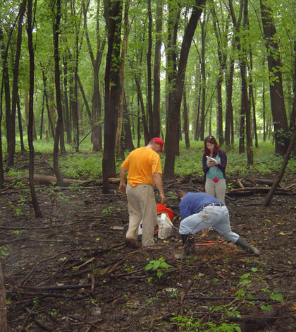
He is in the process of setting the project up at the Eagle Slough Natural Area in Evansville, Ind. The land he will be studying includes diverse plant cover, soil conditions and variable water body geometry.
Hill’s goal is to explore the application of the White method with a variety of adaptations to estimate groundwater seepage and evapotranspiration for this complex wetland environment. “It’s a very difficult task to estimate groundwater seepage and evapotranspiration,” he said. “There’s a lot of uncertainty.”
Evapotranspiration is the combined effect of water evaporating into the atmosphere and plants transpiring water into the atmosphere. Hill said it’s hard to measure one versus the other, so usually they are compiled into one measurement.
He plans to estimate evapotranspiration levels by examining time-series data from a total of six monitoring wells at the wetland site. Solinst vented and absolute pressure loggers are dispersed among three wells to monitor groundwater levels. Three more monitoring wells will be online soon. A rain gauge will keep Hill informed on precipitation.
Diurnal curves, which White pioneered to chart water level versus time, will document fluctuations. Hill hopes to use these curves to estimate loss from groundwater seepage versus evapotranspiration. “You measure water levels with your instrument and then decouple groundwater seepage and evapotranspiration from the time series data,” he said.

He and a some of his students will look at areas of land with different saturation characteristics as part of the study. “We want to monitor diurnal curves in both inundated and non-inundated areas,” he said.
He also plans to compare the performance of vented loggers and electronically compensated loggers in detail.
Hill notes that using water level fluctuations to estimate important hydrologic processes is an attractive, low-cost alternative compared to parameter-intensive techniques. If all goes to plan, the research will improve guidance on use of the method for surface water systems, including instrumentation design and data analysis. It also may give wetland restorers information they need to keep their bogs soggy.
Images: Eagle Slough Nature Preserve in southwest Indiana. (Credit: Josh Collins)
2 Comments
Leave a Reply


Josh Collins
October 16, 2013 at 9:26 am
Hey there. See you used a couple of my pictures,thats great!
These are from one of the times we helped drill & install the wells
and monitors.My kids and I have been helping out at this nature preserve
(Eagle Slough Natural Area) consistently for a couple years now.
This place means a lot to us and others too.Thank you for helping
promote awareness.Let me know if you would like some more photos
from this project & of this wonderful nature preserve.
Austen Verrilli
October 21, 2013 at 12:47 pm
Thanks for the comment Josh. I will be sure to add your name to the story as a photo credit.
Its great to hear you and your kids are involved in helping with the research. I think some of the best times I had as a kid were running around in the woods.
-Austen