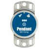
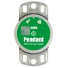
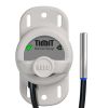
HOBO TidbiT MX Temp 400 Logger
Features
- Waterproof to 120 meters (400 feet)
- Water detection feature records when the logger is in and out of the water
- Convenient wireless setup and download via Bluetooth Low Energy (BLE)
- Expedited repair and warranty service
- Lifetime technical support
- More
Overview
The Onset HOBO MX2203 TidbiT waterproof temperature logger leverages the power of Bluetooth Low Energy (BLE) to deliver high-accuracy temperature measurements straight to a mobile device or Windows computer with Onset's free HOBOconnect app. Designed for durability, this rugged, waterproof logger is ideal for long-term deployments in streams, lakes, and oceans (up to 400-foot depths). The Onset HOBO MX2203 also provides the additional feature to detect and record the presence of water, which is ideal for monitoring intermittent water applications.
Benefits
- Convenient wireless setup and download via Bluetooth Low Energy (BLE)
- Large memory stores 96,000 measurements
- Waterproof to 120 meters (400 feet)
- Water detection feature records when the logger is in and out of the water
- User-replaceable battery
- Waterproof boot protects the logger during deployment
- LED alarm notifies when temperature exceeds the set threshold
- Battery life extension feature
- Works with Onset’s free HOBOconnect app
- ±0.2°C (±0.36°F) accuracy
- Data Logger
- Protective Boot
In The News
Monitoring Meadowbrook Creek: Real-Time Data Collection in an Urban Creek
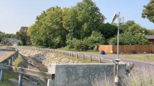
Meadowbrook Creek in Syracuse, New York, has been monitored by Syracuse University (SU) faculty and students for over a decade. Originally established by Dr. Laura Lautz in 2012, the early years of the program focused on collecting grab water samples for laboratory analysis and evaluating the impact of urban land use, human activities, and natural processes on water resources. Tao Wen , an Assistant Professor in SU’s Department of Earth and Environmental Sciences, took over the program in 2020 and upgraded the existing systems to include 4G modems that allowed for real-time data viewing. [caption id="attachment_39339" align="alignnone" width="940"] An overview of the Fellows Ave monitoring station along Meadowbrook Creek.
Read MoreFrom Paddles to Phytoplankton: Studying Vermont’s Wildest Lakes
For six months of the year, Rachel Cray, a third-year PhD student at the Vermont Limnology Laboratory at the University of Vermont, lives between a microscope and her laptop, running data. For the other six months, she is hiking and canoeing four of Vermont’s lakes, collecting bi-weekly water samples. Cray studies algal phenology across four lakes in Vermont, US, that have low anthropogenic stress—or in other words, are very remote. Funded by the National Science Foundation Career Award to Dr. Mindy Morales, the lakes Cray researches part of the Vermont Sentinel Lakes Program, which studies 13 lakes in the area and, in turn, feeds into the Regional Monitoring Network, which operates in the Northeast and Midwest US.
Read MoreReimagining Water Filtration: How Monitoring and Science Enhance FloWater Filtration Systems
Over 50% of Americans think their tap water is unsafe , according to the Environmental Working Group (EWG). Other recent surveys have found that number to be as high as 70% of persons surveyed. Whether due to increased public awareness of water quality issues or confusion about how municipal water sources are regulated, there is a clear distrust of tap water in the United States. According to industry expert Rich Razgaitis, CEO and co-founder of the water purification company FloWater, this issue creates a damaging cycle. Razgaitis explained that the health and environmental problems associated with contaminated water aren’t the only issues. As people become increasingly aware that some tap water is unsafe, they resort to bottled water.
Read More


