
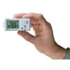
HOBO MX Gateway
Features
- Near real-time measurements transmitted to your HOBOlink dashboard
- Alarm notifications (out-of-range sensor, low battery, stopped logger, missing logger)
- 100-foot line-of-site communication
- Free ground shipping
- Expedited repair and warranty service
- Lifetime technical support
- More
Overview
The MX Gateway automatically transmits HOBO MX Bluetooth Low Energy (BLE) logger data to Onset's cloud-based HOBOlink software. The MX Gateway communicates with compatible HOBO MX data loggers through the HOBOconnect app on a mobile device or Windows computer.
Applications
The MX Gateway is ideal for obtaining remote access to data from multiple HOBO MX data loggers monitoring indoor environmental conditions in office buildings, residential environments, warehouses, indoor growing facilities, server rooms, museums, and more.
| Transmission Range | Approximately 30.5 m (100 ft) line-of-sight |
| Wireless Data Standard | Bluetooth 5.0 (BLE) |
| Connectivity | WiFi 802.11a/b/g/n 2.4/5 GHz or 10/100 Ethernet |
| Security | WPA and WPA2, protocols not listed are not supported |
| Power Source | AC adapter or Power over Ethernet (PoE) |
| Dimensions | 12.4 x 12.4 x 2.87 cm (4.88 x 4.88 x 1.13 inches) |
| Weight | 137 g (4.83 oz) |
- MX Gateway
- Mounting Kit
- AC adapter
Select Options

In The News

From Paddles to Phytoplankton: Studying Vermont’s Wildest Lakes
For six months of the year, Rachel Cray, a third-year PhD student at the Vermont Limnology Laboratory at the University of Vermont, lives between a microscope and her laptop, running data. For the other six months, she is hiking and canoeing four of Vermont’s lakes, collecting bi-weekly water samples. Cray studies algal phenology across four lakes in Vermont, US, that have low anthropogenic stress—or in other words, are very remote. Funded by the National Science Foundation Career Award to Dr. Mindy Morales, the lakes Cray researches part of the Vermont Sentinel Lakes Program, which studies 13 lakes in the area and, in turn, feeds into the Regional Monitoring Network, which operates in the Northeast and Midwest US.
Read More
Reimagining Water Filtration: How Monitoring and Science Enhance FloWater Filtration Systems
Over 50% of Americans think their tap water is unsafe , according to the Environmental Working Group (EWG). Other recent surveys have found that number to be as high as 70% of persons surveyed. Whether due to increased public awareness of water quality issues or confusion about how municipal water sources are regulated, there is a clear distrust of tap water in the United States. According to industry expert Rich Razgaitis, CEO and co-founder of the water purification company FloWater, this issue creates a damaging cycle. Razgaitis explained that the health and environmental problems associated with contaminated water aren’t the only issues. As people become increasingly aware that some tap water is unsafe, they resort to bottled water.
Read More
Monitoring New Hampshire’s Aquatic Ecosystems: Continuous Data Collection in the Lamprey River Watershed
New Hampshire’s aquatic ecosystems provide a range of ecosystem services to the state and region. Resources and services like clean water, carbon storage, climate regulation, nutrient regulation, and opportunities for recreation all depend on New Hampshire’s aquatic ecosystems remaining healthy. Jody Potter, an analytical instrumentation scientist at the University of New Hampshire (UNH), is studying these aquatic ecosystems in hopes of developing an improved understanding of ecosystem services and their interactions with climate change, climate variability, and land use changes. [caption id="attachment_39799" align="alignnone" width="940"] Aquatic sensors in the Merrimack River in Bedford, NH, with I-293 in the background.
Read More