
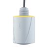
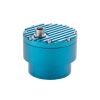
OTT RLS Radar Water Level Sensor
Features
- Transmit & receive antenna enclosed in a lightweight, durable housing with flat antenna design
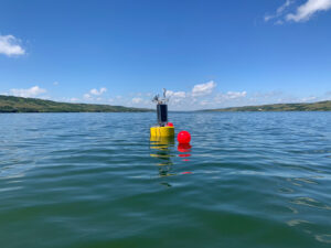
- Easily mounts to a bridge, frame, pipeline, or extension arm
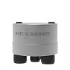
- Connects to NexSens X2 data logging system via SDI-12 interface
- Free ground shipping
- Expedited repair and warranty service
- Lifetime technical support
- More

Overview
The OTT RLS is a non-contact radar level sensor with pulse radar technology that is ideal for monitoring in remote areas and applications where conventional measuring systems are unsuitable. The RLS accurately and efficiently measures surface water level with a non-contact distance range of up to 115 feet above the water. The sensor is IP67 waterproof and has extremely low power consumption, making it ideal for solar-charged monitoring systems.
Revolutionary
The radar level sensor uses a revolutionary level measurement technology, meeting the USGS accuracy requirement of +/-0.01 feet. Two antennas are enclosed in a compact housing and transmit pulses toward the water surface. The time delay from transmission to receipt is proportional to the distance between the sensor and the water surface. A sampling rate of 16 Hz (16 measurements/second) with 20-second averaging minimizes water surface conditions such as waves and turbulence. The RLS does not require calibration and is unaffected by air temperature, humidity, flood events, floating debris, or contaminated water.
- (1) Radar level sensor
- (1) 2-part swivel mount
- (1) Installation kit - Includes (4) 6x40mm wood screws & (4) plastic plugs
- (2) Double open-ended wrenches (10x13)
- (1) Factory acceptance test certificate (FAT)
- (1) Operations manual
Select Options


In The News
Combating Water Insecurity in Saskatchewan with Real-Time Data
The prairies of Saskatchewan can be described as one of the least water-secure parts of Canada, making water quality monitoring essential for informed resource management in a region already facing water insecurity. While natural physical properties worsen some of the poor water quality conditions in the region, others are connected to land use. Having grown up spending summers on the shores of Lake Huron, Helen Baulch, an associate professor at the School of Environment and Sustainability at the University of Saskatchewan , has always been dedicated to the protection of water resources. Looking back fondly at her childhood playing along the shore, Baulch also recalls the invasion of quagga mussels during her teenage years and watching the lake change as a result.
Read More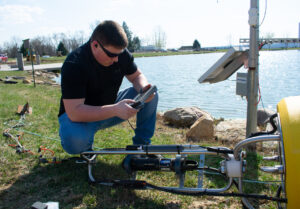
Seametrics Turbo Turbidity Logger: Boost your Turbidity Monitoring
The Seametrics Turbo Turbidity Logger is a self-cleaning turbidity sensor capable of internally logging over 260,000 data records. The sensor enables researchers, compliance officers, and contractors to monitor turbidity in various applications, from construction and dredging sites to wastewater effluent. Due to its narrow width, this device can be deployed in a range of areas, from small well spaces to rivers and streams. The stainless steel housing and built-in wiper allow the sensor to withstand long-term deployments and reduce the need for maintenance trips. The logger accurately records temperature and turbidity up to a depth of 50 meters.
Read More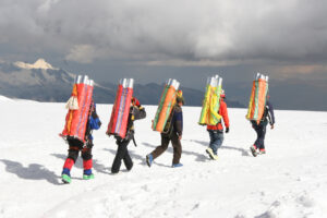
Collecting Data at the Top of the World: How Scientists Retrieve Glacial Ice Cores
A helicopter touches down in the small town of Sicuani, Peru, at an elevation of 11,644 feet. Earlier that day, a boxcar brought fuel, drills, food, and other equipment for a glacial expedition. The year is 1979, and glaciologist Lonnie Thompson is preparing to lead a team to the Quelccaya ice cap in hopes of becoming the first scientists to drill an ice core sample from this glacier. The only problem? The glacier is located at 19,000 feet in one of the most remote areas of the world. The helicopter takes off from the town, but the thin atmosphere at that elevation does not allow it to safely touch down on the ice– due to the aircraft’s weight, and it becomes unstable when the air is less dense.
Read More