
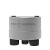
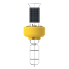
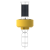
Airmar 200WX-IPX7 Ultrasonic WeatherStation
Features
- Outputs both apparent and true wind speed & direction
- Integrated GPS, accelerometer & compass
- IPX7 waterproof rating for buoys and offshore platforms
- Free ground shipping
- Expedited repair and warranty service
- Lifetime technical support
- More
Overview
The Airmar 200WX-IPX7 meets a growing need for real-time, site-specific weather information. For moving applications where true and apparent wind are different, the 200WX includes additional sensors such as a 10Hz GPS, solid-state compass and tilt sensors. The 200WX features configurable RS-232 and CAN BUS digital data outputs, providing unparalleled versatility for nearly all weather monitoring needs.
Durable in Harsh Conditions
The Airmar 200WX-IPX7 outputs both apparent and true wind speed and direction. The Airmar 200WX is IPx7 rated and has been developed to be more robust and meet the operational challenges of the harsh ocean environment.
Meets Offshore Needs
Reliable environmental monitoring is critical for various offshore needs. The numerous sensors contained in the compact size of the 200WX is an attractive feature for installations where space is limited, such as on buoys, USVs, and AUVs.
- (1) 200WX-IPX7 WeatherStation
- (1) Post mount with 1-14 UNS threads
- (1) WeatherCaster Software CD
- (1) Calibration Certificate
- (1) Owner's Manual
Select Options


In The News

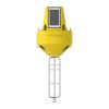
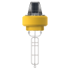
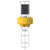
Wave-Powered Buoy Deployed in Puget Sound
While the development of solar-powered monitoring systems has improved access to real-time environmental data, solar power is still limited by low light conditions, such as poor weather, nighttime, or high-latitude environments. To supplement these incumbent power solutions at sea, Ocean Motion Technologies has developed a small-scale ocean wave energy system that can be directly integrated with existing data buoy platforms. Not only does wave energy supplement solar power during periods when the buoys are limited by light availability, but it also allows data buoys to perform beyond their current power capacities.
Read More
No Red Herrings: Data Driving the Largest Salt Marsh Restoration in the NE USA
The Herring River system encompasses around 1,000 acres in the Towns of Wellfleet and Truro, Massachusetts. In 1909, the Chequessett Neck Road dike was built at the river’s mouth, drastically limiting tidal flow. Today, it’s one of the most restricted estuaries in the northeastern United States. As a result, the area has suffered environmental decline, including poor water quality, hypoxia, lower pH, and salt marsh degradation. In 2023, the Town of Wellfleet received $14.7 million from NOAA’s Office of Habitat Conservation to fund the Herring River Restoration Project (HRRP). Francesco Peri, President and CEO at Charybdis Group LLC, uses a network of NexSens data loggers to monitor water level and water quality on the Herring River.
Read More
Expanding the Port Everglades: Real-Time Monitoring of Water Quality Conditions from Planned Dredging Operation
The Port Everglades in Broward County, Florida, serves large trade vessels and cruiseliners and incoming and outgoing recreational boaters. However, as cargo ships become larger, the port must expand. A dredging project led by the US Army Corps of Engineers will substantially deepen and widen the port's navigation channel to accommodate larger Panamax cargo ships and modern cruise liners. As a result of this project, a large amount of sediment will be displaced into the water column. This suspended sediment may settle outside of the project area, burying benthic organisms like corals, and possibly carrying harmful particulates to other regions. [caption id="attachment_39497" align="aligncenter" width="2560"] A CB-950 and CB-25 deployed on site at Port Everglades.
Read More