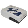
Eos Arrow Gold RTK GNSS Receivers
Features
- Supports GPS, GLONASS, Galileo & BeiDou
- 100% Android, iOS, Windows compatible
- 1cm RTK real-time accuracy
- Free ground shipping
- Expedited repair and warranty service
- Lifetime technical support
- More
The World’s Most Advanced GNSS Receiver for Every Mobile Device
The Eos Arrow Gold is a high-accuracy Bluetooth GNSS receiver that implements all four global GNSS constellations (GPS, GLONASS, Galileo, BeiDou), multi-frequency, and satellite-based RTK augmentation on iOS, Android, and Windows. Moreover, the new Arrow Gold+ adds full-band support for all GNSS signals, including Galileo’s free High-Accuracy Service (HAS). Both the Arrow Gold® and Arrow Gold+™ receivers support connection to popular apps like Esri’s ArcGIS apps and other mobile GIS apps on iOS, Android, and Windows.
RTK in Poor Cell Coverage Areas
SafeRTK is the answer. SafeRTK is a proprietary feature included exclusively with the Arrow Gold and Arrow Gold+ receivers. When cellular connection to the RTK network drops, SafeRTK takes over within a few seconds and maintains RTK-level accuracy for up to 20 minutes. This enables uninterrupted RTK accuracy in spotty areas.
No RTK Network?
The Arrow Gold supports low-cost global corrections. The Eos Arrow Gold features a 4cm, real-time satellite correction service called Atlas, available globally. Using all four constellations and signals, the Arrow Gold offers convergence times as low as 15 minutes at a revolutionary price point.
Multiplexing with the Arrow Gold+
The Arrow Gold+ has the functionality of the Eos Bridge Bluetooth connector built-in. Connect the Arrow Gold+ to any third-party sensor (e.g., laser rangefinder). The Arrow Gold+ will stream the content of that sensor to a chosen iOS or other mobile devices via the receiver’s own location datastream.
Ultimate Flexibility in Mobile Accuracy
iOS, Android, and Windows compatibility is our expertise. Eos Positioning Systems offers GNSS hardware with some of the most innovative, advanced connectivity on the market, supporting connection to popular apps like Esri’s ArcGIS and other mobile GIS apps.
- (1) Arrow Gold receiver with USB & Serial ports
- (1) Arrow Smart Battery Pack
- (1) L1/L2/L5 / LBand Precision Antenna
- (1) Large Antenna Mounting Plate
- (1) Two-section Short Antenna Cable for survey pole
- (1) Arrow Pole Mount Bracket
- (1) Range Pole Clamp
- (1) USB Data Cable
- (1) 12V International Power Supply for Arrow Smart Battery pack
- (1) Hard Shell Case
In The News
Three Decades of Research at Acton Lake
A multi-disciplinary team at Miami University, Ohio, has been studying the environmental change at Acton Lake for over three decades. Using three different NexSens buoys over this time, the team has an incredible archive of data that is helping build a picture of Acton’s past, present, and future. Until recently, a NexSens CB-50 buoy was used alongside other environmental monitoring at Acton Lake. In May 2025, the Miami team deployed a new XB-200 buoy , future-proofing their ongoing monitoring using real-time buoy systems. Acton Lake, a small hypereutrophic reservoir in southwest Ohio, covers 2.4km² and has a maximum depth of about 8m. The dam was built in 1956, and the lake has a large agricultural watershed.
Read MoreSource Water Monitoring in Albany, New York: Tracing Water Quality throughout Tributaries
Thousands of US cities pull their drinking water from natural source waters like reservoirs, rivers, and streams, making overall watershed health a key consideration for water providers. In Albany, New York, the Albany Department of Water and Water Supply delivers drinking water to over 100,000 residents as well as monitors and manages the larger drinking water supply watershed. Hannah Doherty, Environmental Specialist at the Albany Department of Water and Water Supply , spends her days working with a small team to monitor the drinking supply and the connected water bodies. Doherty explains, “We’re the first to encounter the water that ends up being the drinking water.
Read MoreWildfire Prevention in the Sierra Nevada Region with the Yuba Watershed Institute
Though recent wildfires have sparked new conversations about wildfire management and response, groups like the Yuba Watershed Institute have been monitoring the forests and water resources of the Sierra Nevada region for decades, managing approximately 5,000 acres of land with the Bureau of Land Management (BLM) and about 7,000 acres in private land partnerships. The goal of the Institute is to work with local communities and land agencies to improve watershed and forestry management through informed practices and public outreach. The goals of the Yuba Watershed Institute are three-fold: Improve the ability of fire suppression agencies like the California Department of Forestry and Fire Protection ( CAL FIRE ) and the US Forest Service.
Read More


