
Lufft V200A Multi-Parameter Weather Sensor
Features
- Four ultrasound sensors take cyclical measurements in all directions
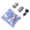
- Easily mounts to 2" diameter pipe with integrated bracket mount & nuts
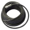
- SDI-12 output for integration with NexSens and other data loggers
- Free ground shipping
- Expedited repair and warranty service
- Lifetime technical support
- More
Overview
The Lufft family of multi-parameter weather sensors offer a cost-effective, compact alternative for the acquisition of a variety of measurement parameters on land- and buoy-based weather stations. Depending on the model, each sensor will measure a different combination of weather parameters to meet a wide variety of applications.
Pressure
Absolute air pressure is measured using a built-in MEMS sensor. The relative air pressure referenced to sea level is calculated using the barometric formula with the aid of the local altitude, which is user-configurable on the equipment.
Wind Speed & Direction
The wind sensor uses four ultrasound sensors which take cyclical measurements in all directions. The resulting wind speed and direction are calculated from the measured run-time sound differential.
Select Options


In The News

From Paddles to Phytoplankton: Studying Vermont’s Wildest Lakes
For six months of the year, Rachel Cray, a third-year PhD student at the Vermont Limnology Laboratory at the University of Vermont, lives between a microscope and her laptop, running data. For the other six months, she is hiking and canoeing four of Vermont’s lakes, collecting bi-weekly water samples. Cray studies algal phenology across four lakes in Vermont, US, that have low anthropogenic stress—or in other words, are very remote. Funded by the National Science Foundation Career Award to Dr. Mindy Morales, the lakes Cray researches part of the Vermont Sentinel Lakes Program, which studies 13 lakes in the area and, in turn, feeds into the Regional Monitoring Network, which operates in the Northeast and Midwest US.
Read More
Reimagining Water Filtration: How Monitoring and Science Enhance FloWater Filtration Systems
Over 50% of Americans think their tap water is unsafe , according to the Environmental Working Group (EWG). Other recent surveys have found that number to be as high as 70% of persons surveyed. Whether due to increased public awareness of water quality issues or confusion about how municipal water sources are regulated, there is a clear distrust of tap water in the United States. According to industry expert Rich Razgaitis, CEO and co-founder of the water purification company FloWater, this issue creates a damaging cycle. Razgaitis explained that the health and environmental problems associated with contaminated water aren’t the only issues. As people become increasingly aware that some tap water is unsafe, they resort to bottled water.
Read More
Monitoring New Hampshire’s Aquatic Ecosystems: Continuous Data Collection in the Lamprey River Watershed
New Hampshire’s aquatic ecosystems provide a range of ecosystem services to the state and region. Resources and services like clean water, carbon storage, climate regulation, nutrient regulation, and opportunities for recreation all depend on New Hampshire’s aquatic ecosystems remaining healthy. Jody Potter, an analytical instrumentation scientist at the University of New Hampshire (UNH), is studying these aquatic ecosystems in hopes of developing an improved understanding of ecosystem services and their interactions with climate change, climate variability, and land use changes. [caption id="attachment_39799" align="alignnone" width="940"] Aquatic sensors in the Merrimack River in Bedford, NH, with I-293 in the background.
Read More