Earth, Water, Fire: Understanding How Landscapes Impact Flooding in New Mexico
In early July, devastating floods swept through Texas, North Carolina, and New Mexico. In Texas and North Carolina, the floods primarily arose from a mix of torrential rain and topography. However, in New Mexico, the floods were influenced by another natural disaster: wildfires.
The town of Ruidoso, New Mexico, was ravaged by fires last summer and hit by intense floods this year. A small, rural community in southern New Mexico, Ruidoso historically lacked access to flood information and risk assessments, according to Shawn Penman, a GIS Specialist and Cooperating Technical Partner Coordinator at the Earth Data Analysis Center (EDAC) at the University of New Mexico.
But that is changing.
In collaboration with the Federal Emergency Management Agency (FEMA), the EDAC is working to understand how floods move in a landscape, provide accurate forecasts and warnings, and, ultimately, protect people living in the most hazardous flood areas.
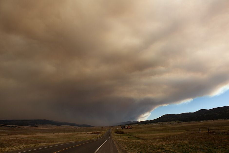
The Hermit’s Peak – Calf Canyon Fire, as pictured from Angel Fire, NM. (Credit: Highlightwiki via Wikimedia Commons CC BY 4.0)
How Wildfires Promote Intense Flooding
When the South Fork and Salt fires burned over 25,000 acres of land near Ruidoso in the summer of 2024, they left long-lasting scars on the landscape. Despite a seemingly unlikely link between wildfires and floods, Penman says that growing research is showcasing their correlation.
Wildfires often decimate the vegetation in their path, and when the trees, shrubs, and grasses fall, they are turned to detritus. With large wildfires, this layer of organic matter grows thick and widespread, transforming a permeable surface into an impermeable one.
Therefore, when the rains fall on the mountains where these fires blazed, the water has nowhere to go but down into the streams and rivers, leading to quickly rising water levels. Ruidoso sits just north of the mountains where these 2024 fires burned, putting it in the crosshairs of this phenomenon.
Ruidoso also flooded in 2024, not long after the wildfires. And still, a year after they burned, the fires are wreaking havoc on the land. Yet, this link between wildfires, flooding, and water quality isn’t new.
In 2022, the Calf Canyon/Hermit Peak Fires burned in New Mexico, the largest wildfires in the state’s history. Since then, the US Geological Survey has been monitoring streamflow and water quality in the burned watershed, along with others in the western US.
Beyond flooding, wildfires degrade the water quality where they burn. Floods have already been shown to pick up organic matter when they crest river banks. Wildfires exacerbate this problem by causing plants to come crashing to the ground, adding both to the organic matter that floods can sweep up and that rains can carry from mountains to rivers.
For Penman, understanding and predicting the interactions between these natural disasters is a key part of protecting people from floods.
Understanding Flooding in New Mexico
In highly populated areas, homeowners often understand their flood risk through flood insurance. However, for Ruidoso, a town of under 10,000 people and almost three hours from Albuquerque, they often lack this resource.
“We map flood risk in areas where flood insurance usually doesn’t,” Penman says.
The EDAC works as a Cooperating Technical Partner with FEMA, which uses GIS, LIDAR, and other mapping techniques to create comprehensive flood hazard maps around the country. This process is known as Base Level Engineering. It provides “credible engineering analysis,” showing how landscapes and man-made structures may be impacted by floods.
Their collaboration between EDAC and FEMA in New Mexico is predicting debris flow, providing risk maps on watershed-level scales, creating plans to acquire stream gauges, and more. In a state prone to floods during the monsoon season, this information can be crucial.
What Penman likes about the scale of the project is that communities can tailor it to their own needs. She says they can take a section of the interactive flood map and input their own data, such as local bridges and culverts, to get even more precise estimations about flood impacts in their communities.

USGS Gallinas Creek near Montezuma, NM (08380500) streamgaging and water-quality monitoring station in August 2022 (watershed burned by Calf Canyon/Hermit Peak Fires April-August 2022) (photo showing Johanna Blake, USGS). (Credit: Jeannie Barlow / USGS)
For Penman, her work is most effective when local floodplain managers use it to communicate with residents in towns such as Ruidoso. The positive effect of EDAC and FEMA’s project was apparent in the Ruidoso floods, despite the enormous flooding it faced.
“When there’s that much water, it’s almost impossible to mitigate it,” Penman says.
Penman and EDAC are not involved in flood mitigation strategies, which she says would have been extremely difficult considering the sheer amount of rainfall in Ruidoso. Rather, using their maps to predict the impact of floods, EDAC and their partnership with FEMA provided resources for the locals to know when and where to evacuate.
Despite the infrastructure damage and the tragic deaths of the recent Ruidoso floods in 2025, Penman says that most residents were safely evacuated before the worst of the flooding. The local floodplain manager, with whom Penman works, knows both the area and the people of Ruidoso and was able to sound the alarm early, mitigating the human damage from flooding.
Therefore, though it’s difficult to physically stop large-scale floods, especially in rural areas, resources like the FEMA-funded flood maps can be crucial to protect people before the waters reach their homes.
These predictions are made through diligent data collection, mapping, and research. For Penman and her colleagues, this means understanding the entire landscape, as it’s not just rain that causes river levels to surge.
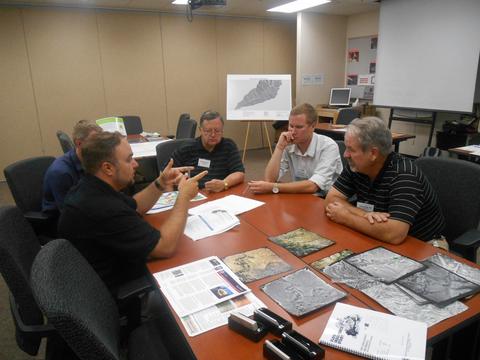
A community meeting discussing burns in the Animas watershed. (Credit: Shawn Penman)
Conclusion
As scientists continue learning more about how floods are formed and move through a landscape, relaying that information to the public is vital. For Penman, the EDAC’s work with rural communities and local floodplain managers is a good first step.
For her, creating these free, publicly accessible databases is important, but the public must still know they exist. By bringing her work down to the local level, as was the case in Ruidoso, people may become more aware of the resources available to them.
Whether attending community conferences or asking the public to share photos and videos of flooding, buy-in from those outside the EDAC team is important. As natural disasters continue to evolve, growing in severity and frequency due to climate change, so must the research into them.
Pairing diligent research with targeted dissemination may be key to creating situations like those in Ruidoso, where the public knows and reacts to natural disasters before the flood waters arrive.


0 comments