Lake Michigan’s Smarter, Streamlined Buoys

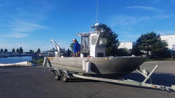
A new buoy in action. (Credit: Ed Verhamme, via communication)
This summer, scientists deployed new buoys in Lake Michigan—smarter, smaller buoys that record and provide data in real time. EM spoke to Illinois State Geological Survey coastal geologist and University of Illinois at Chicago adjunct assistant professor of earth and environmental sciences, Ethan Theuerkauf and Limnotech project engineer Ed Verhamme about this development.
Smarter monitoring on Lake Michigan
Buoys monitoring conditions in the Great Lakes are not a new phenomenon, but Lake Michigan, in particular, was due for some attention at the time of this recent deployment.
“A network of buoys exists in the Great Lakes, but there were only a few in Lake Michigan,” comments Dr. Theuerkauf. “The few that were in Lake Michigan were far apart, which meant that in some locations there were no real-time observations. In order to conduct scientific studies of beach erosion along coastal Illinois, we need real-time observations of waves and currents.”
The buoys collect data on a variety of parameters, and the data is available publicly on the Great Lakes Buoys site (featured recently in a piece on texting buoys).
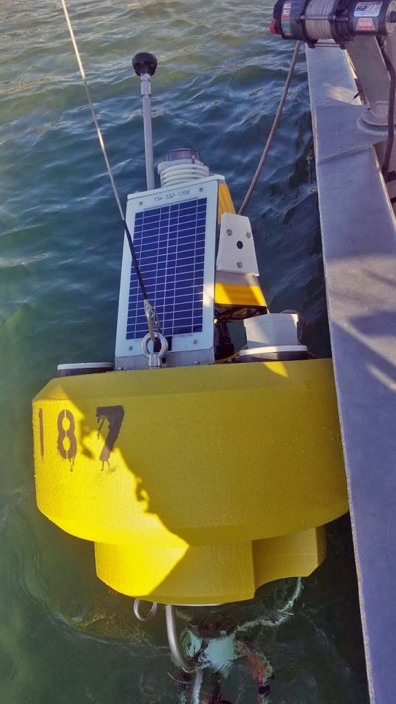
“These buoys are monitoring wave height, wave period, wave direction, current speed and direction, air and water temperature, and wind direction,” explains Dr. Theuerkauf. “They also have a webcam that shows hourly images of lake conditions.”
Ease of deployment was one of the principal reasons for selecting these particular buoys.
“These buoys were chosen because they are smaller, lighter, and easier to deploy than the other types of smart buoys deployed on Lake Michigan,” remarks Ed Verhamme. “We’ve been building and deploying smart buoys on Lake Michigan for ten years, and we’re continually evaluating new technology and buoys to make them cheaper and easier to deploy.”
Loading the buoys onto a boat. (Credit: Ed Verhamme, via communication)
The team selected the locations for the buoys carefully, based on holes in existing data due to a lack of in situ observations along the NE shore of coastal Illinois.
“The Winthrop Harbor buoy was placed right at the Illinois/Wisconsin state line in order to gather observations of potential sediment transport across the state line,” states Dr. Theuerkauf. “These data are important for developing accurate sediment budgets for southwestern Lake Michigan. The Waukegan Harbor buoy was placed to understand how wave conditions and currents change around that harbor.”
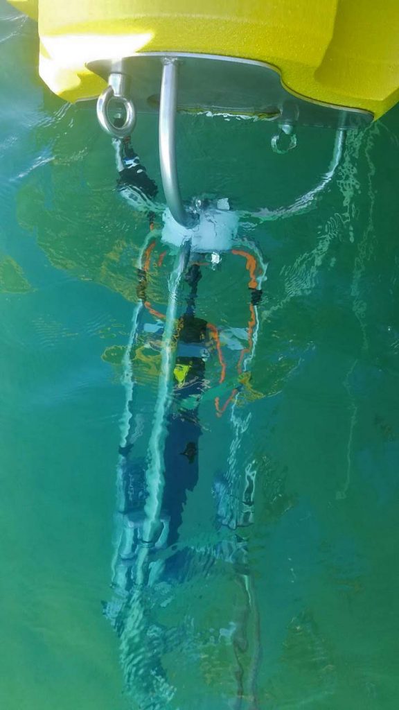
The buoys have nearshore placements as well as deeper placements into the lake, away from the shore, in water depths that range from 50 to 90 feet. The nearshore buoys are designed to help study coastal erosion.
“We wanted to get the buoys as close to shore as safely possible to accurately capture what wave and current conditions are impinging upon the shoreline,” details Dr. Theuerkauf. “Waves and currents are altered as they approach the shore from offshore, and we wanted to get in-situ observations of nearshore conditions, which are driving patterns of erosion and accretion.”
Smaller, faster, more data
There is a notable range of features that make these buoys the smartest on the lake.
“These buoys are full of the latest technology, including sensors that use sound waves to measure wind speeds and water currents, ultra-low power motion sensors to measure every wave passing by, high definition webcams about the size of your thumb, the latest cell phone modem technology to transmit buoy and video data, and a matchbox size satellite tracking device,” explains Mr. Verhamme. “No other buoy on the Great Lakes has this much technology packed into it and can be lifted up by two people.”
The team lowers the buoy into Lake Michigan. (Credit: Ed Verhamme, via communication)
The buoys that are deployed in the middle of Lake Michigan are 10 feet across, weigh over 2,000 pounds, and require a fully staffed, 225-foot US Coast Guard ship to deploy and retrieve. These new buoys are notably smaller.
“These new buoys monitor the same things, but can be deployed by two people and a 23-foot boat in a few hours,” states Mr. Verhamme. “We’re continually pushing the boundary and testing how small we can make each component in the buoy and still collect quality observations. The real cost associated with these buoys will be deploying and retrieving them each season to prevent damage from ice, and the smaller and lighter we can make the buoys, the easier they are to deploy. This, in turn, allows us to deploy more buoys to serve more people across the Great Lakes.”
Deploying buoys for the long-term is one of the “big picture” goals for this team, and they take it seriously.
“Considering the full life-cycle cost of acquiring and maintaining environmental monitoring equipment was extremely important to our project team, as we strive to keep these stations operational indefinitely,” adds Mr. Verhamme. “This meant carefully navigating options related to cost, size, serviceability, and reliability.”
Smarter buoys, better science
Getting lake conditions in real-time has real scientific value for the team, not to mention importance for the public.
“From a scientific perspective it is important to understand in real-time what conditions are occurring so that we can plan data collection efforts,” Dr. Theuerkauf describes. “From a public perspective, it is important for boaters, beachgoers, search and rescue personnel, weather forecasters, and others to have up to date observations of on-water conditions to enjoy the lake safely.”
Parsing out which erosion effects are the result of natural forces and which have to do with development is very difficult. The team hopes that these buoys will shed light on this issue.
Deploying a buoy in Winthrop Harbor. (Credit: Ed Verhamme, via communication)
“This is a major component of my lab group’s research,” comments Dr. Theuerkauf. “We are tackling this issue in a couple of ways. By analyzing past data, such as aerial photographs, we can get a sense of the interplay between natural and anthropogenic forces. We are also gathering erosion and accretion data in response to storms and high water events to isolate the impacts of natural processes versus human impacts.”
The buoys have their own, specific research questions to help answer, but of course, they may prove useful for other kinds of research as well.
“My group is utilizing these data to unravel the processes leading to beach and nearshore geomorphic change,” states Dr. Theuerkauf. “However, these data could be used for a variety of research studies in such fields as biology, chemistry, physics, and ecology.”
Of course, information from the buoys is also relevant to boaters and other recreational users for safety reasons, as well as commercial fisherpeople. This is partly why the public has access to the data and visuals, which also helps build support for lake management.
“The primary reason for public access is so that everyone can enjoy the benefits of having real-time wave and current observations in this region that has never had those data before,” remarks Dr. Theuerkauf. “We’ve partnered with a non-profit organization, called the Great Lakes Observing System (GLOS), that has expanded public access to buoy data across the Great Lakes. They made it easy for us to add a cell phone modem to our buoys and then use their website and data system to make that data available to everyone.”
“One other aspect that guided this project from the beginning was involving the public in as many aspects of the project as possible,” adds Mr. Verhamme. “While sharing the data with the public didn’t meet any specific scientific goals, it allowed us to connect directly to a wider audience for support of the project and will lead to a smarter and better-informed public.”
Top image: A new buoy in action. (Credit: Ed Verhamme, via communication)


0 comments