Lufft WS800: Introducing A Station that Can Weather the Storm
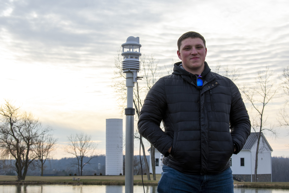
 Applications Scientist, Joe Davidson, next to the Lufft WS800 after deploying the sensor for new product testing. (Credit: Emma Jones / Fondriest Environmental, Inc.)
The Lufft WS800 Multi-Parameter Weather Station measures a full suite of atmospheric parameters that provides all-encompassing data on the local environment, including a one-of-a-kind lightning detector. This compact, cost-effective sensor simultaneously measures air temperature, humidity, pressure, precipitation, solar radiation, lightning, and wind with an integrated electronic compass. An internal fan and heater reduce the effects of external influences for accurate measurements during long-term deployments. The sensor can be easily mounted on a 2-inch diameter pipe above any local obstructions with the included bracket mount, U-bolts, and 10-meter cable.
Settings for the unit can be adjusted using the latest UMB-ConfigTool.NET software and a supplied configuration cable. Multiple communication protocols (i.e., Modbus, SDI-12, ASCII, etc.) are available on the sensor to easily integrate with 3rd party data loggers using the RS485 and SDI-12 sensor interfaces. All parameters are measured using the latest in weather sensor technology.
Latest Weather Sensor Technology
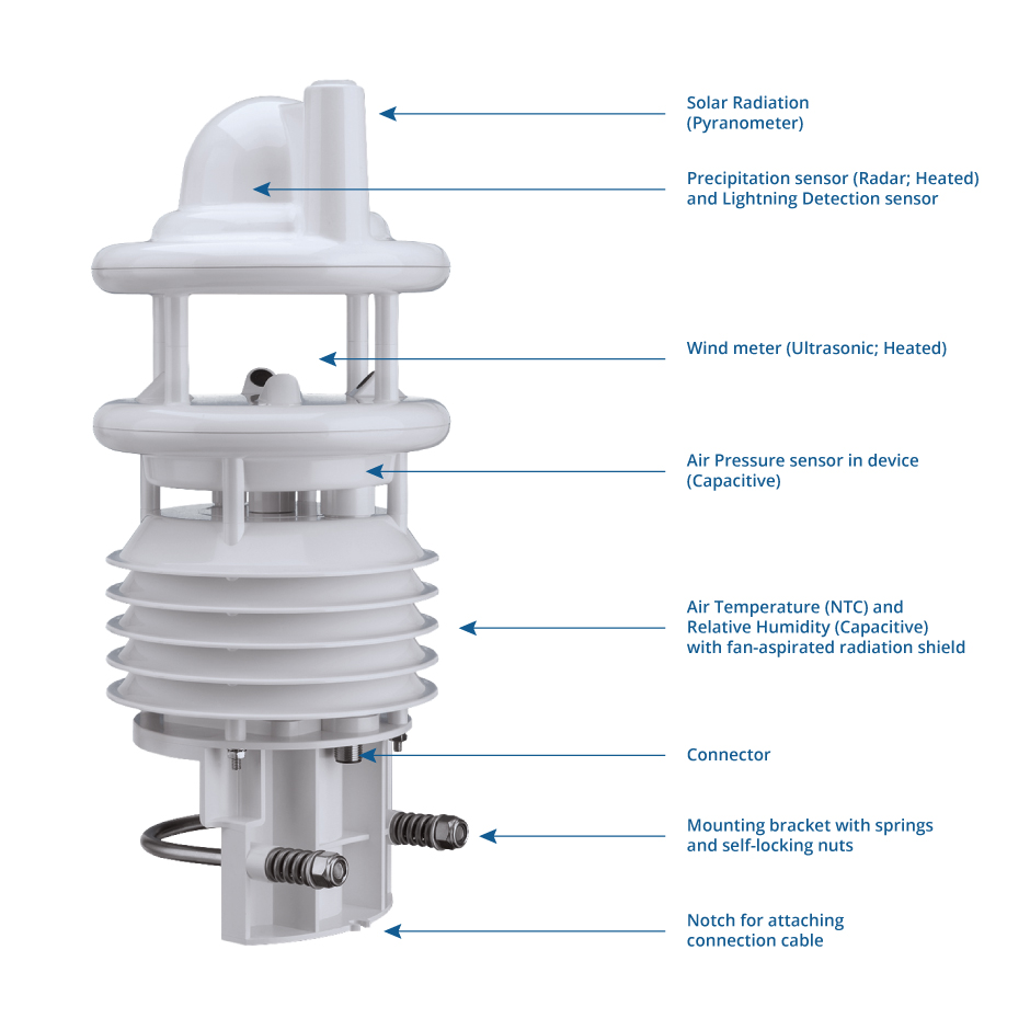
Topside, the instrument contains the latest technology for measuring precipitation, solar radiation and lightning events. Precipitation is measured using a 24 GHz Doppler radar that calculates overall quantity and type by correlating the drop size and speed. Solar radiation measurements utilize a CMP3 Thermopile Pyranometer, which is compliant with IEC 61724-1:2017 Class C for accuracy. Lightning events are detected within a 5 km radius using an integrated sensor analyzing the radio wave emission of lightning occurrences. False detections from artificial electrical discharges are suppressed by analyzing the waveform and spectrum of the received signal.
Right below the top portion of the instrument, four ultrasonic sensors log continuous wind measurements. The location of the ultrasound sensors on the station allows for an area where wind speed and direction can be accurately measured. Wind speed and direction are calculated using the sound differential between the sensors in all directions. The integrated electronic compass provides a north-south adjustment, so the true wind direction can be accounted for correctly.
Underneath the wind channel is the air pressure sensor housed within the device. The integrated sensor (MEMS) measures absolute atmospheric pressure, and with this measurement, relative air pressure can be calculated. Relative air pressure, referenced to sea level, is found using the barometric formula, local altitude and absolute pressure. The calculation of relative air pressure is crucial for comparing pressure conditions from one location to another.

WS800 Sensor Technology. (Credit: Lufft)
Temperature and humidity sensors are enclosed within a fan-aspirated radiation shield at the bottom of the instrument. Temperature readings can be influenced by direct exposure to solar radiation; thus, the radiation shield reduces these effects. Air temperature is measured using a Negative Temperature Coefficient (NTC)-thermistor. The electrical resistance of this sensor is inversely proportional to temperature changes, making it highly accurate. Local humidity is determined with a capacitive humidity sensor, and the fan within the unit helps disperse any persistent condensation that might affect readings in low wind conditions.
All sensors on the station are housed in a durable, plastic material with an ingress protection (IP) rating of IP66. IP ratings were developed by the International Electrotechnical Commission (IEC) and determine the resistance of an electrical device to the intrusion of dust or liquids, which can cause malfunctions in electronic equipment. An IP66 rating means the WS800 is dust-tight and protected against high water pressure, making the station more than adequate for long-term deployments in nearly all environmental conditions.
| Parameter | Range | Accuracy | Resolution | Measurement Principle |
| Precipitation | 0 to 200 mm/hr | +/- 20% | 0.01 mm | Radar |
| Solar Radiation | 0 to 1400 W/m2 | +/- 5.0% | – | Thermopile Pyranometer |
| Wind Speed | 0 to 60 m/s | +/- 0.3 m/s | 0.10 m/s | Ultrasonic |
| Wind Direction | 0 to 359.9 degrees | +/- 3.0 degrees | 0.10 degrees | Ultrasonic |
| Barometric Pressure | 300 to 1200 hPa | +/- 1.5 hPa | 0.10 hPa | Capacitive |
| Air Temperature | -50 to 60°C | +/- 0.2°C | 0.10°C | NTC |
| Relative Humidity | 0 to 100% | +/- 2.0% | 0.10% | Capacitive |
PC Software (UMB-ConfigTool.NET)
Each sensor is user-configurable within the UMB-ConfigTool.NET software to accommodate for conditions at the final deployment location. Entering information specific to the deployment location is essential for gathering the most accurate data. For example, setting the local declination accounts for the difference between true and magnetic north (measured by the internal compass) to correct wind direction measurements. Additionally, setting averaging intervals (1 to 10 minutes) for the 1-second wind measurements provides further accuracy during fluctuating conditions.
Advanced energy management modes allow users to balance power consumption with data accuracy. The heating and fan operation primarily determine power consumption; however, these elements are critical in certain conditions. For instance, during snowfall, the heating element removes snow from the top of the station and around the wind meters. Snow blockage would reduce the impact of precipitation measured by the Doppler radar, cover the solar radiation pyranometer and disrupt ambient wind conditions over the wind meters. In warmer climates, users can completely turn off the heater operation, allowing for reduced power consumption.
After configuring the settings, the user can perform function tests within the field using the software. Individual parameters may be polled at a user-specified interval (1 to 10 minutes) to evaluate the sensor response and accuracy. These parameters can be selected to output as the current, minimum, maximum or average value over the interval. Function tests are critical to ensure accurate data is gathered during long-term deployments. Once function tests are performed, the station is generally connected to a wireless telemetry system.
Environmental IoT
Internet of Things (IoT) is the connection or communication between sensors, software or other types of technologies to each other over the internet. Environmental IoT is used to stay ahead of emergencies and system malfunctions, minimize site visits or sampling trips and allow the user to receive easy-to-assess data quickly. When used with the NexSens Technology, WQData LIVE cloud-based datacenter, the Lufft WS800 provides researchers, emergency management coordinators and compliance officers with real-time data to make informed decisions.
With multiple communication protocols to choose from, the Lufft WS800 is compatible with a host of industry-leading data loggers and telemetry systems from NexSens Technology, Sutron, Campbell Scientific and all Programmable Logic Controllers used in industrial automation. Upon request, data loggers can receive measurements from the weather station and transmit the information directly or wirelessly to a data center. From there, researchers can collect data for analysis or automated systems can be programmed to respond to real-time measurements. Industrial automation using Lufft weather stations has been used to optimize energy consumption in buildings, enhance traffic management efficiency, monitor local conditions at airports, control wind turbines and more.
Real-World Sensor Applications
The Lufft WS-Series of weather stations have been used in a variety of land-based and buoy-based applications. For many years, these stations have been a part of early-warning systems for algal bloom detections after the Toledo water crisis (2014) that shut off the water supply to 500,000 people. The units provide critical insight into the atmospheric conditions when algal bloom conditions begin to form. Multi-year data sets can display correlations between atmospheric conditions, water quality parameters, and algal bloom formation, providing predictive power.
These systems also supply data in remote areas for national monitoring networks such as the Great Lakes Observing System (GLOS) and the Global Lake Ecological Observatory Network (GLEON). Throughout the Great Lakes, both buoy and land-based applications of these weather stations provide real-time data through the GLOS Seagull web data center, in collaboration with WQData LIVE, to provide vital lake information to more people than ever before. In West Okoboji Lake, a limnological field station for over 100 years, a weather buoy has been utilized since 2015 to provide local boaters and fishermen with real-time information on conditions on the lake. Additionally, through GLEON, data on West Okoboji Lake can now be shared with researchers globally.

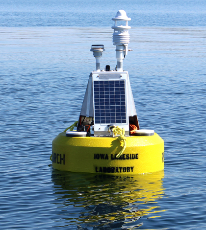
Lufft WS-Series weather station deployed on a GLEON-approved data buoy by the Iowa Lakeside Laboratory. (Credit: Doug Nguyen / NexSens Technology)
Fondriest Environmental Field Testing Analysis
Environmental scientists at Fondriest Environmental have conducted multiple seasonal deployments of the WS800 weather station for insight into conditions at the Fondriest Environmental Field Station. The WS800 has been mounted with other rain gauges and weather stations to compare data. Comparisons of the different methods for precipitation monitoring have been of keen interest to researchers and governmental bodies. Using a NexSens X2 Environmental Data Logger and NexSens Lufft Mount, the station was easy to configure (Modbus-RTU protocol) and deploy. Lufft station data was transmitted to WQData LIVE within minutes, and comparisons were made between a NexSens tipping bucket rain gauge and the radar precipitation sensor on the device.
Since the Lufft WS-Series of weather stations has been a standard-bearer in the industry for many years, the Fondriest scientists have also used the station for product testing of new devices. Along with other industry-leading weather stations (Airmar and Vaisala), testing is currently underway to confirm the accuracy and durability of a new NexSens smart weather station coming in 2023.

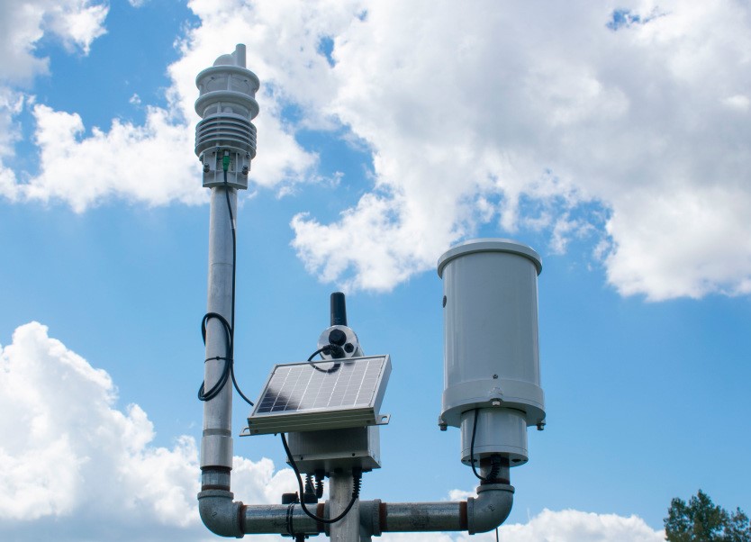
WS800 Weather Station deployed at the Fondriest Center for Environmental Studies. (Credit: Emma Jones / Fondriest Environmental, Inc.)


0 comments