
Lufft WS-Series Smart Weather Sensors
- Free ground shipping
- Expedited repair and warranty service
- Lifetime technical support
- More
- Each model offers different combination of sensors to suit a range of applications
- Easily mounts to 2" diameter pipe with integrated bracket mount & U-bolts
- SDI-12 or Modbus RTU output for integration with NexSens and other data loggers
Overview
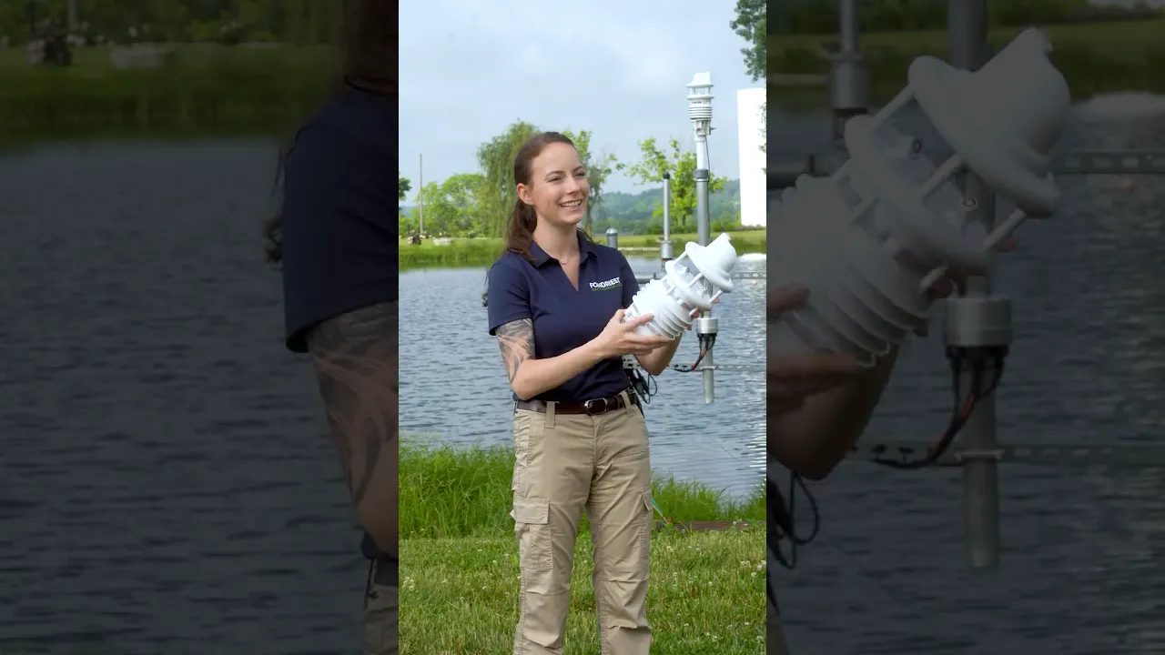
The Lufft WS-Series Multi-Parameter Weather Sensors simultaneously measure a combination of air temperature, humidity, pressure, precipitation, solar radiation, lightning & wind with an integrated electronic compass.
Air Temperature & Humidity (WS300, WS301, WS302, WS400, WS401, WS500, WS501, WS502, WS600, WS601, WS700, WS800)
Temperature is measured using a highly accurate NTC-resistor, while humidity is measured using a capacitive humidity sensor. Both sensors are located in a ventilated radiation shield to reduce the effects of solar radiation.
Pressure (WS300, WS301, WS302, WS400, WS401, WS500, WS501, WS502, WS600, WS601, WS700, WS800)
Absolute air pressure is measured using a built-in MEMS sensor. The relative air pressure referenced to sea level is calculated using the barometric formula with the aid of the local altitude, which is user-configurable on the equipment.
Wind Speed & Direction (WS200, WS500, WS501, WS502, WS600, WS601, WS700, WS800)
The wind sensor uses four ultrasound sensors which take cyclical measurements in all directions. The resulting wind speed and direction are calculated from the measured run-time sound differential.
Compass (WS200, WS500, WS501, WS502, WS600, WS601, WS700, WS800)
The integrated electronic compass can be used to check the north-south adjustment of the sensor housing for wind direction measurement. It is also used to calculate the compass-corrected wind direction.
Radar Precipitation (WS400, WS600, WS700, WS800)
Tried and tested radar technology is used to measure precipitation. The precipitation sensor works with a 24GHz Doppler radar, which measures the drop speed and calculates precipitation quantity and type by correlating drop size and speed.
Tipping Bucket Rainfall (WS401, WS601)
Precipitation is measured using an integrated tipping bucket rain gauge. The tipping bucket is configured for 0.2mm rainfall resolution.
Solar Radiation (WS301, WS302, WS501, WS502, WS700, WS800)
The pyranometer is intended for shortwave global solar radiation measurements in the spectral range from 300 to 1100nm (WS302, WS502, WS700, WS800) or 300 to 2800nm (WS301, WS501). The thermopile sensor construction measures the solar energy that is received from the total solar spectrum and the whole hemisphere. The output is expressed in Watts per square meter.
Lightning Detection (WS800)
Lightning detection is measured by an integrated sensor analyzing the radio wave emission of lightning, delivering a count of recognized lightning events. The sensor analyzes the spectrum and waveform of the received signal to suppress the detection of manmade electrical discharges.
- Air Temperature
- Principle: NTC
- Measuring Range: -50 to +60 C
- Resolution: 0.1 C (-20 to +50 C); otherwise 0.2 C
- Accuracy: +/-0.2 C (-20 to +50 C); otherwise +/-0.5 C
- Units: C; F
- Humidity
- Principle: Capacitive
- Measuring Range: 0 to 100% RH
- Resolution: 0.1% RH
- Accuracy: +/-2% RH
- Units: % RH; g/m3; g/kg
- Pressure
- Principle: Capacitive
- Measuring Range: 300 to 1200hPa
- Resolution: 0.1hPa
- Accuracy: +/-1.5hPa
- Unit: hPa
- Radiation
- Response Time (95%): <1s
- Spectral Range: 300 to 1100 nm
- Measuring Range: 1400 W/m2
- Wind Speed
- Principle: Ultrasonic
- Measuring Range: 0 to 60m/s
- Resolution: 0.1m/s
- Accuracy: +/-0.3m/s or 3% (0 to 35m/s); +/-5% (>35m/s)
- Response Threshold: 0.3m/s
- Units: m/s; km/h; mph; kts
- Wind Direction
- Principle: Ultrasonic
- Measuring Range: 0 to 359.9 degrees
- Resolution: 0.1 degrees
- Accuracy: +/-3 degrees
- Response Threshold: 0.3m/s
- Compass
- Principle: Integrated Electronic Compass
- Measuring Range: 0 to 359.9 degrees
- Resolution: 1.0 degree
- Precipitation
- Principle: Radar
- Measuring Range: 0.3mm to 5.0mm
- Liquid Precipitation Resolution: 0.01mm
- Precipitation Types: Rain, Snow
- Repeatability: Typically> 90%
- Response Threshold: 0.01mm
- Lightning Detection
- Unit: Number of Lightning Events
- Coverage Area: 5-10km
- Technical Data
- Interface: SDI-12, Modbus
- Operating Temperature: -50 to +60 C
- Operating Humidity: 0 to 100% RH
- Each model offers different combination of sensors to suit a range of applications
- Easily mounts to 2" diameter pipe with integrated bracket mount & U-bolts
- SDI-12 or Modbus RTU output for integration with NexSens and other data loggers
Overview
The Lufft WS-Series Multi-Parameter Weather Sensors simultaneously measure a combination of air temperature, humidity, pressure, precipitation, solar radiation, lightning & wind with an integrated electronic compass.
Air Temperature & Humidity (WS300, WS301, WS302, WS400, WS401, WS500, WS501, WS502, WS600, WS601, WS700, WS800)
Temperature is measured using a highly accurate NTC-resistor, while humidity is measured using a capacitive humidity sensor. Both sensors are located in a ventilated radiation shield to reduce the effects of solar radiation.
Pressure (WS300, WS301, WS302, WS400, WS401, WS500, WS501, WS502, WS600, WS601, WS700, WS800)
Absolute air pressure is measured using a built-in MEMS sensor. The relative air pressure referenced to sea level is calculated using the barometric formula with the aid of the local altitude, which is user-configurable on the equipment.
Wind Speed & Direction (WS200, WS500, WS501, WS502, WS600, WS601, WS700, WS800)
The wind sensor uses four ultrasound sensors which take cyclical measurements in all directions. The resulting wind speed and direction are calculated from the measured run-time sound differential.
Compass (WS200, WS500, WS501, WS502, WS600, WS601, WS700, WS800)
The integrated electronic compass can be used to check the north-south adjustment of the sensor housing for wind direction measurement. It is also used to calculate the compass-corrected wind direction.
Radar Precipitation (WS400, WS600, WS700, WS800)
Tried and tested radar technology is used to measure precipitation. The precipitation sensor works with a 24GHz Doppler radar, which measures the drop speed and calculates precipitation quantity and type by correlating drop size and speed.
Tipping Bucket Rainfall (WS401, WS601)
Precipitation is measured using an integrated tipping bucket rain gauge. The tipping bucket is configured for 0.2mm rainfall resolution.
Solar Radiation (WS301, WS302, WS501, WS502, WS700, WS800)
The pyranometer is intended for shortwave global solar radiation measurements in the spectral range from 300 to 1100nm (WS302, WS502, WS700, WS800) or 300 to 2800nm (WS301, WS501). The thermopile sensor construction measures the solar energy that is received from the total solar spectrum and the whole hemisphere. The output is expressed in Watts per square meter.
Lightning Detection (WS800)
Lightning detection is measured by an integrated sensor analyzing the radio wave emission of lightning, delivering a count of recognized lightning events. The sensor analyzes the spectrum and waveform of the received signal to suppress the detection of manmade electrical discharges.
- Air Temperature
- Principle: NTC
- Measuring Range: -50 to +60 C
- Resolution: 0.1 C (-20 to +50 C); otherwise 0.2 C
- Accuracy: +/-0.2 C (-20 to +50 C); otherwise +/-0.5 C
- Units: C; F
- Humidity
- Principle: Capacitive
- Measuring Range: 0 to 100% RH
- Resolution: 0.1% RH
- Accuracy: +/-2% RH
- Units: % RH; g/m3; g/kg
- Pressure
- Principle: Capacitive
- Measuring Range: 300 to 1200hPa
- Resolution: 0.1hPa
- Accuracy: +/-1.5hPa
- Unit: hPa
- Radiation
- Response Time (95%): <1s
- Spectral Range: 300 to 1100 nm
- Measuring Range: 1400 W/m2
- Wind Speed
- Principle: Ultrasonic
- Measuring Range: 0 to 60m/s
- Resolution: 0.1m/s
- Accuracy: +/-0.3m/s or 3% (0 to 35m/s); +/-5% (>35m/s)
- Response Threshold: 0.3m/s
- Units: m/s; km/h; mph; kts
- Wind Direction
- Principle: Ultrasonic
- Measuring Range: 0 to 359.9 degrees
- Resolution: 0.1 degrees
- Accuracy: +/-3 degrees
- Response Threshold: 0.3m/s
- Compass
- Principle: Integrated Electronic Compass
- Measuring Range: 0 to 359.9 degrees
- Resolution: 1.0 degree
- Precipitation
- Principle: Radar
- Measuring Range: 0.3mm to 5.0mm
- Liquid Precipitation Resolution: 0.01mm
- Precipitation Types: Rain, Snow
- Repeatability: Typically> 90%
- Response Threshold: 0.01mm
- Lightning Detection
- Unit: Number of Lightning Events
- Coverage Area: 5-10km
- Technical Data
- Interface: SDI-12, Modbus
- Operating Temperature: -50 to +60 C
- Operating Humidity: 0 to 100% RH
Select Options


PRODUCT VIDEOS


Customer Stories


