Soil Moisture Meter Network Has Nothing On SMAP Satellite
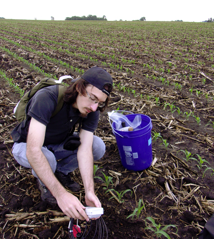
Iowa Flood Center graduate student Andre Della Libera Zanchetta measures surface water content using a soil moisture meter. (Credit: Iowa Flood Center)
The soil moisture meter is an outstanding tool, but it still has its shortcomings. For one, it can only monitor moisture in the soil where it’s installed. And with today’s ever-advancing satellite technology that is dissecting all of Earth’s processes, that resolution simply isn’t high enough.
To help make up for the limitations of soil moisture meters, scientists a few years ago launched the Soil Moisture Active Passive (SMAP) satellite. Backed by NASA and put into orbit by the United Launch Alliance, the satellite can measure soil moisture across the globe through radar backscatter and microwave emissions.
In a recent showing of how the SMAP satellite’s reach bests the typical soil moisture meter, researchers at the Iowa Flood Center have helped to validate and calibrate its measurements using ground-based data gathered over a summer sampling session. Much of the effort had investigators at the Center, housed at the University of Iowa, comparing data collected by the SMAP satellite to measurements taken from the South Fork watershed near Ames, Iowa.
The Iowa Flood Center was an ideal partner for the effort, as it hosts a large-scale network of soil moisture monitoring sensors that provide real-time data to farmers around the state. Conducting the study in agriculture-heavy Iowa also gave investigators a neat look at how vegetation and farming practices can affect satellite-based measurements of soil moisture.
Numerous students from the Iowa Flood Center helped in the first phase of the project, which stretched through May and June of 2016. They assisted experts across Iowa deploy and maintain soil moisture sensors as crops were first emerging.
One key process that scientists are hoping to better understand is the springtime roughness that comes with soil after tillage. The roughness, which is typically softened over time with rainfall, can affect satellite observations.
Investigators from Iowa State University and other Iowa colleges and government agencies also assisted in the SMAP satellite validation effort.
Top image: Iowa Flood Center graduate student Andre Della Libera Zanchetta measures surface water content using a soil moisture meter. (Credit: Iowa Flood Center)


0 comments