USGS releases chemical, mineral maps of U.S. soils
By Daniel Kelly on June 2, 2014
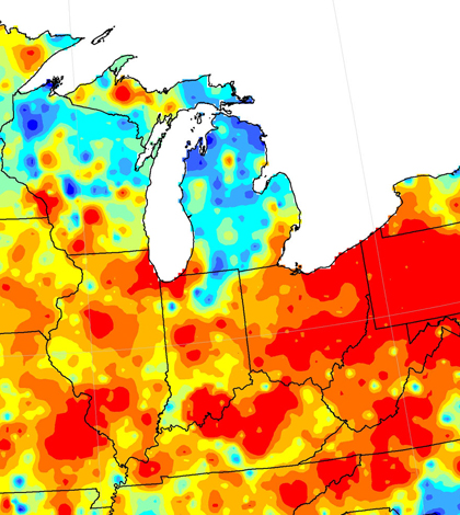
A section of the USGS map of soil lead levels (Credit: USGS)
The U.S. Geological Survey has published a set of maps depicting the distribution of selected chemical elements and minerals in soils throughout the United States, according to a release.
Officials at the agency say specialists in agriculture and food safety will find the maps useful in understanding soil composition. This is because soil is the source of most elements that reach humans through the food chain.
In addition, regulators can use the maps to identify soil contamination and assess risks to human health. Accompanying the maps are data sets that can be used to start future research into related subjects.
Image: A section of the USGS map of soil lead levels (Credit: USGS)


0 comments