
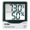
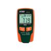
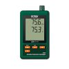
HOBO MX Temp/RH Logger
Features
- Stores 84,000 measurements
- Easy to deploy and offload using the free HOBOconnect app
- Visual and audible high & low alarm thresholds
- Expedited repair and warranty service
- Lifetime technical support
- More
Overview
The Onset HOBO MX1101 data logger measures and transmits temperature and relative humidity data wirelessly to mobile devices or Windows computers via Bluetooth Low Energy (BLE) technology. Add the MX Gateway for remote access to data in Onset's cloud-based HOBOlink software.
Mechanics
The self-contained wireless data logger works with a mobile device or Windows computer and Onset's free HOBOconnect app so users can configure the logger and read out data over a 100-foot range, with no other dedicated equipment required. Using Onset's free app, users can also view data in graphs, check the operational status of loggers, configure alarm notifications, and share data files.
| Temperature Sensor | |
| Range | -20° to 70°C (-4° to 158°F) |
| Accuracy | ±0.21°C from 0° to 50°C (±0.38°F from 32° to 122°F) |
| Resolution | 0.024°C at 25°C (0.04°F at 77°F) |
| Drift | <0.1°C (0.18°F) per year |
| RH Sensor* | |
| Range | 1% to 90%, non-condensing |
| Accuracy | ±2.0% from 20% RH to 80% RH typical to a maximum of ±4.5% including hysteresis at 25˚C (77˚F); below 20% RH and above 80% RH ±6% typical |
| Resolution | 0.01% |
| Drift | <1% per year typical |
| Response Time | |
| Temperature | 7:30 minutes in air moving 1 m/s (2.2 mph) |
| RH | 20 seconds to 90% in airflow of 1 m/s (2.2 mph) |
| Logger | |
| Radio Power | 1 mW (0 dBm) |
| Transmission Range | Approximately 30.5 m (100 ft) line-of-sight |
| Wireless Data Standard | Bluetooth Smart (Bluetooth Low Energy, Bluetooth 4.0) |
| Logger Operating Range | -20° to 70°C (-4° to 158°F); 0 to 95% RH (non-condensing) |
| Logging Rate | 1 second to 18 hours |
| Logging Modes | Fixed interval (normal, statistics) or burst |
| Memory Modes | Wrap when full or stop when full |
| Start Modes | Immediate, push button, date & time, or next interval |
| Stop Modes | When memory full, push button, date & time, or after a set logging period |
| Restart Mode | Push button |
| Time Accuracy | ±1 minute per month at 25°C (77°F) |
| Battery Life | 1 year, typical with logging interval of 1 minute. Faster logging and/or statistics sampling intervals, entering burst logging mode, and remaining connected with the app will impact battery life. Excessive readouts, audible alarms, and paging all impact battery life. Visual alarms and other events can have a marginal impact on battery life. |
| Battery Type | Two AAA 1.5 V alkaline batteries, user replaceable |
| Memory | 128 KB (84,650 measurements, maximum) |
| Full Memory Download Time | Approximately 60 seconds; may take longer the further the device is from the logger |
| LCD | LCD is visible from 0° to 50°C (32° to 122°F); the LCD may react slowly or go blank in temperatures outside this range |
| Size | 3.66 x 8.48 x 2.29 cm (1.44 x 3.34 x 0.9 in.) |
| Weight | 56 g (1.98 oz) |
| Environmental Rating | IP50 |
- HOBO MX1101 Temp/RH Data Logger
- Command strip
- Double-sided tape
- Hook & loop strap
- Two AAA 1.5 V alkaline batteries
Select Options


In The News

Wildfire Prevention in the Sierra Nevada Region with the Yuba Watershed Institute
Though recent wildfires have sparked new conversations about wildfire management and response, groups like the Yuba Watershed Institute have been monitoring the forests and water resources of the Sierra Nevada region for decades, managing approximately 5,000 acres of land with the Bureau of Land Management (BLM) and about 7,000 acres in private land partnerships. The goal of the Institute is to work with local communities and land agencies to improve watershed and forestry management through informed practices and public outreach. The goals of the Yuba Watershed Institute are three-fold: Improve the ability of fire suppression agencies like the California Department of Forestry and Fire Protection ( CAL FIRE ) and the US Forest Service.
Read More
Wave Sensors Integration with NexSens Buoys: A Cutting-Edge Solution for Wave Measurment
Real-time wave data supports accurate weather prediction, safe and efficient maritime operations, and provides valuable safety and operating condition information for recreation and commercial fishing. Understanding wave dynamics also helps with the design of protective coastal structures like seawalls, breakwaters, and jetties. It also supports better prediction of their impact on sediment transport and coastal geomorphology. Wave data is a key factor in qualifying and designing offshore wind farms and harnessing kinetic energy for electrical generation. It helps with the understanding of ocean-atmosphere interactions and contributes to studies of sea-level rise and climate change impacts.
Read More
Spring 2025 Environmental Monitor Available Now
In the Spring 2025 edition of the Environmental Monitor, we highlight partnerships across the world and the importance of collaboration between government agencies, universities, environmental groups, local communities, and other stakeholders. From great white shark research in Cape Cod to monitoring fisheries in Lake Erie, this latest edition underscores partnerships that connect stakeholders in a watershed through environmental data. With an emphasis on data sharing, a combination of real-time and discrete sampling keeps the public and partners informed of environmental conditions. Our writers also sought out science professionals dedicated to working with peers within and outside of the environmental sector.
Read More