
HOBO MX2001 Direct Read Cables
Features
- Kevlar reinforced cable suspends sensor, and provides sensor communication and power
- Two O-rings in each connector ensure a long-term waterproof seal
- Integrated strain relief provides support for long cables
- Expedited repair and warranty service
- Lifetime technical support
- More
Overview
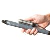
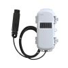
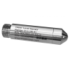
The Onset HOBO MX2001 Direct Read Cables provides the connection between the MX2001 logger’s top-end unit and water level sensor. provides the connection between the MX2001 logger’s top-end unit and water level sensor. Cables can be ordered in lengths from 0.2 to 500m for deployment in a wide range of wells. Please see specifications for pricing on the cables.
Note: The logger and sensor add 0.39 meters to the length of the cable. Cable length can vary up to 3% from the length ordered. The 5, 10, 15, 30 and 60 meter cable lengths are standard. For all cable lengths, please call for availability. For conversion tables from meters to feet and lengths of cables with the logger and sensor, please refer to the direct read cable table on the Documents tab.
Select Options


In The News

Source Water Monitoring in Albany, New York: Tracing Water Quality throughout Tributaries
Thousands of US cities pull their drinking water from natural source waters like reservoirs, rivers, and streams, making overall watershed health a key consideration for water providers. In Albany, New York, the Albany Department of Water and Water Supply delivers drinking water to over 100,000 residents as well as monitors and manages the larger drinking water supply watershed. Hannah Doherty, Environmental Specialist at the Albany Department of Water and Water Supply , spends her days working with a small team to monitor the drinking supply and the connected water bodies. Doherty explains, “We’re the first to encounter the water that ends up being the drinking water.
Read More
Wildfire Prevention in the Sierra Nevada Region with the Yuba Watershed Institute
Though recent wildfires have sparked new conversations about wildfire management and response, groups like the Yuba Watershed Institute have been monitoring the forests and water resources of the Sierra Nevada region for decades, managing approximately 5,000 acres of land with the Bureau of Land Management (BLM) and about 7,000 acres in private land partnerships. The goal of the Institute is to work with local communities and land agencies to improve watershed and forestry management through informed practices and public outreach. The goals of the Yuba Watershed Institute are three-fold: Improve the ability of fire suppression agencies like the California Department of Forestry and Fire Protection ( CAL FIRE ) and the US Forest Service.
Read More
Wave Sensors Integration with NexSens Buoys: A Cutting-Edge Solution for Wave Measurment
Real-time wave data supports accurate weather prediction, safe and efficient maritime operations, and provides valuable safety and operating condition information for recreation and commercial fishing. Understanding wave dynamics also helps with the design of protective coastal structures like seawalls, breakwaters, and jetties. It also supports better prediction of their impact on sediment transport and coastal geomorphology. Wave data is a key factor in qualifying and designing offshore wind farms and harnessing kinetic energy for electrical generation. It helps with the understanding of ocean-atmosphere interactions and contributes to studies of sea-level rise and climate change impacts.
Read More