
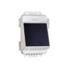
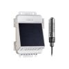
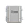
HOBOlink Cloud IoT Platform
Features
- View and monitor all RX and MX devices on one platform
- Stay updated with customizable real-time email/text alerts
- Gain insight into data with Google Maps, built-in templates & customizable dashboards
- Expedited repair and warranty service
- Lifetime technical support
- More
A comprehensive cloud environmental monitoring platform for HOBO MX & RX products, HOBOlink integrates near real-time, research-grade environmental data from IoT RX stations and MX devices into its single, intuitive platform's robust data management, visualization, and API integration tools for deeper analysis. Flexible and customizable, HOBOlink lets you choose a plan to match your monitoring application and goals and make the most of your data, giving you 24/7 access and key insights to help you make the most informed decisions and support your sustainability initiatives.
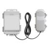
RX Basic |
RX Standard |
RX Premium |
|
Description |
Value plan for up to 10 measurements with longer logging intervals | Advanced monitoring capability with standard sensor support | Advanced monitoring capability with best sensor support |
Max # of Measurements |
10 | 25 | Supports max sensors for each device added |
Fastest Logging Interval |
Every hour | Every 5 minutes | Supports each device's max logging rate |
Remote access and monitoring via HOBOlink |
Included | Included | Included |
Select Options


In The News

Long-Term Monitoring in the Chautauqua Lake Watershed
With a widely developed shoreline, Chautauqua Lake experiences influxes of non-point source pollution that have historically impacted the health of the lake. The Chautauqua Lake Association (CLA) has been monitoring the lake for over two decades, reporting on changes that have occurred over the years. A pair of local lake advocates, Jane and Doug Conroe, have lived on the lake for over 40 years and have played an important role in establishing monitoring programs and facilitating consistent data collection throughout the watershed. Doug has been involved with the Chautauqua Lake Association (CLA) since the pair moved to the area in 1980, and is currently serving as the Executive Director.
Read More
No Red Herrings: Data Driving the Largest Salt Marsh Restoration in the NE USA
The Herring River system encompasses around 1,000 acres in the Towns of Wellfleet and Truro, Massachusetts. In 1909, the Chequessett Neck Road dike was built at the river’s mouth, drastically limiting tidal flow. Today, it’s one of the most restricted estuaries in the northeastern United States. As a result, the area has suffered environmental decline, including poor water quality, hypoxia, lower pH, and salt marsh degradation. In 2023, the Town of Wellfleet received $14.7 million from NOAA’s Office of Habitat Conservation to fund the Herring River Restoration Project (HRRP). Francesco Peri, President and CEO at Charybdis Group LLC, uses a network of NexSens data loggers to monitor water level and water quality on the Herring River.
Read More
Carbon and Nutrient Monitoring in the Great Lakes Using Satellite Observations
Carbon and nutrients are the foundation of lake food webs and play an important role in the chemical and physical processes that shape aquatic ecosystems and various lake dynamics. Studying these cornerstones can help improve understanding of other lake conditions like harmful algal blooms, hypoxia, and phytoplankton community composition. The way in which these characteristics are monitored varies, though many rely on a proxy approach wherein parameters are extrapolated from the measurement of a different parameter. An assistant professor at Cleveland State University, Brice Grunert, is working to improve current strategies and take a satellite approach to monitoring the Great Lakes.
Read More