
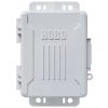
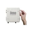
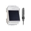
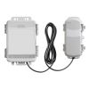
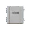
HOBO MicroRX Station
Features
- Robust, weatherproof IP66/NEMA 4X enclosure
- Inputs for up to five plug-and-play sensors
- Built-in LCD confirms proper setup and operation
- Free ground shipping
- Expedited repair and warranty service
- Lifetime technical support
- More
Overview
The compact and rugged Onset HOBO MicroRX Station is an easy-to-deploy, low-cost cellular solution for long-term, reliable field monitoring. Two power source options are available: a solar panel for extended deployments, and user-replaceable batteries for flexible mounting in covered or protected locations. The station includes inputs for up to five of Onset's research-grade plug-and-play sensors. Configurable station-side alarms trigger immediate notifications of critical conditions, and Onset's cloud-based HOBOlink platform makes it easy to view, access, and share data.
Real-Time Data
Logged data from the station is transferred at regular connection intervals to HOBOlink® web-based software allowing access to the latest conditions, view graphs, configure sensors and alarms, set up a dashboard, download data, or schedule data delivery via email or FTP.
- HOBO RX2100 MicroRX Station
- Grease packet
- Cable ties
- Screws and washers
- Six AA lithium batteries (RX2101 battery-powered stations)
- Battery pack (RX2102 solar-powered stations)
Select Options


In The News

Wave-Powered Buoy Deployed in Puget Sound
While the development of solar-powered monitoring systems has improved access to real-time environmental data, solar power is still limited by low light conditions, such as poor weather, nighttime, or high-latitude environments. To supplement these incumbent power solutions at sea, Ocean Motion Technologies has developed a small-scale ocean wave energy system that can be directly integrated with existing data buoy platforms. Not only does wave energy supplement solar power during periods when the buoys are limited by light availability, but it also allows data buoys to perform beyond their current power capacities.
Read More
Long-Term Monitoring in the Chautauqua Lake Watershed
With a widely developed shoreline, Chautauqua Lake experiences influxes of non-point source pollution that have historically impacted the health of the lake. The Chautauqua Lake Association (CLA) has been monitoring the lake for over two decades, reporting on changes that have occurred over the years. A pair of local lake advocates, Jane and Doug Conroe, have lived on the lake for over 40 years and have played an important role in establishing monitoring programs and facilitating consistent data collection throughout the watershed. Doug has been involved with the Chautauqua Lake Association (CLA) since the pair moved to the area in 1980, and is currently serving as the Executive Director.
Read More
No Red Herrings: Data Driving the Largest Salt Marsh Restoration in the NE USA
The Herring River system encompasses around 1,000 acres in the Towns of Wellfleet and Truro, Massachusetts. In 1909, the Chequessett Neck Road dike was built at the river’s mouth, drastically limiting tidal flow. Today, it’s one of the most restricted estuaries in the northeastern United States. As a result, the area has suffered environmental decline, including poor water quality, hypoxia, lower pH, and salt marsh degradation. In 2023, the Town of Wellfleet received $14.7 million from NOAA’s Office of Habitat Conservation to fund the Herring River Restoration Project (HRRP). Francesco Peri, President and CEO at Charybdis Group LLC, uses a network of NexSens data loggers to monitor water level and water quality on the Herring River.
Read More