
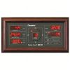
RainWise MK-III Wireless Weather Stations
Features
- Solar charged system for continuous operation
- Long range 2.4 GHz radio transmits up to 1600m
- Manufactured in the USA with 2-year standard warranty
- Free ground shipping
- Expedited repair and warranty service
- Lifetime technical support
- More
Overview
The RainWise MK-III sensor features a powerful new 2.4 GHz spread spectrum radio that Increases range to 1-mile line of sight. It also features a real-time 2-second wind speed and direction update interval. An 18” Mounting Mast is included with purchase.
Easy-to-Install
The MKlll-LR is a wireless, solar-powered weather station providing the best accuracy of any consumer weather station on the market. This compact, rugged and elegantly designed unit comes fully assembled, providing quick and easy installation. The MKlll-LR’s lightweight and compact design makes installation quick and easy. The MKlll-LR is supplied with a detachable mast section that can be secured to an existing structure.
Benefits
- Transmission range of up to one mile
- Rapid data refresh rate of every 2 seconds
- Tipping bucket rain gauge option available
- Unique aervane design - Trademark rotary blade design eliminates freezing or breaking potential
- Utilizes an internal, contact-free magnetic system that provides constant horizontal wind tracking, leaving no mechanical parts to wear out over time and require replacement.
Select Options


In The News

Source Water Monitoring in Albany, New York: Tracing Water Quality throughout Tributaries
Thousands of US cities pull their drinking water from natural source waters like reservoirs, rivers, and streams, making overall watershed health a key consideration for water providers. In Albany, New York, the Albany Department of Water and Water Supply delivers drinking water to over 100,000 residents as well as monitors and manages the larger drinking water supply watershed. Hannah Doherty, Environmental Specialist at the Albany Department of Water and Water Supply , spends her days working with a small team to monitor the drinking supply and the connected water bodies. Doherty explains, “We’re the first to encounter the water that ends up being the drinking water.
Read More
Wildfire Prevention in the Sierra Nevada Region with the Yuba Watershed Institute
Though recent wildfires have sparked new conversations about wildfire management and response, groups like the Yuba Watershed Institute have been monitoring the forests and water resources of the Sierra Nevada region for decades, managing approximately 5,000 acres of land with the Bureau of Land Management (BLM) and about 7,000 acres in private land partnerships. The goal of the Institute is to work with local communities and land agencies to improve watershed and forestry management through informed practices and public outreach. The goals of the Yuba Watershed Institute are three-fold: Improve the ability of fire suppression agencies like the California Department of Forestry and Fire Protection ( CAL FIRE ) and the US Forest Service.
Read More
Wave Sensors Integration with NexSens Buoys: A Cutting-Edge Solution for Wave Measurment
Real-time wave data supports accurate weather prediction, safe and efficient maritime operations, and provides valuable safety and operating condition information for recreation and commercial fishing. Understanding wave dynamics also helps with the design of protective coastal structures like seawalls, breakwaters, and jetties. It also supports better prediction of their impact on sediment transport and coastal geomorphology. Wave data is a key factor in qualifying and designing offshore wind farms and harnessing kinetic energy for electrical generation. It helps with the understanding of ocean-atmosphere interactions and contributes to studies of sea-level rise and climate change impacts.
Read More