
RS5 Hydroboard ADCP Rental
RS5 Hydroboard Acoustic Doppler Current Profiler
Starting At $651.00
Stock Check Availability
Fondriest Exclusives
- Expedited repair and warranty service
- Lifetime technical support
- More
Key Features
- Towed discharge measurement system with wireless Bluetooth communication
- Accurately measure velocity & depth down to 6m
- Integrated DGNSS receiver for back-up position data in moving bed conditions
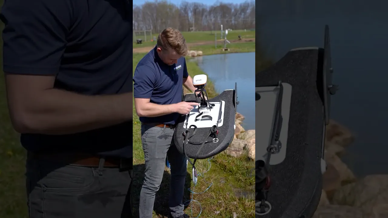
The RS5 ADCP with Hydroboard II Micro includes everything needed to make accurate discharge measurements in streams and rivers up to 6m (20 ft).
- RS5 acoustic Doppler current profiler
- RSQ Windows software
- Plastic shipping case
- 3‐ft (91‐cm) radio antenna cable
- USB Bluetooth radio
- (2) Li‐Ion rechargeable batteries
- USB battery charger
- GNSS smart antenna
- 1-ft (30-cm) interface cable
- Hydroboard II-Micro
- Hydroboard II-Micro soft carrying case
Questions & Answers
Key Features
- Towed discharge measurement system with wireless Bluetooth communication
- Accurately measure velocity & depth down to 6m
- Integrated DGNSS receiver for back-up position data in moving bed conditions
The RS5 ADCP with Hydroboard II Micro includes everything needed to make accurate discharge measurements in streams and rivers up to 6m (20 ft).
- RS5 acoustic Doppler current profiler
- RSQ Windows software
- Plastic shipping case
- 3‐ft (91‐cm) radio antenna cable
- USB Bluetooth radio
- (2) Li‐Ion rechargeable batteries
- USB battery charger
- GNSS smart antenna
- 1-ft (30-cm) interface cable
- Hydroboard II-Micro
- Hydroboard II-Micro soft carrying case
Questions & Answers
Select Options
Products
0 Item Selected
Image
Part #
Product Description
Price
Stock
Select

RS5-D
Rental of SonTek RS5 Hydroboard ADCP with DGNSS and Bluetooth radio, priced per day
$651.00
Check Availability
$651.00

RS5-2D
Rental of SonTek RS5 Hydroboard ADCP with DGNSS and Bluetooth radio, priced per 2-day period
$1,041.00
Check Availability
$1,041.00

RS5-W
Rental of SonTek RS5 Hydroboard ADCP with DGNSS and Bluetooth radio, priced per week
$1,822.00
Check Availability
$1,822.00

RS5-2W
Rental of SonTek RS5 Hydroboard ADCP with DGNSS and Bluetooth radio, priced per 2-week period
$2,733.00
Check Availability
$2,733.00

RS5-M
Rental of SonTek RS5 Hydroboard ADCP with DGNSS and Bluetooth radio, priced per month
$3,904.00
Check Availability
$3,904.00
Accessories
0 Item Selected

Notice: At least 1 product is not available to purchase online
PRODUCT VIDEOS

Related Products


Customer Stories


