
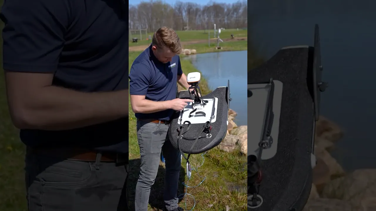
SonTek RS5 Acoustic Doppler Current Profiler
America’s Premier Xylem and YSI Dealer!
America’s Premier Xylem and YSI Dealer!
- Expedited repair and warranty service
- Lifetime technical support
- More
- SmartPulse+ utilizes Pulse-coherent and Broadband acoustic profiling that automatically adjusts based on conditions
- Vertical acoustic beam for the most accurate channel cross-sectional area in discharge applications
- Batteries and Bluetooth radio are housed in the RS5, eliminating external electric boxes
Vertical Acoustic Beam
Superior channel definition for the most accurate cross-sectional area for discharge applications. Measures the depth directly under the system and extends maximum discharge depth if bottom-tracking is out of range. 360º compass and two-axis tilt sensor
SmartPulse+
An intelligent algorithm utilizing Pulse-coherent and Broadband acoustic profiling that automatically adjusts based on conditions—reliable bottom tracking and velocity profiling in water depths shallower than ever. Visualize velocity data like never before with cell sizes down to 2.5 cm.
360º Compass and Two-Axis Tilt Sensor
Reports vessel heading and magnetic error and compensates for motion due to surface conditions. The tilt sensor uses pitch and roll to correct depth and velocities.
DGNSS (Option)
Integrated DGNSS smart antenna for position as a backup or alternative to bottom tracking in moving bed or other challenging conditions.
RTK GPS (Option)
Ultra-precise positioning as an alternative to bottom tracking in moving beds or other difficult situations. Geolocate each sample (or ensemble) during measurement. Corrections are sent from the SonTek RTK base station or a local NTRIP.
| Water Velocity Profiling | Profiling Range | 0.1-6 m (*1) |
| Velocity Range | ±5 m/s | |
| Accuracy | 1% ±0.002 m/s | |
| Resolution | 0.001 m/s | |
| Number of Cells | Up to 128 | |
| Cell Size | 2.5-30 cm | |
| Data Output Rate | 1.0 Hz | |
| Bottom Tracking | Depth Range | 0.1-6 m (*1) |
| Accuracy (*2) | 1% ± 0.002 m/s | |
| Resolution | 0.001 m/s | |
| Depth Measurement | Range | 0.1-6.5 m (*1) |
| Accuracy | 1% ±0.005 m | |
| Sensors | Temperature Sensors | Resolution: ±0.01°C Accuracy: ±0.5°C |
| Compass/Tilt Sensor | Range: ±180° Pitch/Roll, 0-360° Heading Heading Accuracy: ±2° Pitch/Roll Accuracy: ±1° |
|
| Transducers | Total Number | Five, 3.0 Mhz |
| Beam Angle | 25° | |
| Beam Width | 3° | |
| Bandwidth | 25% | |
| Battery Characteristics | Input Voltage | 3.3-4.2 VDC |
| Power Source - Li-Ion | 1x size 18650, Tenergy, Type 30016-04, 3.7Vdc, 2600mAh | |
| Battery Life - 1 x size 18650 | Seven hours continuous use, typical settings (*3) | |
| Power Consumption | 1.0 W (Average) | |
| Dimensions | 19.2 mm x 69.7 mm | |
| Communications | Radio Protocol | Bluetooth Low Energy (BLE5) |
| Range | 100 m (*4) | |
| Bluetooth Compliance | FCC Part 15, FCC ID: XPYNINAB30 ISED Certification: 8595A-NINAB30 |
|
| Environmental | Operation Temperature | -5° to 45°C (23°F to 113°F) |
| Storage Temperature | -20° to 70°C (-4°F to 158°F) | |
| Storage with Battery Temperature (*5) | -20° to 45°C (-4°F to 113°F) | |
| RS5 Physical Properties | Dimensions - HBII Micro | 76 cm (30”) x 50 cm (20”) x 11cm (4.25”) |
| Dimensions - RS5 Unit | 24 cm (9.5”) x 5 cm (2.2”) | |
| Weight in Air - RS5 Unit | 0.45 kg (1.0 lbs) | |
| Weight in Water - RS5 Unit | 0.15 kg (0.33 lbs) | |
| Weight in Air - RS5/HBII Micro/Geode | 3.63 kg (8.0 lbs) | |
| Waterproof Rating | IP67 | |
| DGNSS | Horizontal RMS | SBAS (WAAS): <0.3 m (0.98 ft) |
| 2DRMS | SBAS (WAAS): <0.6 m (1.96 ft) | |
| Frequency | L1, Multi-GNSS |
*Additional notes
1 Maximum range will vary with environmental conditions.
2 Bottom velocity accuracy.
3 Seven hours continuous use, typical settings.
4 When using provided SonTek USB radio with antenna.
5 Remove batteries from the RS5 if storage temperatures exceed the storage temperature of the Li-Ion battery.
- RS5 acoustic Doppler current profiler
- RSQ Windows software
- Plastic shipping case
- 3‐ft (91‐cm) radio antenna cable
- USB Bluetooth radio
- (2) Li‐Ion rechargeable batteries
- USB battery charger
Select Options


PRODUCT VIDEOS


Customer Stories


