
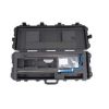
SonTek FlowTracker2 ADV Probes
Features
- Versatile probe can be used in the lab or field
- Optional integrated pressure sensor for depth data
- Available extension cables in 1.5m, 3.5m, and 8.5m lengths
- Expedited repair and warranty service
- Lifetime technical support
- More
Overview
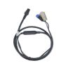
The Sontek FlowTracker2 ADV probe can be used in the field with the handheld display, or it can be used in the lab with direct PC connection. The ADV’s acoustic probe and processing electronics are housed in one small, lightweight, easily maneuverable unit, and the acoustic head has an optional, integrated pressure (depth) sensor.
Mechanics
Depth data are even correctable for dynamic pressure (Bernoulli) and altitude effects using SonTek’s patent-pending method. Setup of the probe and PC software is simple and mistake-proof. Just connect the cables between the probe and a laboratory PC or laptop, check a few settings, and press the “Start Logging” button. Data are output directly to a .CSV file that is immediately ready for use in the project, model, or database as required.
Probe Specifications
| Velocity Range | ±0.001 to 4.0 m/s (0.003 to 13 ft/s) |
| Velocity Resolution | 0.0001 m/s (0.0003 ft/s) |
| Velocity Accuracy | +/1% of measured velocity, +/- 0.25cm/s |
| Acoustic Frequency | 10.0 MHz |
| Sampling Volume Location | 10 cm (3.93 in) from the center transducer |
| Minimum Depth | 0.02 m (0.79 in) |
| Depth Measurement Range | 0 to 10m (0 to 32.81ft) |
| Depth Measurement Resolution | 0.001m (0.003ft) |
| Depth Sensor Accuracy | +/- 0.1% of FS (temperature compensated over full operating range) |
| +/- 0.05% Static (steady-state at 25°C) | |
| Additionally compensated for real-time water velocity, temperature, salinity, and altitude. |
|
| Temperature Sensor | Resolution: 0.01° C, Accuracy: 0.1° C |
| Tilt Sensor | Resolution: 0.001°, Accuracy: 1.0° |
| Communication Protocol | RS-232 |
| Operating/Storage Temperature | -20° C to 50° C (-4° F to 122° F) |
| Probe Head Dimensions | (L)13.3 cm (5.22 in) (W) 6.1 cm (2.39 in) (H) 2.3 cm (0.90 in) |
| Standard Cable Length | 1.5 m (4.92 ft) |
| Weight in Air | 0.90 kg (1.98 lbs) |
| Weight in Water | 0.30 kg (0.66 lbs) |
Select Options


In The News

From Paddles to Phytoplankton: Studying Vermont’s Wildest Lakes
For six months of the year, Rachel Cray, a third-year PhD student at the Vermont Limnology Laboratory at the University of Vermont, lives between a microscope and her laptop, running data. For the other six months, she is hiking and canoeing four of Vermont’s lakes, collecting bi-weekly water samples. Cray studies algal phenology across four lakes in Vermont, US, that have low anthropogenic stress—or in other words, are very remote. Funded by the National Science Foundation Career Award to Dr. Mindy Morales, the lakes Cray researches part of the Vermont Sentinel Lakes Program, which studies 13 lakes in the area and, in turn, feeds into the Regional Monitoring Network, which operates in the Northeast and Midwest US.
Read More
Reimagining Water Filtration: How Monitoring and Science Enhance FloWater Filtration Systems
Over 50% of Americans think their tap water is unsafe , according to the Environmental Working Group (EWG). Other recent surveys have found that number to be as high as 70% of persons surveyed. Whether due to increased public awareness of water quality issues or confusion about how municipal water sources are regulated, there is a clear distrust of tap water in the United States. According to industry expert Rich Razgaitis, CEO and co-founder of the water purification company FloWater, this issue creates a damaging cycle. Razgaitis explained that the health and environmental problems associated with contaminated water aren’t the only issues. As people become increasingly aware that some tap water is unsafe, they resort to bottled water.
Read More
Monitoring New Hampshire’s Aquatic Ecosystems: Continuous Data Collection in the Lamprey River Watershed
New Hampshire’s aquatic ecosystems provide a range of ecosystem services to the state and region. Resources and services like clean water, carbon storage, climate regulation, nutrient regulation, and opportunities for recreation all depend on New Hampshire’s aquatic ecosystems remaining healthy. Jody Potter, an analytical instrumentation scientist at the University of New Hampshire (UNH), is studying these aquatic ecosystems in hopes of developing an improved understanding of ecosystem services and their interactions with climate change, climate variability, and land use changes. [caption id="attachment_39799" align="alignnone" width="940"] Aquatic sensors in the Merrimack River in Bedford, NH, with I-293 in the background.
Read More