Boogie board loaded with sensors tracks water quality in urban Kansas stream
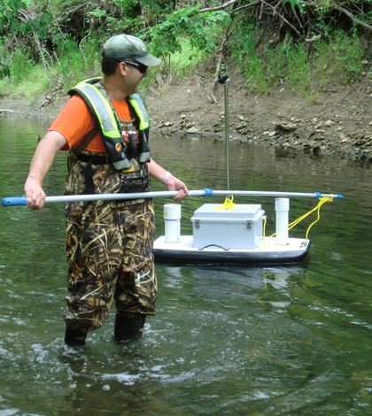
The bodyboard sensor platform needed some help passing slow spots of Indian Creek (Credit: Gary Foster/USGS)
Floating a boogie board down an urban creek downstream of a wastewater treatment facility in Kansas might not sound like the most enticing day on the water. But it made for a good day of data collecting for scientists who loaded up their board with water quality sensors and measured the effects of the treatment plant’s recent upgrades.
In 2010, Johnson County Wastewater upgraded its Middle Basin treatment facility to better remove nutrients from effluent that discharges into Indian Creek. Scientists at the U.S. Geological Survey’s Kansas Water Science Center were tasked with studying the stream to document water quality changes over the next several years.
They set up a series of fixed water quality monitoring stations at intervals downstream from the plant. Data from those sites showed stepwise decline in nitrogen from site to site. That’s good, but the scientists, including hydrologist Guy Foster, wanted to know more about what was going on between the stations.
To do that, Foster turned to custom bodyboard company Kenu Hawaii, which supplied a board with holes drilled in all the right places to support a suite of water quality sensors that the science center had on hand. There are commercially available vehicles designed for monitoring that could have just as easily traveled down the creek taking measurements of a single parcel of water as it moved downstream, Foster said. But they wanted to keep costs down.
“The whole idea behind this was ‘Hey, instead of spending $100,000 on a fancy remote controlled gizmo, let’s take what we have, put it together and string a dataset together,” Foster said. “That’s one of the keys for this: just keep it simple. And keep it as cheap as possible.”
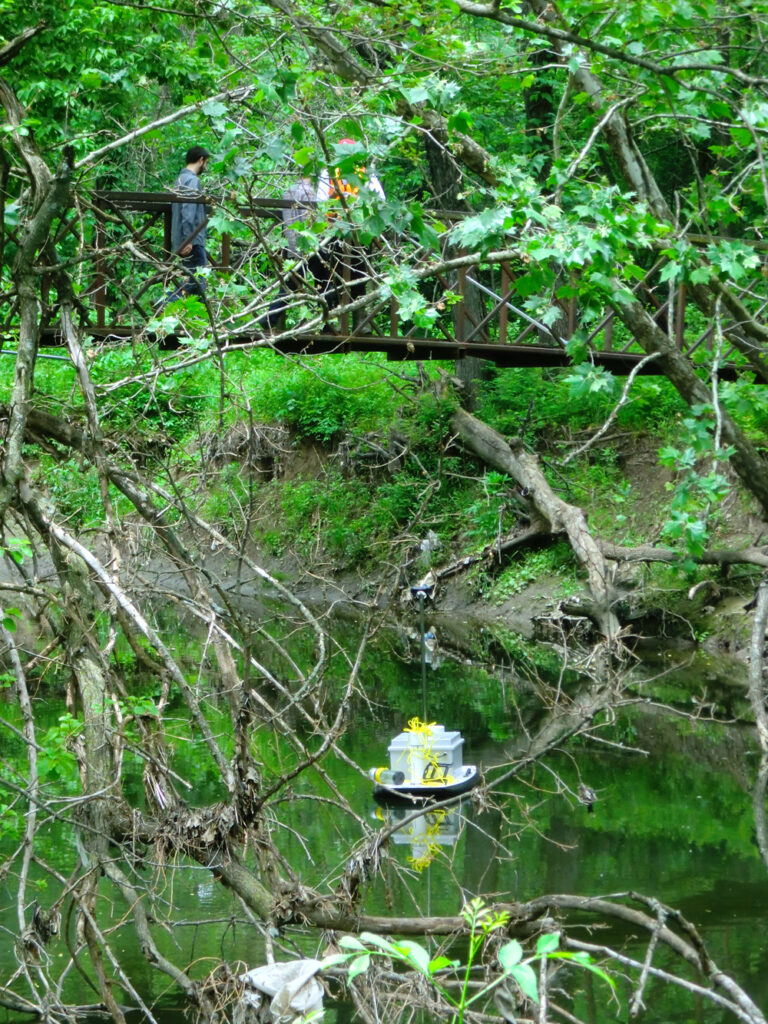
The custom floating sensor platform making its way down Indian Creek (Credit: Guy Foster/USGS)
On the day of the deployment, the crew had to learn quickly how to help the platform get around the stream features that disrupted its free free-floating path. For example, the craft needed a foot and half of depth, so when it came up on shallow riffles someone had to pick it up and move it downstream.
“And when we hit some of the longer, deeper pools, which didn’t have any velocity in them, we had to get out and push, so to speak,” Foster said.
It made for a physical day in which the crew covered 2.6 miles of stream over 8 hours. Foster said the data from the float mostly confirmed what they had already seen from the fixed stations, but it did reveal a few anomalies. For example, after a few miles of steady decreases in nitrogen levels, the nutrient jumped back up where the creek ran through a golf course and passed the confluence of a tributary that flows through a neighborhood.
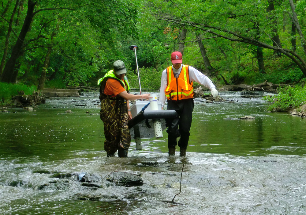
Carrying the platform over a riffle (Credit: Guy Foster/USGS)
Johnson County Wastewater was excited about the results and the methods, said Jennifer Graham, research hydrologist who worked on this and other Indian Creek projects. The agency plans another float for the platform on the creek in 2014, and is adapting the technique for use on some of the state’s larger reservoirs.
“This is an idea that we had and executed and got a favorable response, so we will be doing it again,” Graham said.
Image: The bodyboard sensor platform needed some help passing slow spots of Indian Creek (Credit: Guy Foster/USGS)


0 comments