Landsat 8 Images Pinpoint Cheatgrass Stands, Idaho Wildfire Risk
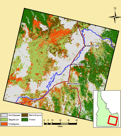
Landsat 8 imagery is helping scientists discover increasing wildfire susceptibility in Idaho. (Credit: Idaho State University)
Using Landsat 8 satellite imagery, scientists at Idaho State University have discovered increasing wildfire susceptibility in large portions of eastern Idaho, according to a release from the school. The cause for the increased risk, they say, is encroaching populations of cheatgrass on rangelands.
In making the find, scientists ran the satellite images through advanced artificial intelligence routines to create reliable classifications that helped them pinpoint cheatgrass infestations. It’s important to know where the stands are, researchers say, because they are involved with much of the wildfire activity that occur on the state’s rangelands.
The project was funded by the NASA DEVELOP project, which has a goal of taking the space agency’s technologies and finding ways to apply them to improve land management decisions. In keeping with that objective, researchers have plugged their findings into maps for Idaho land managers, as well as officials with the federal Bureau of Land Management.
Top image: Landsat 8 imagery is helping scientists discover increasing wildfire susceptibility in Idaho. (Credit: Idaho State University)


0 comments