Posts for tag "Landsat"
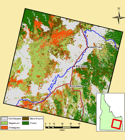
Landsat 8 Images Pinpoint Cheatgrass Stands, Idaho Wildfire Risk
Using Landsat 8 satellite imagery, scientists at Idaho State University have discovered increasing wildfire susceptibility in large portions of eastern Idaho, according to a release from the school. The cause for the increased risk, they say, is...
- Posted August 17, 2015

Modeling Ohio River chlorophyll using satellite imagery
Researchers at Marshall University use satellite imagery and grab samples to develop a model of the Ohio River’s chlorophyll levels.
- Posted June 2, 2015


