Monitoring Northern Idaho Watersheds Helps Keep Them Wild and Pristine
Northern Idaho is a land sparse with people, but bountiful with lakes, forests, and mountains. Up in the Northern Rocky Mountains, countless streams and rivers slice through the landscape, cascading from peaks to the tranquil valleys below.
This region of Idaho contains an immense amount of public land and wilderness, more than anywhere else in the state. With no major population centers, many watersheds remain relatively pristine, but others are impacted by human activities, including forestry, agriculture, and recreation.
The state of Idaho, federal agencies, and dedicated citizen groups work together to monitor and understand the characteristics of their nearly unspoiled home. Global environmental changes still find their way to places that have avoided major human impact; so Idaho is working to manage and monitor its breathtaking environments and protect them for future generations.
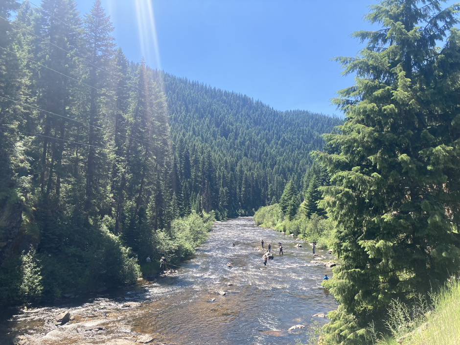
Idaho DEQ and USFS employees working together on late summer sediment monitoring in the main channel of the South Fork Clearwater River. (Credit: David McIntyre)
Why Do Northern Idaho Watersheds Need Protecting?
David McIntyre is a Water Quality Analyst in the Lewiston regional office of the Idaho Department of Environmental Quality (DEQ), which manages five counties stretching from the Payette National Forest to just south of the Saint Joe National Forest, in North Central Idaho.
Within these counties, McIntyre finds himself assessing streams in the Lower North Fork of the Clearwater River subbasin, a coldwater hydrologic subbasin that, despite the lack of large permanent populations, draws Idahoans to the region for outdoor recreation.
“There’s a lot of activity up there, and there’s a lot of people who use this area and downstream areas as well,” McIntyre says.
DEQ has been exploring the area for years, assessing streams for their water quality and determining if they’re viable for the main activities in the area: fishing and swimming. These activities go hand in hand with the other goal of the Idaho DEQ, which is to protect human health and the quality of Idaho’s air, land, and water.
“This is a very nice area, a beautiful place to be, and it is about protecting that,” McIntyre explains.
Protecting the watersheds in northern Idaho is especially important because, according to McIntyre, the streams in this area are quite sensitive. The snow-fed streams have historically been cold and clear, and even small changes in the temperature or external stressors can cause problems, both for the streams themselves and the cold-loving plants and animals that call them home.
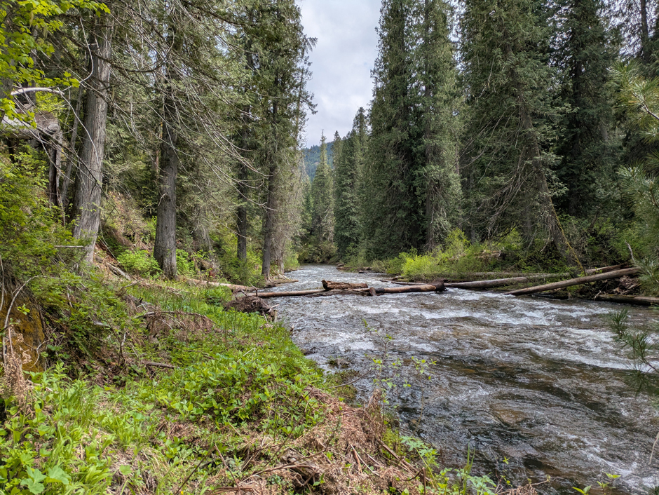
Stony Creek, a few hours hike downstream. (Credit: David McIntyre)
Monitoring the Water Quality of Northern Idaho’s Streams
In Idaho, streams with poor water quality are designated as assessment units and given total maximum daily loads (TMDL) for various water quality parameters, such as temperature, sediment, or nutrients. These limits are established using data from previous monitoring efforts and represent what healthy external loads for the streams would look like.
“I’ll work out what the appropriate amount of those substances that’s okay to be in there is, and that’s the total maximum daily load,” McIntyre says.
It’s also McIntyre’s job to monitor these streams after they’re designated and determine if they are still exceeding their TMDL. He currently has 41 streams that are exceeding their limits in this subbasin.
So, McIntyre’s field days consist of traveling around northern Idaho to these dozens of streams to take their water quality profiles. He says this often leads him deep into the wilderness, next to campsites and hikers, or surrounded by the wild landscapes where salmon swim upstream and bears may stop for a drink from the rushing current.
These remote locations are often at high altitudes where cold water proliferates, meaning the native plants and animals have evolved with the chilly environment. Therefore, one of the most important parameters McIntyre tracks in these streams is temperature.
With a HOBO Water Temp Pro v2 temperature logger in each impaired stream, he will spend time recording temperature at various depths and locations in the streams. The snowpack in this region often arrives late and departs early, so McIntyre typically has only several months to reach all the locations.
McIntyre collects flow measurements with an OTT MF pro Flow Meter to help calculate sediment load, along with measuring solar radiation and taking grab samples for sediment and bacteria. And when winter comes, he’ll spend his time hunkered down and dissecting the water quality data he’s been collecting.
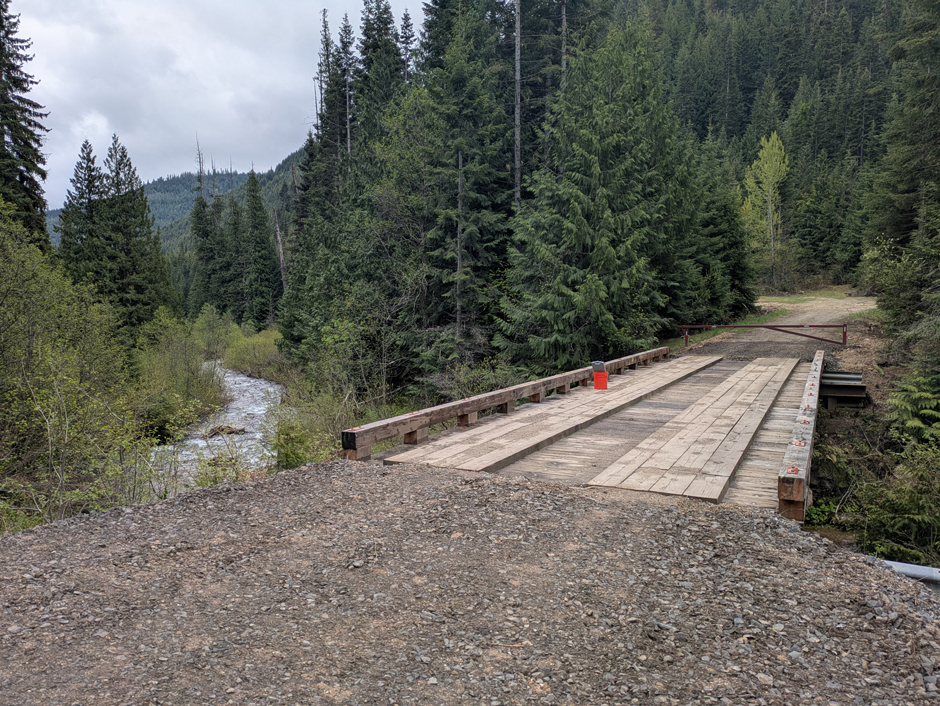
A bridge over Stony Creek provides access and an anchor point for the deployment of a temperature logger. (Credit: David McIntyre)
Application of Data
Streams that continue to exceed their TMDL become the target of state or local management and restoration projects. So, one of the most important applications of McIntyre’s water quality data is determining which streams still exceed their load limits.
“If we have achieved [reaching below] those TMDLs, then we will delist them from the impaired list of waterways,” McIntyre explains.
However, simply noting when water quality parameters cross a maximum threshold is not his only job. McIntyre also looks for patterns in the data to parse out why streams are suffering from bad water quality.
“I’m really looking at some critical periods where the temperature has the potential to rise above the threshold limits that we set,” he says.
For example, in some of northern Idaho’s streams, cold-loving salmon travel hundreds of miles from the Pacific Ocean to reach their spawning grounds. Conserving these native species is a priority for stakeholders across the state, and McIntyre’s data can show which salmon spawning streams are impaired and if the timing of threshold exceedance lines up with the spawning season.
And, by determining what triggers high temperatures, whether it be the time of year, lack of riparian vegetation, or something else, the various decision-making organizations that rely on the Idaho DEQ’s data are well-equipped to tackle conservation and restoration projects.
“The DEQ is primarily a data collection agency,” McIntyre says. “[Others] manage land, we just come in and we collect this data and we create these documents.”
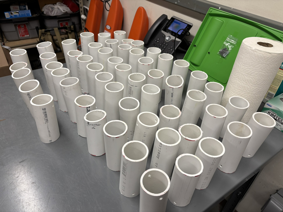
PVC casings prepared for the deployment of temperature loggers (for two subbasins, Lower North Fork Clearwater, and Upper Clearwater Tributaries). (Credit: David McIntyre)
Partnering With Local, State, and Federal Organizations
Across the state, McIntyre says that the watersheds where streams exceed their TMDLs are given “Watershed Implementation Plans,” which outline both the problems in the watershed and the proposed solutions. The Idaho DEQ plays a crucial role in these plans, providing the base data that guides management.
“Those Watershed Implementation Plans will point to my study and say, ‘the DEQ says we need to reduce these things by this amount in these areas,’” McIntyre says.
Several organizations help to create and implement these plans, including the Idaho Department of Fish and Game, the US Army Corps of Engineers, local watershed advisory groups, and indigenous tribes such as the Nez Perce.
Idaho is further broken up into soil and water conservation districts by the state, but it’s often the organization that owns land in a district that implements the plans.
McIntyre says that collaborating with other organizations gives them several advantages. The first being that, with their different expertise, they can actually go to these streams and help the DEQ implement restoration projects.
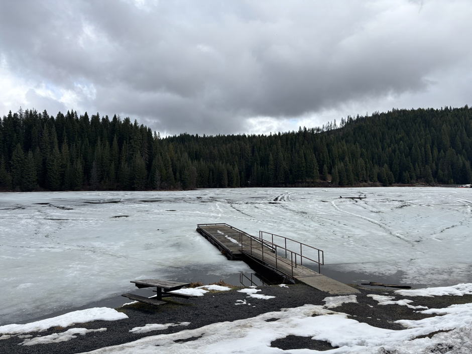
Elk Creek Reservoir still partially frozen. This is a popular waterbody at the township of Elk River, part of the Elk Creek watershed that flows into Dworshak Reservoir. (Credit: David McIntyre)
One of the strategies to reduce temperatures in streams is to increase shade through riparian vegetation. McIntyre explains that this relates to ongoing monitoring efforts that focus on estimating a streamside’s “potential natural vegetation.”
“We look at how much shade is coming in, basically, and we can see what the ecology would have been and how much shade there should be,” McIntyre says.
Plenty of land in the subbasin is owned by the State or Federal Government, or by private landowners who can then use his data to target specific streams that need additional riparian vegetation planted.
“So for something like riparian vegetation, it might be that they want to do restoration projects in targeted areas where they get the best benefit,” he says.
And, although temperature is extremely important, other pollutants can also reduce water quality in these streams. Other parameters that he measures, and that the DEQ’s partners can tackle, include sediment and bacteria.
“For sediment, they might repair culverts on those forest roads, or even restoring vegetation can help with that,” McIntyre explains. “For E. coli, they might encourage local livestock producers to fence their cattle away from the streams.”
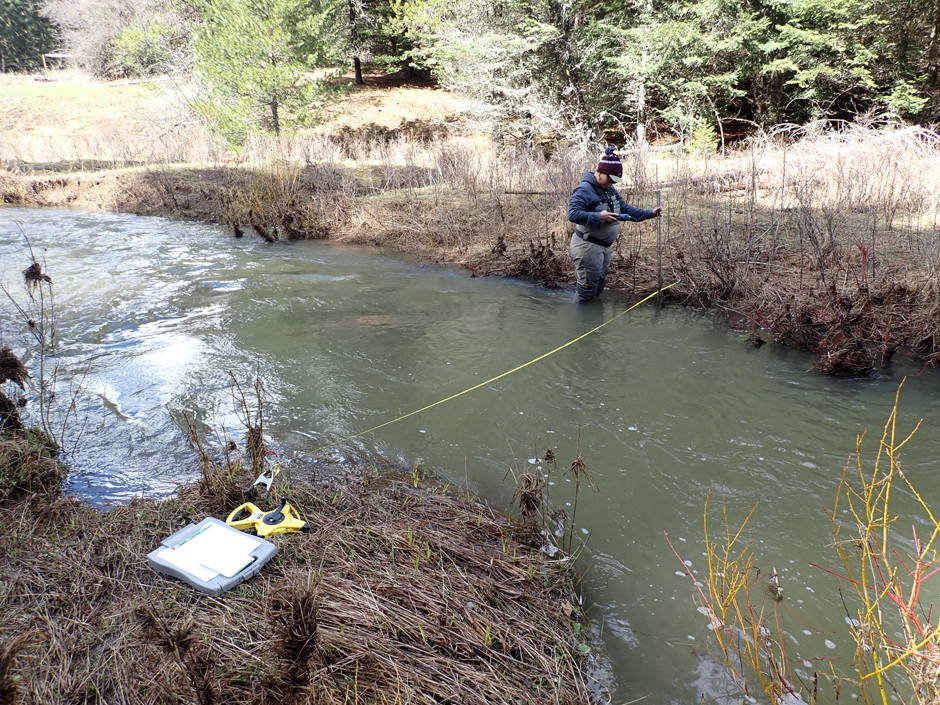
Sara Anzalone of the Idaho DEQ collecting flow measurements in an upper Clearwater River tributary. (Credit: Jenna Fortier)
Transparency and Collaboration Lead to Healthier Watersheds
In a region as remote as northern Idaho, McIntyre appreciates the honesty and collaboration that come with partnership. He’s the only analyst on this project, and explains that “boots on the ground” observations and data collection often find their way into his reports, and eventually into implementation plans.
The watershed advisory groups are the primary method to engage with the public regarding watershed conditions, and McIntyre himself helps facilitate one, the Lower North Fork Clearwater River Watershed Advisory Group. He explains that when locals and non-scientists get a chance to protect their home, they take it and run.
They also become more understanding of the work that agencies such as the Idaho DEQ do—with a state as self-reliant as the “Gem State,” transparency is vital.
“There are a lot of these people who are in our watershed group, and they represent interests that are explicitly active in that watershed,” McIntyre says. “And we value that representation too. We look for the people who are on the ground or who are seeing what’s on the ground.”
He continues, “But just the local knowledge alone, to us is extraordinarily valuable.”
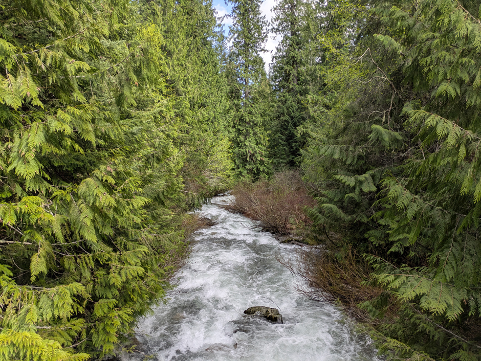
A high elevation stretch of Floodwater Creek showing high Spring flow. (Credit: David McIntyre)


0 comments