SCOOP sensor packages a ‘game changer’ for National Data Buoy Center
A National Data Buoy Center weather buoy near Grays Reef, Georgia (Credit: NOAA)
A federal program that operates more than a hundred weather buoys across oceans and the Great Lakes is adapting to the rising price of ocean observations by slimming down and simplifying its sensor payloads.
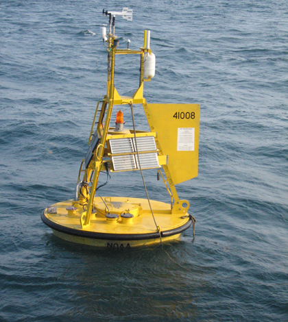
Based in southern Mississippi, the National Data Buoy Center is a part of the National Weather Service under the National Oceanic and Atmospheric Administration. The center operates 111 meteorological buoys along the U.S. East and West coasts and within the Gulf of Mexico and Gulf of Alaska.
The buoys report wind speed and direction, temperature, barometric pressure, and wave measurements. They’re also large and carry complex sensor systems that can be difficult and expensive to maintain. A big part of the cost revolves around the large ships needed to access the hulking buoys.
“A very significant driver is that over the years, ship time has become more and more expensive and more and more difficult to obtain,” said Helmut Portmann, director of the National Data Buoy Center. “Every organization in the U.S. and worldwide that I’m aware of that maintains observing systems out in the ocean has that problem.”
So the center’s engineers sought a solution that would eliminate the need for large ships by shrinking sensor packages down to a size that one person can lift. They also wanted to seal the electronics against the harsh sea environment to increase reliability and cut down on maintenance time. The result is the Self-Contained Ocean Observations Payload, or SCOOP. It’s a small sensor and wireless communications package that will be easier to handle and less expensive and time-intensive to produce than current NDBC buoys.
“We call it a game-changer in how we do business,” Portmann said.

A mockup of the SCOOP package (Credit: NOAA)
That’s because the NDBC has traditionally relied on large buoys that weigh thousands of pounds, take hundreds of hours to build, and require 6 to 8 hours of service time for each ship visit in the field. Those visits also mean opening the buoy’s hatches and exposing electronics to the sea environment.
The SCOOP units, on the other hand, take around 40 hours to construct and will leave the NDBC facility already calibrated and sealed against the elements. They aren’t intended to be serviced on-site. If one breaks, a crew can visit the buoy — which is specially designed to accept SCOOP packages — in a small ship or boat and simply replace it with a new one.
The SCOOP platform is an evolution of earlier developments from the NDBC,
including an anti-vandalism effort called BuoyCAM. The center has a significant issue with buoy damage caused by fisherman — intentional or otherwise — as they pursue fish that are attracted to the buoys. To combat the vandalism, the center’s engineers developed a stand-alone module that contains a camera and wireless communications system that, when placed on a buoy, captures and transmits a 300-degree panoramic photo every hour.

A buoy from the NDBC’s DART tsunami monitoring network outfitted with a first generation SCOOP meteorological station (Credit: NOAA)
“We’ve actually caught vessels messing with our buoys by doing this,” Portmann said. “We’re working with the Weather Service’s international affairs office to figure out how to approach the companies that operate those ships to basically educate the people not to damage the buoys.”
One of the benefits of the BuoyCAM system is the unit has its own batteries and communications system, which means it doesn’t have to be integrated into the electronics of the buoys they’re monitoring. Keeping those benefits in mind, the engineers applied the same concept to a meteorological station that the NDBC is testing in the Gulf of Alaska on one of the buoys in its DART tsunami monitoring network.
The camera and meteorological stations are essentially first-generations of the SCOOP system, Portmann said. They’re using data from those to understand how well they work and how long they last, and will use what they learn to develop similar packages for wave measurements and other parameters.
Portmann said the center will develop SCOOP through 2014 to be ready for a 2015 rollout across a 15-buoy hurricane monitoring network. They’ll expand to the rest of the 111 weather buoys over time.


0 comments