Sedimentation Research Helps Determine Effects of Seabed Mining
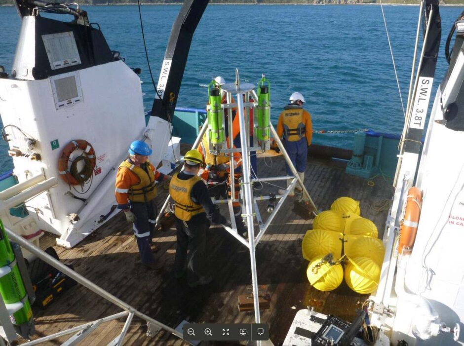
Benthic lander fitted with high definition cameras, lights and instruments to record physical, chemical and biological activity. (Credit: NIWA, https://www.niwa.co.nz/news/niwa-undertakes-an-ambitious-complex-seabed-experiment)
Scientists from New Zealand’s National Institute of Water and Atmospheric Research, NIWA, are engaging in sedimentation research to help determine the effects of seabed mining and fishing on the environment. This work represents some of the most challenging underwater research ever undertaken by the NIWA team.
The need for the work arises from the controversy surrounding proposed seabed ventures—each of which was met with serious opposition based on presumed environmental effects such as drifting sediment plumes. In an effort to determine the full environmental impacts of such seabed activities, the NIWA team has undertaken an unusual project deploying high-tech instruments on the ocean floor.
NIWA principal scientist and voyage leader Dr. Malcolm Clark filled EM in as to the details of the ambitious research project.
“The program developed from a previous research project funded by the government [the Ministry of Business Innovation and Employment or MBIE] where we looked at potential environmental impacts of deep-sea mining, and what might be required to assess and manage them effectively,” explains Dr. Clark. “It was clear doing this work, as well as through international connections, that a major gap in our understanding of mining impacts in the deep-sea (as well as fisheries and other human activities that contact the seabed) was the effects that higher sediment loads in the water column could have on benthic animals. Hence the proposal in 2016 to look at this aspect which is the focus of the current program.”
The team is filling in this gap in information by deploying a complex network of instruments, all at 500 meters, designed to cover three main survey areas: a multi-corer to take sediment samples, an underwater glider, seabed moorings, three undersea observational platforms called “benthic landers,” an underwater camera to be towed above the seafloor, water column sampling equipment, and a “benthic disturber”.
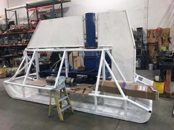
Benthic disturber used on the TAN1805 Sedimentation Impacts voyage during May – June 2018. (Credit: NIWA, https://www.niwa.co.nz/news/niwa-undertakes-an-ambitious-complex-seabed-experiment)
“There are three key components to the survey, and each gear type has a role to play,” details Dr. Clark. First, seabed disturbance. This is what the Benthic Disturber is designed for, to create a plume above the seafloor – it picks up sediment and pumps it out a chimney, giving some height and control to the plume that is generated.”
The plume naturally disperses with the current. For tracking the midwater plume, the second key component of the research, the team will use ship-mounted acoustic echosounders, an acoustic Doppler current profiler (which indicates current direction), the towfish and glider (with turbidity sensors) and the CTD, again with a range of sensors.
Finally, the team will explore seabed sampling, the third component of the survey.
“As the plume is expected to settle, we have benthic landers and moorings deployed which will measure environmental conditions, photograph the seafloor, and collect sediment,” Dr. Clark describes. “A multicorer takes several tubes of sediment around 30cm long, which enables us to measure the parameters of the sediment, as well as the animals living under the surface. A towed camera system images the seabed, and the animals living above and on the seafloor.”
Measuring the conditions before and after disturbance will enable the team to detect the plume’s effects, both immediate and longer-term, and provide information on the effects of both bottom-trawl fishing and mining.
“The depth of 500 meters is one that is relevant to both potential seabed mining, and to commercial fisheries, for example, for hoki,” comments Dr. Clark. “So the results will be useful to a range of managers.”
Deploying that much equipment at one time under these conditions is very complex, but the team, in this case, is up to that challenge.
“The research team for the voyage is experienced and multidisciplinary,” remarks Dr. Clark. “Many of us have worked together before. Hence coordination is a challenge, especially as it will be a flexible and adaptable program once we get out there—but everyone knows that, and is aware that integration is a top priority in planning activities and events.”
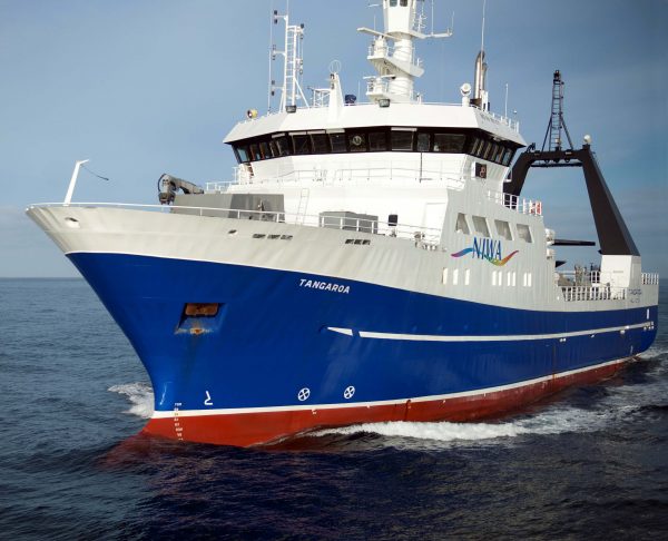
NIWA research vessel, the Tangaroa. (Credit: By Dave Allen, National Institute of Water and Atmospheric Research [CC BY 3.0 (https://creativecommons.org/licenses/by/3.0)], via Wikimedia Commons)
“Effects on the seabed animals will be measured by photographs, which show the animals in their natural habitat, and we hope to measure changes as sediment might settle on or around them (such as color),” explains Dr. Clark. “Laboratory experiments later on at NIWA will measure a number of ‘health’ factors such as feeding rates, respiration rates, weight, size, et cetera.”
Together, the laboratory and field studies should offer powerful insights into the effects of seabed disturbance from human activities. The work will continue through 2020.
“The first survey is for 30 days in 2018, there will be another voyage in 2019 to repeat the monitoring stations and a final time in 2020,” remarks Dr. Clark. “This gives an immediate post-disturbance picture, and then a longer-term view to see what might recover.”
This kind of careful study and focused deployment of technologies will offer practical information for decision makers hoping to base policy on evidence.
“The research program is not about whether mining should occur or not,” adds Dr. Clark. “Our job is to provide objective and independent information that managers and industry themselves can use to assess environmental effects, and measures to avoid or mitigate impacts.”
Top image: Benthic lander fitted with high definition cameras, lights and instruments to record physical, chemical and biological activity. (Credit: NIWA, https://www.niwa.co.nz/news/niwa-undertakes-an-ambitious-complex-seabed-experiment)


0 comments