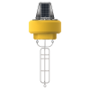
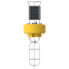
Sea-Bird Scientific HydroCAT CTD
Features
- Anti-foulant device and pumped internal flow path for maximum bio-fouling protection
- High initial accuracy with factory-calibration and low drift rate
- Common deployment duration of three plus months, reducing field costs
- Expedited repair and warranty service
- Lifetime technical support
- More
Overview
The Sea-Bird Scientific HydroCAT CTD is ideally suited for extended deployments in remote, biologically rich environments. Field-proven sensors measure and record conductivity, temperature, pressure and optical dissolved oxygen, ensuring long-term data stability. Depending on the application, the HydroCAT can collect high-quality data for several months up to a year.
Stable and Durable
Excellent bio-fouling protection is provided by EPA-approved anti-foulant devices, an integral pump, and a unique internal flow path, which minimizes flow between samples and provides stable measurements throughout a deployment.
Field-Proven
The aged and pressure–protected thermistor has a long history of exceptional stability and accuracy. The oxygen sensor was designed by SBE to meet the demand for a low maintenance and high accuracy sensor for use in applications such as hypoxia monitoring. All HydroCAT sensors are built with careful choices of materials and geometry combined with superior electronics and calibration methodology to optimize field performance.
In The News
Wave-Powered Buoy Deployed in Puget Sound
While the development of solar-powered monitoring systems has improved access to real-time environmental data, solar power is still limited by low light conditions, such as poor weather, nighttime, or high-latitude environments. To supplement these incumbent power solutions at sea, Ocean Motion Technologies has developed a small-scale ocean wave energy system that can be directly integrated with existing data buoy platforms. Not only does wave energy supplement solar power during periods when the buoys are limited by light availability, but it also allows data buoys to perform beyond their current power capacities.
Read MoreScience for Science’s Sake: Monitoring Ocean Energy Availability and Gulf Stream Dynamics
Scientific research often begins with a question, sometimes driven by a specific goal or application, but many scientists believe in science for science’s sake. Marine environments and physical dynamics like the Gulf Stream are popular fields of research due to their complexity and importance, presenting a unique opportunity to learn more about previously unexplored phenomena. Environmental researchers, in particular, see the value in these ecosystems, but many also grew up with a passion for the natural world, and choosing a field that allows them to interact with and learn about the environment around us is an easy choice.
Read MoreSustainable Data Collection: Climate Monitoring in the Caribbean
Environmental monitoring in the Caribbean may be essential, but it has also historically been placed on the back burner. Albert Jones, Instrumentation Officer for the Caribbean Community Climate Change Centre (CCCCC), explains, “Data collection itself is not what is considered one of those sexy activities where you can easily get funding.” Still, monitoring the water surrounding island nations is necessary to protect residents and the environment. The CCCCC works to establish environmental monitoring networks and systems in the Caribbean. One aspect of Jones’ work centers around data buoy instrumentation and deployment,—equipment that will be used to support Ecoforecasts for Coral Health Monitoring and to provide valuable environmental data to the public.
Read More


