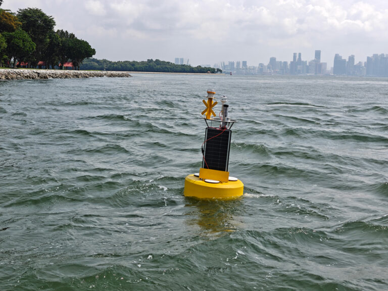
SeaView Systems SVS-603HR Wave Sensor
The SVS-603HR Wave Sensor is an augmented version of the highly accurate SVS-603 wave sensor that reports heading, wave height, wave period and wave direction via RS-232 or logs to its on-board data logger.
Your Price Call
Stock Check Availability
Fondriest Exclusives
- Expedited repair and warranty service
- Lifetime technical support
- More
Key Features
- Plug-and-play interface with the full line of NexSens XB-Series & CB-Series data buoys
- Sophisticated onboard electronics provide near-real-time wave statistics
- On-board data logger capable of logging as much as twenty years of wave data
The SeaView Systems SVS-603HR represents a new generation in accuracy and completeness for wave sensing electronics whose features include:
- Low power consumption; fits the smallest power budget
- Small environmental footprint; sold packaged or as bare PCB
- Sensors account for 3-D motion, rotation and compass heading in all dimensions to cover nine degrees of freedom
- Onboard electronics provide near-real-time wave statistics
- Variable sample set size (256, 512, 1024, 2048 or 4096)
- On-board temperature compensation
- On-board data logger capable of logging as much as twenty years of wave data, depending on desired outputs
- Easy configuration to match exact sensing rate and output requirements
- Readily interfaced with transmitter using NMEA or other configurable data output
- Sampling rates from 1 to 8Hz (user configurable)
The SVS-603HR can be used to replace existing sensors, to upgrade existing buoys, or to add wave sensing capabilities to even the most compact buoys. Among the wave data that are available as outputs from the sensor are:
- Significant wave height in meters (Hs)
- Wave period in seconds
- Wave direction in degrees from north
- North, east and up displacement time series
- First-5 Fourier wave coefficients
- Maximum wave height (Hmax)
- Wave period at Hmax
- Wave energy
- Spectrum (raw or processed)
- Heading in degrees
- Custom outputs as required
Other outputs or data manipulations can be incorporated via firmware updates or through calculations on the available data stream.
Questions & Answers
Select Options
Products
0 Item Selected
Image
Part #
Product Description
Price
Stock
Select

SVS-603HR
SVS-603HR inertial wave height, period & direction sensor, board only
Request Proposal
Check Availability
Request Proposal

SVS-603XB-UW
SVS-603HR inertial wave height, period & direction sensor with XB-Series buoy waterproof housing & UW plug connector, 1m cable
Request Proposal
Check Availability
Request Proposal

SVS-603HR-UW
SVS-603HR inertial wave height, period & direction sensor with CB-Series buoy waterproof housing & UW plug connector, 3m cable
Request Proposal
Check Availability
Request Proposal
Accessories
0 Item Selected


Notice: At least 1 product is not available to purchase online
Related Products


Customer Stories