Spectrum WatchDog 3250 Wireless ET Stations
Features
- Integrated solar power system for reliable power
- Optional Wi-Fi or cellular modem for wireless communications
- Integrated data logger holds 18 months of data at a 15-minute recording interval
- Free ground shipping
- Expedited repair and warranty service
- Lifetime technical support
- More
Overview
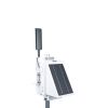
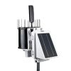
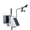
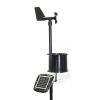
The fully integrated WatchDog 3250 Wireless ET Station measures temperature, humidity, rainfall, and wind speed & direction, recording and communicating the data to the cloud using its internal modem or radio. With these sensors, evapotranspiration (ET) can be computed by SpecConnect, and users can know how much water is leaving the fields.
Benefits
- Integrated Solar Power system for reliable power
- Integrated Modem/Radio for reliable communications: available with a choice of cellular modems or other radios.
- Integrated Data Logger protects your data. Holds over 18 months of data at a 15-minute recording interval. Data can be transferred to a USB flash drive.
- Easy to install - be running in minutes. Mounts to a 1.25 inch mast. U-bolts included.
- Bluetooth connectivity to your Apple or Android smartphone running the free WatchDog Mobile App speeds setup and displays current conditions.
- Sends data to the SpecConnect Cloud Solution - View current conditions or historical data using a broad selection of analytical reports from anywhere in the world.
- Receive alerts via automated phone call, text message, and/or email immediately when temperature crosses your selected threshold - no waiting for the next scheduled upload.
- Customizable with plug-in sensors to meet your needs
- Receive the latest changes with over-the-air updates (also available via a USB flash drive).
- Durable enclosure provides moisture, corrosion, and UV protection for increased reliability in harsh environments.
- Designed and manufactured in the USA to provide the quality data you can rely on.
- External Communication: Cellular, USB, Bluetooth, RS232
- External Sensor Ports: 1 x 2.5mm stereo jack (0 to 3.0VDC analog input)
- Data Capacity: 30,000 data intervals can be stored on the unit before the oldest record is overwritten by the newest data (312 days at 15 minute intervals).
- Dimensions (HxLxW): 12 x 19.5 x 11.25 in (30.5 x 49.5 x 28.6 cm). (Without 7.25 in (18.4 cm) antenna)
- Weight: 9.9 lbs. (4.5 kg)
- Power Source: 3.5W solar panel, Rechargeable 6V/4.5AH SLA battery, optional AC/DC power adapter.
- Battery Life: 14 days minimum with no solar power.
- LED: 3-color (Red, Amber, Green)
- Operating Temperature Range: -22° to 130°F (-30° to 55°C)
In The News
Three Decades of Research at Acton Lake
A multi-disciplinary team at Miami University, Ohio, has been studying the environmental change at Acton Lake for over three decades. Using three different NexSens buoys over this time, the team has an incredible archive of data that is helping build a picture of Acton’s past, present, and future. Until recently, a NexSens CB-50 buoy was used alongside other environmental monitoring at Acton Lake. In May 2025, the Miami team deployed a new XB-200 buoy , future-proofing their ongoing monitoring using real-time buoy systems. Acton Lake, a small hypereutrophic reservoir in southwest Ohio, covers 2.4km² and has a maximum depth of about 8m. The dam was built in 1956, and the lake has a large agricultural watershed.
Read MoreSource Water Monitoring in Albany, New York: Tracing Water Quality throughout Tributaries
Thousands of US cities pull their drinking water from natural source waters like reservoirs, rivers, and streams, making overall watershed health a key consideration for water providers. In Albany, New York, the Albany Department of Water and Water Supply delivers drinking water to over 100,000 residents as well as monitors and manages the larger drinking water supply watershed. Hannah Doherty, Environmental Specialist at the Albany Department of Water and Water Supply , spends her days working with a small team to monitor the drinking supply and the connected water bodies. Doherty explains, “We’re the first to encounter the water that ends up being the drinking water.
Read MoreWildfire Prevention in the Sierra Nevada Region with the Yuba Watershed Institute
Though recent wildfires have sparked new conversations about wildfire management and response, groups like the Yuba Watershed Institute have been monitoring the forests and water resources of the Sierra Nevada region for decades, managing approximately 5,000 acres of land with the Bureau of Land Management (BLM) and about 7,000 acres in private land partnerships. The goal of the Institute is to work with local communities and land agencies to improve watershed and forestry management through informed practices and public outreach. The goals of the Yuba Watershed Institute are three-fold: Improve the ability of fire suppression agencies like the California Department of Forestry and Fire Protection ( CAL FIRE ) and the US Forest Service.
Read More


