Data-Backed Water Management Protects the St. Johns River Watershed
The St. Johns River flows for 300 miles through eastern Florida, beginning in the marshy lowlands south of Melbourne and gradually heading north before emptying into the Atlantic Ocean east of Jacksonville. It has an expansive watershed and is an important natural resource for millions of Floridians.
Overseeing this river and its connected waterbodies is the St. Johns River Water Management District, a state environmental agency committed to protecting the watershed. It’s one of five water management districts in the state, but it manages the state’s longest and arguably most important river.
The watershed contains a variety of ecosystems, and managing it is a balancing act, according to the Director of the Division of Water Resources, Erich Marzolf. But it’s an important balancing act for the nearly 6 million residents in the management district, and the millions of tourists that visit each year.
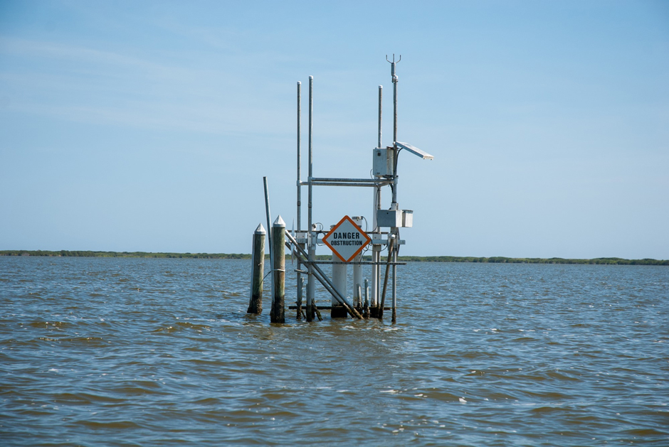
A water quality monitoring site in the Indian River Lagoon. (Credit: St. Johns River Water Management District)
Monitoring in the St. Johns River Water Management District
The District commits significant time and resources to monitoring its region, which includes 18 counties stretching down the Atlantic Coast. Marzolf, who started work there in 1994, has seen this work firsthand over the decades.
“We have a large ambient water monitoring network, and we start with the water cycle you learned in grade school,” Marzolf says.
He explains that they monitor everything from rain showers to surface runoff, and aquifer recharge to freshwater discharge into the Atlantic. The District uses these data to undertake a variety of projects, from ecosystem restoration to canal engineering, hoping to improve the watershed’s aquatic resources.
The District’s broad goals can be broken down into core missions. “We have four core missions: water supply, water quality, flood protection, and natural systems,” says Marzolf.
To protect the water supply, the District monitors groundwater levels. It also ensures that natural water sources like springs and aquifers remain open, and monitors water levels to track recharge.
The District’s flood protection work, meanwhile, incorporates many disciplines. Marzolf explains that, as a regulatory agency, they provide stormwater permits for construction projects.
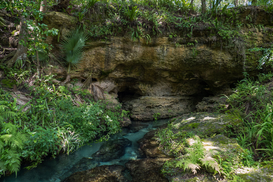
Rock Spring, which is an Outstanding Florida Spring within the St. Johns River Water Management District. (Credit: St. Johns River Water Management District)
They also work with the US Army Corps of Engineers to maintain flood canals and pursue ecological restoration of the St. John River’s vast floodplain wetlands to enhance natural flood protection.
The latter also incorporates their natural systems’ work, as the management District has an interest in nearly 800,000 acres of land. Marzolf explains that they’ll buy and restore degraded land or partner with private landowners to enhance ecosystem services that benefit their core missions.
Touching on all of these missions is the District’s water quality work, where some of its most intensive monitoring occurs.
“We have a very large water quality network, it’s about 410 stations that we adjust as needed, a combination of ambient sites, as well as some sites that are there to monitor projects,” Marzolf explains.
These surface water sites require a team of scientists to visit them for monthly or biweekly samples, using YSI EXO2 sondes to measure important water quality parameters. Marzolf says the District also monitors the water quality of the Floridan aquifer.
“We have a large network of monitoring wells to help us assess the water levels and water quality in the aquifers, and those are really important for us, because the vast majority of the public in our district gets their potable water from groundwater,” Marzolf says.
He explains that these are often remote subsurface sites, continuously uploading data using pressure transducers, data loggers, powered by solar energy.
All of the monitoring data is made public, helping Floridians and their lawmakers understand how to use the state’s resources. Moreover, along with baseline monitoring, Marzolf says tracking the District’s water quality is key to completing successful restoration projects.
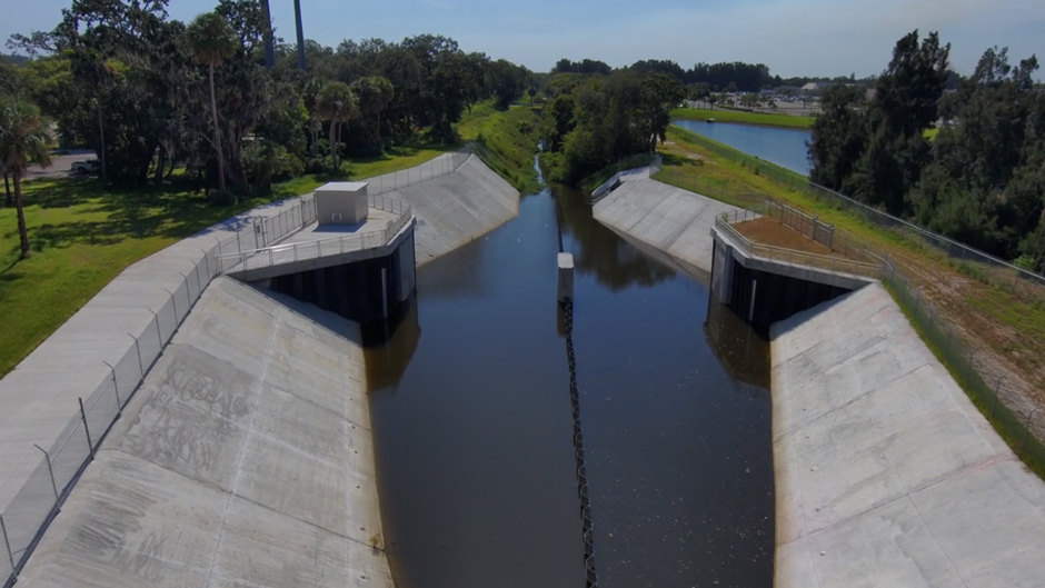
The M-1 Canal and operable weir (submerged in the photo), which prevents water from flowing into the Indian River Lagoon. (Credit: St. Johns River Water Management District)
Ecosystem Restoration and Water Management Projects
When the St. Johns River Water Management District is tasked with restoring a nutrient-impaired lake, river, or estuary, Marzolf says they approach it with a “diet, exercise, and physical therapy” mindset. Understanding the waterbody’s water quality is key to this.
One of their first restoration projects began decades ago in Lake Apopka, which feeds into a St. Johns River tributary just north of Orlando.
In the mid-1900s, the fourth-largest lake in the state was a major tourist attraction. However, intensive agriculture on isolated and drained floodplain wetlands on its north shore caused an influx of phosphorus, leading to algal blooms. These blooms shaded the submerged vegetation that was critical habitat, sustaining the lake’s world-class fishing and hunting.
In response, and with direction from the state legislature, the District bought nearly 20,000 acres of farms on the north shore. Returning this area to wetlands dramatically reduced the phosphorus loading to the lake, a key to the “diet”.
On a portion of the former farms, the District constructed a recirculating filter wetland that continuously removes algae and sediments from the lake’s water. This “exercise” project filters about 30% of the lake’s volume annually, removing legacy phosphorus from the lake.
A second “diet” project involves the District working with state agencies to harvest native rough fish from the lake, thereby removing thousands of pounds of phosphorus annually.
The water quality monitoring has shown substantial improvements, such that Marzolf says the lake is ready for “physical therapy” projects that include replanting native aquatic vegetation and sport fish stocking.

A sunset over the St. Johns River near Palatka. (Credit: St. Johns River Water Management District)
“That combination of putting the lake on a phosphorus diet, implementing ‘exercise’ projects to remove legacy phosphorus, and knowing when to implement ‘physical therapy’ projects has resulted in a dramatic improvement in water quality and habitat,” Marzolf says.
He thinks that the District’s holistic approach to watershed management–buying land, restoring ecosystems, and monitoring water quality–is key to success stories like Lake Apopka. Now, Marzolf says fishing tournaments have returned to Apopka, and lakes downstream also have improved water quality.
Moreover, although the management district covers vast inland water resources, they also manage estuarine areas.
One of these is the Indian River Lagoon, just east of the St. Johns River near Melbourne. For decades, man-made canals have been channeling freshwater runoff from thousands of developed acres into the biodiverse estuary, impairing its water quality and salinity.
So, the district worked with state and local partners to install an operable weir and pumps in the M-1 Canal. Marzolf says this allows them to capture runoff and pump it into a stormwater area, before routing the water west to the St. Johns River through District-owned marshland.
The district estimates annual nitrogen and phosphorus loads to the lagoon will be reduced by 24,000 lbs. and 3,100 lbs., respectively, while returning about seven million gallons per day of freshwater to the St. Johns River, a “win-win” for both ecosystems.
The project was completed in August 2025, and now the District is conducting water quality monitoring to document the project’s efficacy.
“In the Indian River Lagoon, we have a network of seven continuous water quality sites,” Marzolf explains. “So we have towers built out in the lagoon where we’ve got sondes that are providing continuous water quality data on multiple parts of the complex lagoon.”
The towers are equipped with YSI EXO2 sondes measuring multiple parameters, including chlorophyll and turbidity concentrations.
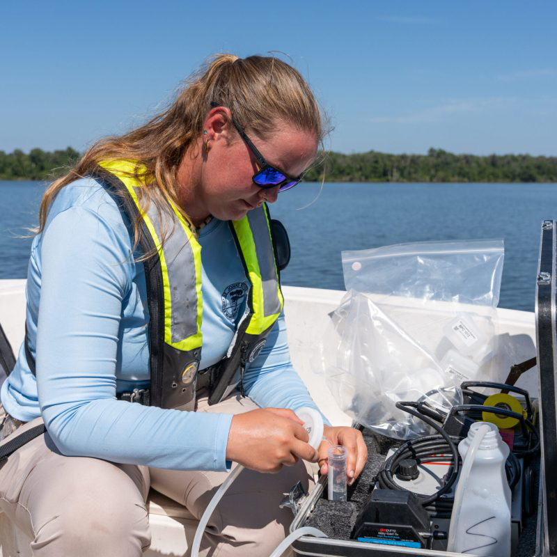
A District scientist conducts water quality sampling. (Credit: St. Johns River Water Management District)
The Importance of Water Management and Data Collection
Marzolf says that the management district’s decisions are made with Northeast Florida’s communities in mind, both natural and human. The data that the District collects is most useful when it helps the public make decisions or is transformed into unique conservation solutions.
The District’s public outreach and free data bolsters collaboration. Marzolf says outside agencies like the National Weather Service will use it for flood prediction, and data from the Indian River Lagoon are used to develop new combined hydrodynamic and water quality models for the estuary.
Ultimately, Marzolf thinks the District’s core missions, widespread resources, and decades of water monitoring give it the confidence to tackle the unique challenges that arise over such a diverse landscape.
“We’re always continuously adapting how we manage to best meet the people’s and the resource’s needs,” he says.
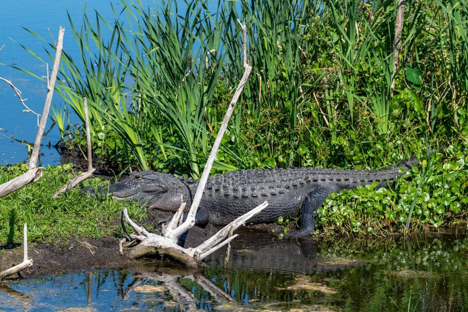
An alligator along the restored wetlands on the north shore of Lake Apopka. (Credit: St. Johns River Water Management District)


0 comments