Developing New Data-Informed Management of the Mississippi Embayment in Memphis
The Center for Applied Earth Science and Engineering Research (CAESER) at the University of Memphis oversees dozens of projects regarding the environment each year, helping to improve resource management in the region. Rodrigo Villalpando-Vizcaino, a Research Assistant Professor at the university, spends his time at the center monitoring groundwater resources.
He explains, “I’m an interesting combination of project management, engineering, and geology, and just trying to bridge the gap between fields with a focus on anything related to water—mostly groundwater.”
Rodrigo Villalpando-Vizcaino, student Jefferson Minton (center), and staff member Saddam Hossain (right). Describing and sampling sediment samples extracted with sonic drilling. (Credit: CAESER)
Updating Management Strategies in Memphis
Tennessee, specifically Memphis’ reliance on the Mississippi embayment, provides unique research opportunities to scientists like Villalpando-Vizcaino. Various studies ranging from computer modeling to age dating and water quality have been conducted over the years, helping improve the understanding of the multi-layered aquifer system and water resources in general.
This part of Villalpando-Vizcaino’s work is of particular importance since Memphis is entirely reliant on groundwater for drinking water and utility use. In an ever-growing city, informed resource management is critical to long-term and sustainable use of these resources.
For a large part of the city’s history, there was a belief that the protective clay layer that sits on top of the aquifer, the upper Claiborne confining unit, kept lesser quality waters from migrating down into deeper groundwater systems.

Rodrigo Villalpando-Vizcaino obtaining survey-grade elevations of groundwater monitoring wells for water levels and pressure transducers. (Credit: CAESER)
“But over time, we found out that this protective clay layer is not as extensive or, as sealed, as we thought, and we’re starting to see water quality changes impacting our groundwater,” explains Villalpando-Vizcaino.
Concerns about water quality and drinking water reliance are also surrounded by the burden of development and new businesses building factories in the region, such as Google, xAI and Ford Motors.
As an example of a proactive approach, Villalpando-Vizcaino works with the state’s Megasite Authority to help monitor an area in the region’s recharge zone for the Memphis aquifer, helping understand water quality, chemistry, and groundwater levels.
He is also involved in other projects in the region, from aquitard breaches in Memphis and recharge processes in West Tennessee, to municipal stormwater monitoring for model development and flood warning systems.

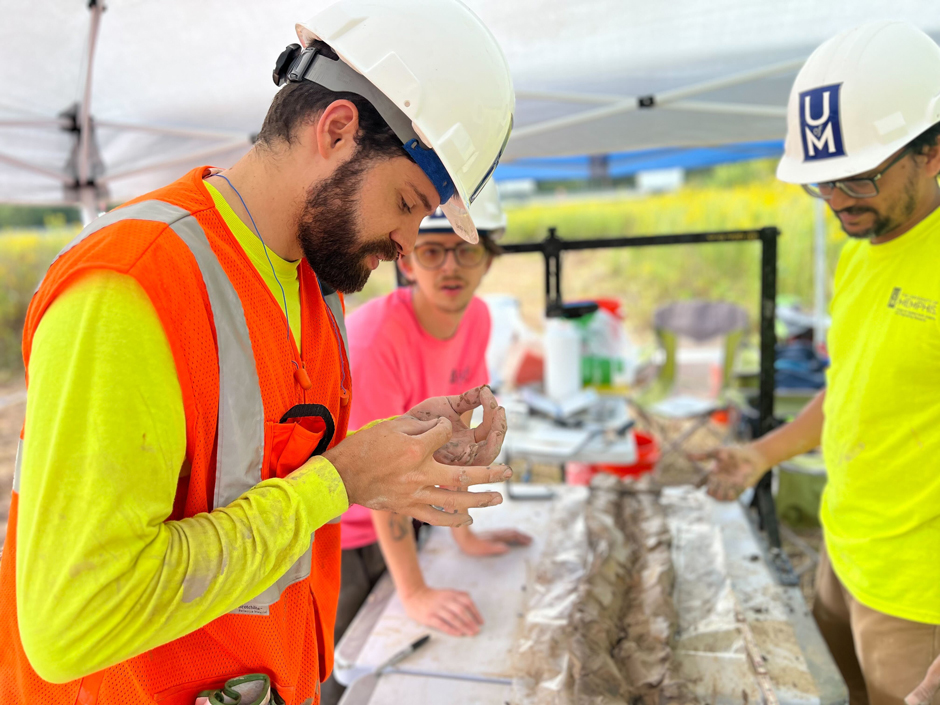
Students in the background Melissa Medina (left), Victoria Matthews (center) and Joe Lane (right), and Rodrigo Villalpando-Vizcaino. Collecting drilling samples for future analysis. (Credit: CAESER)
Monitoring Groundwater in Tennessee
Across these projects, equipment and monitoring solutions may vary based on data needs and the environment, but overall, a similar suite of instrumentation is used.
Villalpando-Vizcaino explains, “Every project is unique. So you have to tailor these solutions to the specifics of what’s needed. You can’t do a monitoring system in one place and then just replicate the exact same thing in a different place. You have to know the system, the needs, and adapt to it to provide the best solution and information.”
Currently, there are some seventy Solinst Levelogger pressure transducers, a handful of Solinst Barologgers and a few Leveloggers paired with cellular Solinst transmitters deployed across various projects in the region, recording continuous water levels and temperatures.

PhD candidate Abrar Hossain and Rodrigo Villalpando-Vizcaino. Measuring water quality parameters and collecting samples for heavy metal analysis. (Credit: CAESER)
Additionally, discrete groundwater sampling using Solinst water level meters, such as Models 101 P7, 102 P10, and 122, is conducted once a month.
Since Villalpando-Vizcaino works predominantly with groundwater, Geotech and Proactive pumps are used to retrieve samples from groundwater wells. ORP, pH, dissolved oxygen, turbidity, conductivity, and other relative parameters are measured using a YSI EXO1 multi-parameter sonde.
In addition to the more standard groundwater and surface water monitoring, other projects require gathering weather data, soil moisture, matric potential, or project-specific variables. Additionally, whenever drilling efforts happen, geophysical logs and detailed samples are collected.
This data is shared with the project sponsor, and—because students run a large number of these projects—is available as thesis projects, dissertations, and scientific publications.
“So, each one of our projects hopefully turns into a scientific publication that is available, not only for to the local community, but to whoever’s interested in the world,” states Villalpando-Vizcaino.

PhD candidate Ivan Zamora (left), PhD candidate Rodrigo Ruiz (center), and Rodrigo Villalpando-Vizcaino. Sampling monitoring wells using a Proactive submersible pump. (Credit: CAESER)
The Importance of Informed Management of Groundwater Resources
Entirely reliant on groundwater resources, continuous data collection and informed, future-oriented management plans are vital for the region’s future reliance on the Mississippi embayment and across the United States.
“The studies we do at CAESER and the University of Memphis allow us to provide some of that information to stakeholders. And [with this data] people in charge can make sure our water resources stay plenty and clean for everybody,” explains Villalpando-Vizcaino.
He continues, “We, as scientists—we’re the data people. So, our goal is to gather that data, interpret it, and make it available so we can make informed decisions for the benefit of the community, and for future sustainable planning. It’s just having a proactive mindset of ‘You have the data, and now you can make informed decisions.’”
In order to do this effectively, communication must also include the average public, not just sponsors and government officials. CAESAR’s Education and Outreach Division does just this, visiting schools, posting on social media, and “translating“ the findings of these projects for public consumption.
The public and private interface of this work is key, and a lack of understanding of conditions in the groundwater is part of the reason resources have been depleted in the world.
“Everybody needs water—people, agriculture, industries—and the fact that back in the day we thought everything was perfect, presents challenges, but also opportunities for us to now make proactive decisions,” stresses Villalpando-Vizcaino.
Fortunately, he believes that the region is in a good place to improve management as the people—scientists, citizens, farmers, developers, politicians—are a “circle where people are trying to do, not only what’s in the regulations, but trying to do what’s right.”

Rodrigo Villalpando-Vizcaino and master’s student Victoria Mathews. Installing a rain gauge and hand augering (AMS soil auger) to deploy moisture sensors to track precipitation pulses. (Credit: CAESER)


0 comments