Flow Photo Explorer: Studying Flows in the Penobscot River Basin
The flow dynamics of rivers and streams play an essential role in the chemical and physical functions of aquatic ecosystems. In Maine, varying flows in the Penobscot River Basin have impacted the health of the ecosystem, water resource use, and habitat suitability for native species—topics of particular concern to the Penobscot Indian Nation, who have been protecting and managing the waterway for millennia.
Parts of the Penobscot basin have been monitored by the USGS stream gage network, which covers larger streams and rivers but excludes many of the small streams found on tribal lands.
In addition to frequent discrete water quality sampling of these streams, Angela Reed, Water Resources Planner for the Penobscot Indian Nation, is currently leading efforts to establish a relative flow monitoring network in these smaller, often overlooked, streams.
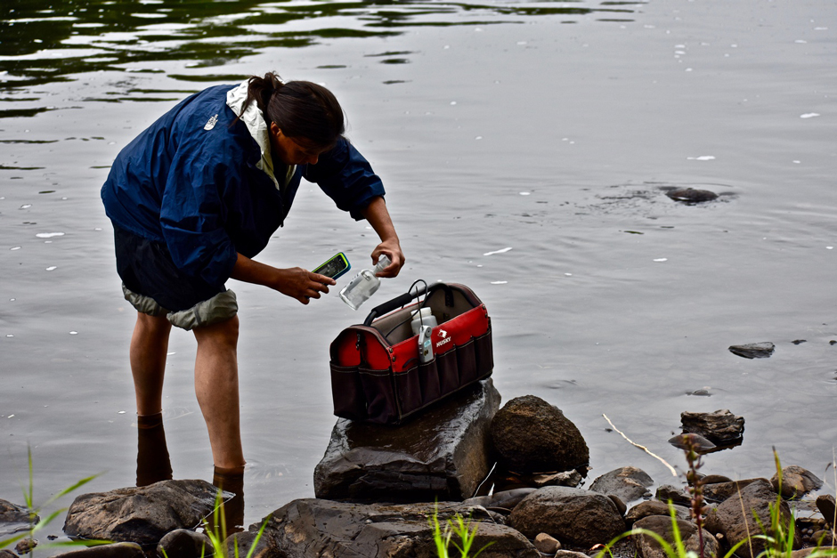
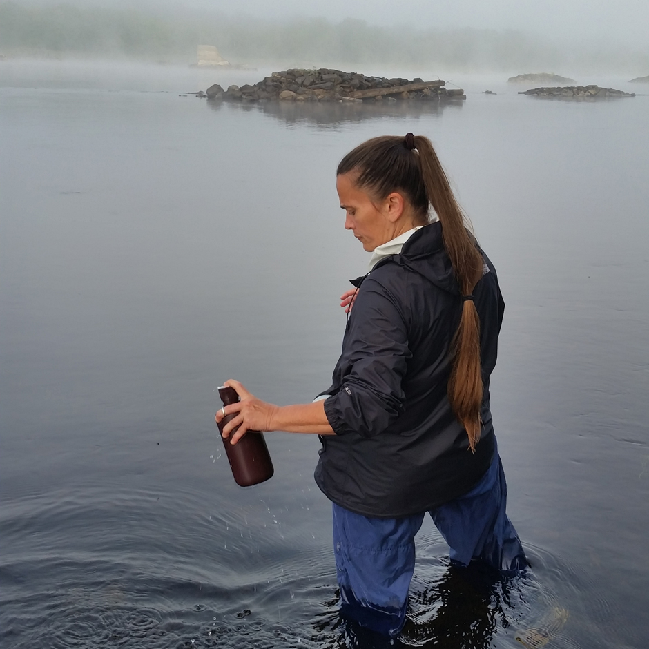
Jan Paul, a Penobscot Nation citizen, rinsing a bottle before collecting a sample. (Credit: Tyler Quiring)
Flow Photo Explorer
The Flow Photo Explorer started in 2021 and, as of April 2025, USGS reports more than 8 million photos at more than 400 sites and has trained over 60 ranking models, documenting relative flow through staff-led annotation of images taken by cameras stationed in waterways across the country.
There are eight stations currently deployed throughout the Penobscot watershed that have environmental field cameras positioned toward the water, facing either upstream or downstream, and snapping a photo of the relative flow and water level every 15 or 30 minutes.
These images are stored in the camera’s SD card and collected every 4-8 weeks. Images are brought back to the office and uploaded to a public database. From there, the images are annotated, identifying high or low relative flow and other conditions such as ice cover in image pairs.
Jan Paul, Penobscot Nation citizen, scanning a QR code on a sample bottle making digital data entry on the cell phone even faster. (Credit: Tyler Quiring)
Reed explains, “[We’ll be] able to see when things start freezing up, when things start thawing out, how much rain it takes to create what kind of water level, etc.”
The images and annotations feed into a deep-learning model that will eventually be able to review and identify relative flow on its own. The goal of the project is to start collecting flow estimates on these smaller streams to document changes over time and better understand temperature variations in the stream.
Thus far, one camera is co-located with a USGS gage station, and all locations have HOBO TidbiT temperature loggers that measure water temperature, with some select sites collecting air temperature data as well. These sites represent a small fraction of the total sites being monitored for stream and air temperature.
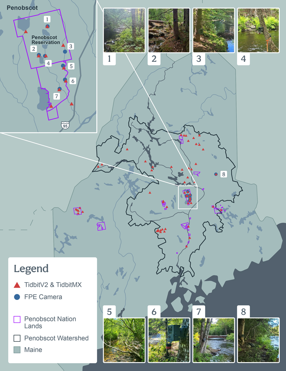
Map of the Penobscot Nation’s monitoring stations in the Penobscot Watershed. (Credit: Emma Jones / Fondriest Environmental, Inc.)
Future Flow Monitoring in the Penobscot River
Over the next year, the Penobscot Indian Nation plans to co-locate another photo station on the East Branch of the Penobscot River. As this site has a new USGS gage, it will provide another site that measures absolute flow to which the camera can be compared and test the capabilities of the model on larger water bodies.
This site will also be included in the helicopter flights collecting thermal infrared imagery using a camera system purchased recently, with the plan of measuring temperatures in a larger area from an aerial view to identify cold-water refuges for fish.
Since some of the sites are remotely located and difficult to access, requiring a snowmobile or ATV and hiking to reach the site, the team is considering an external power supply to minimize the frequency of site visits and prevent data loss if the camera runs out of power.
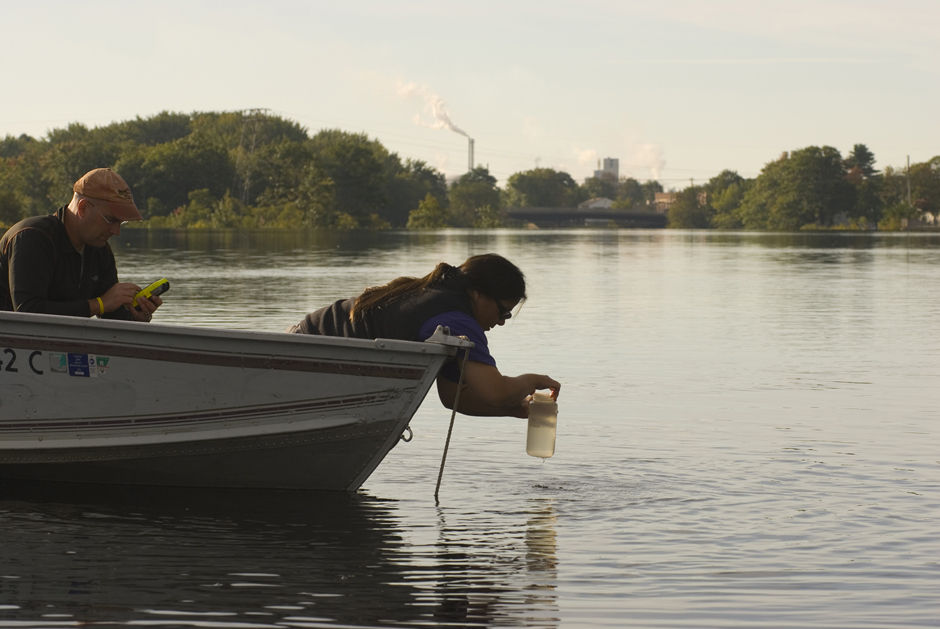
Jan Paul and Dan Kusnierz collecting samples and entering data into digital forms on a cell phone. (Credit: Bridget Besaw)
For a more complete view of the watershed, Reed mentions that the team may add a YSI EXO1 to a few of the sites for dissolved oxygen, conductivity, turbidity, and pH measurement, as well as PME miniDOTs at a few other locations.
The model will take two years’ worth of observations (about 2,000 pairs) to be trained, performing better with time as the machine-learning model improves. Continuous annotation and documentation of changing trends, such as climate conditions and the river’s change over time, will help further refine the model.
Given the ever-changing conditions, Reed doesn’t anticipate the Penobscot Nation will stop this kind of monitoring.
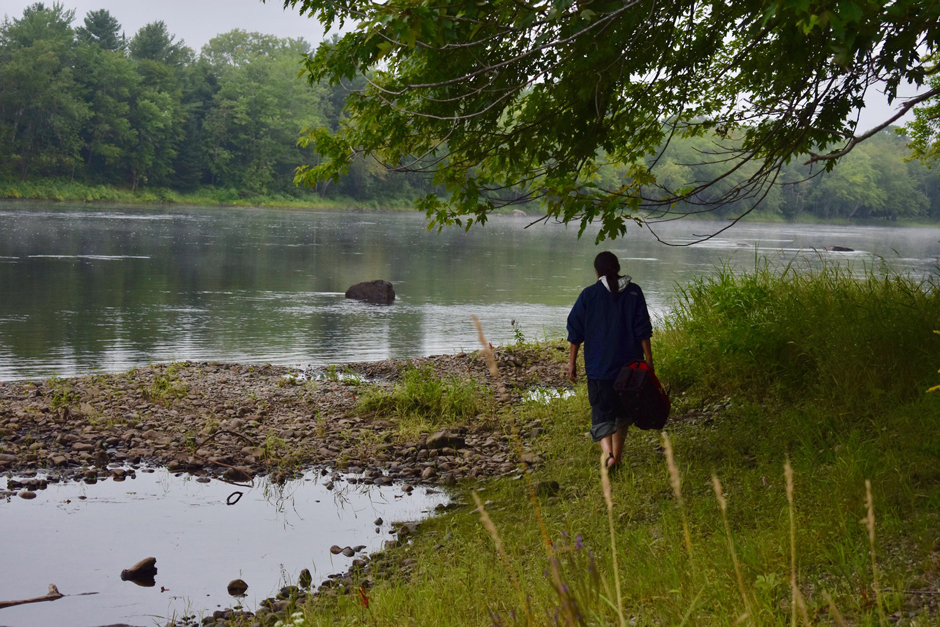
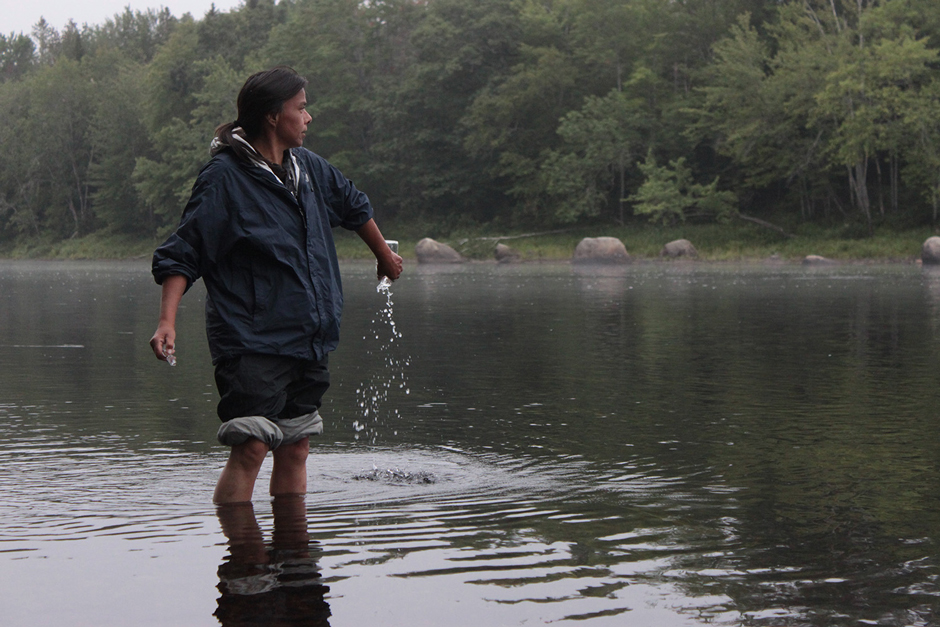
Jan Paul, a Penobscot Nation citizen, walking to a sampling site. (Credit: Tyler Quiring)
A Deeper Connection with the Penobscot River
While understanding these flows is important for management of the waterway, Reed explains that stewardship of the river runs much deeper for the Nation. “The Penobscot Nation sees the river as a relative […]. It’s not just about recreating or experiencing the outdoors—it’s about protecting something much bigger and much more important than that.”
She continues, “There’s a phrase that you don’t let your work dictate your life […] but this is not just a job, it’s literally everything I believe in.”
Angie Reed sampling the Penobscot River at the site of the former Great Works dam shortly after it was removed. (Credit: Dan Kusnierz)


0 comments